More From Contributor

£11.19
Laminated waterproof edition of a detailed topographic map of Boston from the Ordnance Survey Explorer series, covering Tattershall, Billinghay & Heckington. Edition A1; Publication date November 2006 About this series: These highly detailed maps show all the administrative boundaries, settlements as small as isolated farms, the road network down to unfenced roads & country tracks, & field boundaries (hedges & drystone walls) which make navigation across the countryside much easier. Steep gradients on roads are indicated. Various landmarks, e.g. powerlines, archaeological sites, windmills, churches & lighthouses are shown & additional graphics indicate natural terrain features such as cliffs, scree, mud & vegetation variations. The contour interval is 5 metres in the lower parts of the country & 10 metres in the uplands, & spot heights are marked. Each map covers an area of 30 x 20km (i.e. approx. 19 x 12 miles), with some double-sided maps covering more, as indicated in the individual descriptions. The maps are fully GPS compatible, with the National Grid shown at 1km intervals & latitude & longitude indicated by margin ticks at 1'. The Explorer series has replaced the earlier, green-cover Pathfinder maps. The Explorer series is now complete & covers all of Engl&, Wales & Scotl&. Some sheets for popular areas like the National Parks are still branded as Outdoor Leisure (OL) maps, but are now included in this series as the cartography is the same as that in the Explorer Maps. The Explorer maps offer a substantial improvement on the Pathfinder series, with greater use of colour, larger area per map, & stronger emphasis on information for ramblers & tourists. This series is ideal for walking & other outdoor pursuits & each map shows a large amount of information for ramblers & tourists. Public rights of way are shown (except in Scotland), together with other routes with public access: National Trails & Recreational Paths, permitted paths & bridleways, & selected cycle routes. Open access land created under the Countryside & Rights of Way Act 2000 is marked. Tourist information

Includes::
caravan & camp sites, Park & Ride locations, recreation/leisure/sport centres, museums, historic buildings, English Heritage & National Trust sites, rural pubs, etc. The map legend is in English only, except for the tourist information content which is also in French & German.

...
Archived Product
£4.99
Handy, pocket-size, pop-up map of Boston. Ideal to pop in a pocket or bag for easy reference while exploring the city. Explore the historic city of Boston, birthplace of the American Revolution, with the help of this genuinely pocket-sized, pop-up map. Small in size, yet big on detail, this compact, dependable Boston city map will ensure you don`t miss a thing.*

Includes::
two pop-up maps covering greater & downtown Boston* Additional maps covering Beacon Hill, Harvard Square & the subway are also included.* Handy, self-folding tourist map is small enough to fit in your pocket yet offers extensive coverage of the city in an easy-to-use format* Thorough street index is also featured & cross-referenced to the map so you can easily find your destination* Hotels, restaurants, stores & attractions are all included* 3 walking tours also included
- The Heritage Trail, Black Freedom Trail & tour of Harvard are all marked on the maps taking you past many significant historical locations Fold

Size:
95mm x 130mm Sheet

Size:
215mm x 225mm (per sheet; 2 sheets) Approx scale: 1:170, 000 (Greater map); 1:20, 000 (Central map)
- the scales are approximate & should only be used as a guideline.


...
Archived Product
£4.99
This work features a revolutionary new design for pocket-sized travel guides. Open the cover & discover a remarkable new design! 2 popout maps & a comprehensive fully illustrated 64 page guide of Boston. & it works like magic! The map & guide of the city are fully cross-referenced for instant, effortless navigation, making this the easiest guidebook you will ever use. Well-written text covers sights, shopping, entertainment, food, practical information & where to stay. With durable flexibound, stunning laminated covers, the popout cityguide is excellent value for your money for your trip to Boston. ...
Archived Product
£3.99
Boston Pop-Out Map from Compass Maps in a series designed to provide two street plans, the city centre plus a wider area around it, in a handy format to fit neatly all but the smallest pockets, with, as appropriate, transport network diagrams, additional useful maps, etc. Each title ...
Archived Product
£7.99
Frommer's Portable Guides offer all the detailed information & insider advice of a Frommer's Complete Guide
- but in a concise,
...
Archived Product
£8.99
Boston in the Step by Step series by Insight Guides focuses on providing tailor made walks & tours around the city. The guide features sixteen route recommendations that link up better known sights & take you off of the more beaten track; they are written by local experts who have personally selected places to eat & drink en-route & who offer insider tips on culture, shopping & nightlife. The guide has an array of colour photographs which help bring to life the background & descriptive information provided for destinations & attractions. An overview chapter opens the guide & reviews geography, customs & culture, history, food & drink, shopping, culture & entertainment. Next feature the selected itineraries for walks and/or tours, each of which have a good amount of accompanying information & come with a simple route plan. A user friendly alphabetical directory lists practical information to do with day to day basics & listings of h&-picked hotels & restaurants are provided to suit different budgets & tastes. The publisher ...
Archived Product
£13.99
It may be best known for the sites that gave birth to the American Revolution, but Boston
- along with neighbouring Ivy League
...
Archived Product
£12.99
Boston in the City & Regions series from Time Out; comprehensive guides to a range of cities & their surrounding regions & including some of the most detailed listings & directories of places to eat & drink & things to do & see. Time Out guides are strongly focussed on local entertainment & nightlife, in addition to principal sights & attractions, with expert local writers providing an encyclopaedic knowledge of each city. This unique quality has ensured that the guides have won a reputation for their accuracy & reliability. The surrounding region is also incorporated in some guides, with information on the principal attractions, sites, landscapes & the best way of exploring them. Each of the Time Out city & region guides has a similar layout, allowing visitors to explore their destination easily. An ...
Archived Product
£12.99
Now that the dust from the Big Dig
- the largest, most complicated highway project in US history
- has settled, Boston is

...
Archived Product

Boston Red Maps

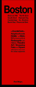
Central Boston on a tourist street plan from Red Maps presented in a handy concertina format and printed on thick high quality paper, with two recommended walks, thematic indexes for museums, hotels, shopping, etc.The plan presents central Boston at 1:15, 000 approx, extending west to include the Museum of Fine Arts. Two historical walks: the Freedom Trail and the Black Heritage Trail are highlighted on the plan and provided with brief descriptions of the relevant sights. On the reverse a separate panel covers the Harvard Square area of Cambridge. On both maps main sights and publishers’ recommendations, colour-coded into different types (museums, hotels, restaurants, etc), are named and main shopping streets and traffic routes across the city are highlighted. Subway stations
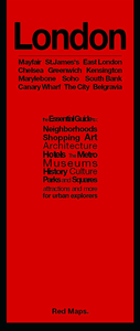
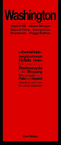
and interchanges are very clearly marked.The map has thematic lists of museums/libraries, theatres, universities, business centres, hotels, restaurants, etc. A special panel provides street-by-street recommendations of (mainly fashion) shops. An index lists neighbourhoods, bridges/tunnels and a selection of major streets.To see other street plans from Red Maps with similar presentation please click on the series link.
RIP - This product is no longer available on our network. It was last seen on 25.09.2019

This page now acts as a permanent archive for this product. Add more information using the comments box below to ensure it can still be found by future generations.

Use our search facility to see if it is available from an alternative contributor.
  • Availability: Out Of Stock
  • Supplier: Stanfords
  • SKU: 9781892238818
Availability: In Stock
£9.99

Product Description

Central Boston on a tourist street plan from Red Maps presented in a handy concertina format & printed on thick high quality paper, with two recommended walks, thematic indexes for museums, hotels, shopping, etc. The plan presents central Boston at 1:15, 000 approx, extending west to include the Museum of Fine Arts. Two historical walks: the Freedom Trail & the Black Heritage Trail are highlighted on the plan & provided with brief descriptions of the relevant sights. On the reverse a separate panel covers the Harvard Square area of Cambridge. On both maps main sights & publishers’ recommendations, colour-coded into different types (museums, hotels, restaurants, etc), are named & main shopping streets & traffic routes across the city are highlighted. Subway stations & interchanges are very clearly marked. The map has thematic lists of museums/libraries, theatres, universities, business centres, hotels, restaurants, etc. A special panel provides street-by-street recommendations of (mainly fashion) shops. An index lists neighbourhoods, bridges/tunnels & a selection of major streets. To see other street plans from Red Maps with similar presentation please click on the series link.

Reviews/Comments

Add New

Price History

Vouchers

No voucher codes found.
Do you know a voucher code for this product or supplier? Add it to Insights for others to use.

Facebook

Jargon Buster

Paper - A thin sheet mainly used for writing. Available in a variety of colours. Made mainly from wood pulp.
Black - A colour which does not emit any colour of the spectrum. Black absorbs all frequencies of the spectrum.
Red - One of the three primary colours
Colour - The categorised spectrum of light visable to humans
Quality - An object that has quality is superior in function and finish than a less quality object.
Museum - A building which exhibits old artefacts for viewing of people who show interest.

Supplier Information

Stanfords
Stanfords was established in 1853 and opened their iconic Covent Garden flagship store in 1901. They have become the top retailer of maps, travel books and accessories in the UK and arguably offer the largest selection of maps and travel books worldwide. Famous names such as Captain Robert Falcon Scott, Ranulph Fiennes and Michael Palin have purchased from Stanfords. They now have a shop in Bristol and both stores together with other venues operate a calendar of events including talks, book signings and exhibitions. As a specialist map retailer, the map selection is comprehensive and includes road maps, street maps and walking maps from worldwide destinations, as well as a selection of world atlases and wall maps. Books include travel guides and travel literature. Stanfords also stock globes, from miniatures made of blue marble to magnificent floor-standing globes. The website features a selection of interesting articles on travel topics.
Page Updated: 2023-11-12 20:15:36

Community Generated Product Tags

Oh No! The productWIKI community hasn't generated any tags for this product yet!
Menu