
 United Kingdom
 France
 Germany
 Netherlands
 Sweden
 USA
USA
 Italy
Italy
 Spain
Spain
More From Contributor


Bordeaux Vinyards
A colourful folded map of the vineyards around the confluence of the Garonne and the Dordogne rivers. Colours distinguish the various appellations, and four insets concentrate on selected regions, presenting more detailed maps and diagrams explaining particular factors in the viticulture, eg. soil diversity and climatic effects. Indexed for towns.Symbols denote notable cellar, museums, wine shops, architectural highlights. Such locations are listed in the map cover, with brief descriptions and contact details.There is also a lexicon of wine-making terms and a diagram describing the red-wine making process.
Product Description
Reviews/Comments
Add New
Intelligent Comparison
Archived Product
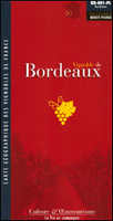
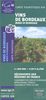
Bordeaux Wine Map Stanfords
£7.50
Vouchers
No voucher codes found.
Do you know a voucher code for this product or supplier? Add it to Insights for others to use.
Do you know a voucher code for this product or supplier? Add it to Insights for others to use.
 Denmark