
 United Kingdom
 France
 Germany
 Netherlands
 Sweden
 USA
USA
 Italy
Italy
 Spain
Spain
More From Contributor


Bolsover 1897
Bolsover in 1897 in a fascinating series of reproductions of old Ordnance Survey plans in the Alan Godfrey Editions, ideal for anyone interested in the history of their neighbourhood or family. Selected towns in Great Britain and Ireland are covered by maps showing the extent of urban development in the last decades of the 19th and early 20th century.In this title: two maps have been published for Bolsover to give good coverage of the town. Sheet 26.06, Bolsover, is the principal map and covers the town itself, including the Castle, St Mary's church, Market Place etc. Coverage extends north to Limekiln Field and Over Woodhouse, and westward to New Bolsover, including the tramway to the houses. An 1891 directory is on the reverse. Sheet 26.05, Bolsover West, extends coverage
westward to Bolsover Colliery and a complicated railway system that includes the Midland Railway Bolsover station and Markham Junction. Coverage also includes Longcourse Farm and Long Duckmanton as well as extracts from Bulmer's History & Topography of Derbyshire 1895. About the Alan Godfrey Editions of the 25
westward to Bolsover Colliery and a complicated railway system that includes the Midland Railway Bolsover station and Markham Junction. Coverage also includes Longcourse Farm and Long Duckmanton as well as extracts from Bulmer's History & Topography of Derbyshire 1895. About the Alan Godfrey Editions of the 25
Product Description
Reviews/Comments
Add New
Intelligent Comparison
Archived Product

Bolsover 1897 Stanfords
£3.50
Archived Product
Bolsover West 1897 Stanfords
£2.95
Archived Product

Bolsover West 1897 Stanfords
£3.50
Archived Product
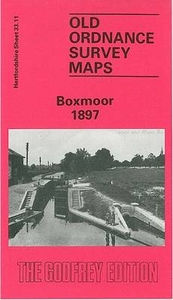
Boxmoor 1897 Stanfords
£3.50
Vouchers
No voucher codes found.
Do you know a voucher code for this product or supplier? Add it to Insights for others to use.
Do you know a voucher code for this product or supplier? Add it to Insights for others to use.
 Denmark