
 United Kingdom
 France
 Germany
 Netherlands
 Sweden
 USA
USA
 Italy
Italy
 Spain
Spain
More From Contributor


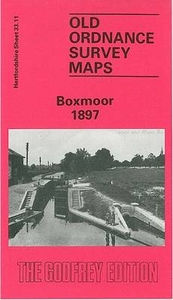
Boxmoor 1897
Boxmoor in 1897 in a fascinating series of reproductions of old Ordnance Survey plans in the Alan Godfrey Editions, ideal for anyone interested in the history of their neighbourhood or family. The map covers Boxmoor area west of Hemel Hempstead, and is double-sided. Coverage of the main map extends from Roughdown Common northward to Hammerfield, and from St John`s church westward to Boxmoor House. Features include LNWR railway with Boxmoor & Hemel station, Duckhall area, Roughdown Villas, Grand Junction Canal, Boxmoor Baths, St John`s church, River Bulbourne, watercress beds, The Fishery, Chaulden House, Greenend House, Crouchfield area, site of Roman Villa, Green End area, cametery, Southhill, Boxmoor Hall, etc. On the reverse is a section of the adjacent sheet 33.07
extending coverage north to include Lockers Park, Bury Mill End, Cemaes Court and Counter`s End; plus an 1899 directory of Boxmoor. About the Alan Godfrey Editions of the 25” OS Series:Selected towns in Great Britain and Ireland are covered by maps showing the extent of urban development in the last decades of the 19th and early 20th century. The plans have been taken from the Ordnance Survey mapping and reprinted at about 15 inches to one mile (1:4, 340). On the reverse most maps have historical notes and many also include extracts from contemporary directories. Most maps cover about one mile (1.6kms) north/south, one and a half miles (2.4kms) across; adjoining sheets can be combined to provide wider coverage.FOR MORE INFORMATION AND A COMPLETE LIST OF ALL AVAILABLE TITLES PLEASE
CLICK ON THE SERIES LINK.

Product Description
Reviews/Comments
Add New
Intelligent Comparison
Archived Product
Bolsover 1897 Stanfords
£2.95
Archived Product

Bolsover 1897 Stanfords
£3.50
Vouchers
No voucher codes found.
Do you know a voucher code for this product or supplier? Add it to Insights for others to use.
Do you know a voucher code for this product or supplier? Add it to Insights for others to use.
 Denmark