
 United Kingdom
 France
 Germany
 Netherlands
 Sweden
 USA
USA
 Italy
Italy
 Spain
Spain
More From Contributor
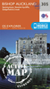


Bishop Middleham And Mainsforth Hall 1896
Bishop Middleham and Mainsforth Hall in 1896 in a fascinating series of reproductions of old Ordnance Survey plans in the Alan Godfrey Editions, ideal for anyone interested in the history of their neighbourhood or family. Selected towns in Great Britain and Ireland are covered by maps showing the extent of urban development in the last decades of the 19th and early 20th century.In this title: the map covers the village of Bishop Middleham, including Brewery, Old Hall, St Michaels church. Coverage extends westward to Mainsforth Hall. A directory of Bishop Middleham from Whellan's 1894 directory is included on the reverse. Unusually for Co Durham, this map is largely rural with no collieries.About the Alan Godfrey Editions of the 25
Product Description
Reviews/Comments
Add New
Intelligent Comparison
Archived Product
Bishop Middleham And Mainsforth Hall 1896 Stanfords
£3.50
Vouchers
No voucher codes found.
Do you know a voucher code for this product or supplier? Add it to Insights for others to use.
Do you know a voucher code for this product or supplier? Add it to Insights for others to use.
 Denmark