
 United Kingdom
 France
 Germany
 Netherlands
 Sweden
 USA
USA
 Italy
Italy
 Spain
Spain
More From Contributor


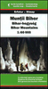


Bihar
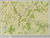
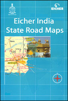
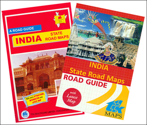
Bihar in a series of state maps of India from Eicher Goodearth reflecting a change in locally produced maps to a more modern style of cartography. Each map is double-sided and includes an index of localities, street plans of main cities, a distance table and a route planner map of the whole of India. Each title comes with a small booklet with brief descriptions of main places of interest and colour photos.The maps show road and rail networks, indicating intermediate distances on many local roads. Towns and villages of particular tourist interest are highlighted and symbols mark national parks and wildlife sanctuaries, temples, etc. The base map shows rivers, lakes and local waterways system and has spot heights for peaks, but the range of elevation colouring is too finely graded to
provide any useful information. No geographical coordinates are marked.The maps show the names and boundaries of local districts, indicating state capitals and district or tehsil administrative headquarters. Outside the state boundaries the colour range of the print is reduced, so only main roads are clearly visible.*Please note:* the various series of state maps of India often show different small villages, supplementing each other to provide a more detailed picture of each state.*In this title:* street plan of Patna.
provide any useful information. No geographical coordinates are marked.The maps show the names and boundaries of local districts, indicating state capitals and district or tehsil administrative headquarters. Outside the state boundaries the colour range of the print is reduced, so only main roads are clearly visible.*Please note:* the various series of state maps of India often show different small villages, supplementing each other to provide a more detailed picture of each state.*In this title:* street plan of Patna.

Product Description
Reviews/Comments
Add New
Intelligent Comparison
Archived Product
Bihar Stanfords
£4.95
Archived Product
Bihar Stanfords
£4.50
Vouchers
No voucher codes found.
Do you know a voucher code for this product or supplier? Add it to Insights for others to use.
Do you know a voucher code for this product or supplier? Add it to Insights for others to use.
 Denmark