
 United Kingdom
 France
 Germany
 Netherlands
 Sweden
 USA
USA
 Italy
Italy
 Spain
Spain
More From Contributor

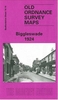

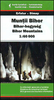


Bihar
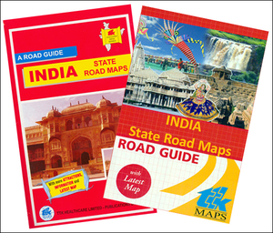
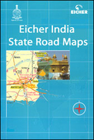
Bihar in a series of locally produced administrative maps of Indian states, each with a booklet providing a guide to the area. The maps show the division of each state into districts and have more small towns and villages than on more general maps of India available from other publishers. Presentation is now considerably improved with the districts shown in different colours. The maps indicate each district’s administrative capital and also show which towns or villages are headquarters of the tehsil (or tahsil, tahasil, taluka, taluk, taluq) administrative units.Road network distinguishes between national highways, state highways, major roads and other local roads. Intermediate driving distances are given on some routes and most titles include a distance table. Railway lines are
also marked and, on some titles, various places of interest. No information on topography or geographical coordinates are provided. Each map comes with a booklet attached to its cover, which contains a guide to the state and, in some titles, an index of place names. In the more recently revised titles the guides provide plenty of information on local places of interest and various attractions, and include lists of selected accommodation and, occasionally, basic street plans.*Please note:* the various series of state maps of India often show different small villages, supplementing each other to provide a more detail picture of each state.
also marked and, on some titles, various places of interest. No information on topography or geographical coordinates are provided. Each map comes with a booklet attached to its cover, which contains a guide to the state and, in some titles, an index of place names. In the more recently revised titles the guides provide plenty of information on local places of interest and various attractions, and include lists of selected accommodation and, occasionally, basic street plans.*Please note:* the various series of state maps of India often show different small villages, supplementing each other to provide a more detail picture of each state.

Product Description
Reviews/Comments
Add New
Intelligent Comparison
Archived Product
Bihar Stanfords
£4.99
Archived Product
Bihar Stanfords
£4.50
Vouchers
No voucher codes found.
Do you know a voucher code for this product or supplier? Add it to Insights for others to use.
Do you know a voucher code for this product or supplier? Add it to Insights for others to use.
 Denmark