More From Contributor
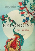
£12.99
Belluno Province at 1:150, 000 in a series of handy size provincial road maps from Litografia Artistica Cartografica (LAC) with more minor local roads & country tracks than can be found on most regional maps from other publishers. This title is now available in a digitally produced edition.LAC’s provincial series is gradually being changed to a new style of digitally derived cartography, so presentation of adjoining titles may vary. All the maps have hill shading to represent the general relief with spot heights for selected peaks, & show a few more local roads & rough tracks than the other road map series. Intermediate road distances are indicated. Regional, provincial & communal borders are marked, & railways, funiculars, airports, sea ferry links & campsites are shown. The legend is in Italian only. The new, digitally produced editions are indexed & have enhanced, more finely drawn cartography: the hill-shading is less bold, motorway service areas are marked, natural parks are highlighted & an expanded range of symbols indicates various landmarks & sites, e.g. antiquities, churches, etc. Two styles of the new cartography are produced, differing only in the colour of the predominant background shading: grey or yellow/green. Some of the new editions include geographical coordinates for the map corners. The index of localities is on the reverse. To see all the titles in this series please click on the series link. ...
Archived Product
£6.95
Topographic coverage of mainland Spain at 1:50, 000 in the MTN50 (Mapa Topográfico Nacional) series from the Centro Nacional de Información Geografica, the country’s civilian survey organization. The maps have contours at 20m intervals, enhanced by relief shading, plus colouring and/or graphics to show different types of terrain, vegetation or land use. Boundaries of national parks & other protected areas are marked. In addition to all the usual information featured on topographic mapping at this scale, detailed presentation of the road & rail networks, rural tracks & paths, etc, the maps also show campsites & mountain refuges. On more recent editions some GRs, the official long-distance hiking routes, are also marked (although not as clearly as on hiking maps from other publishers). Each map covers 29.5x 18.5 km (with adjustments in the border or coastal areas). The maps have a 1-km UTM grid, plus margin ticks for latitude & longitude at 1` intervals. Map legend is in Spanish only.HOW TO CHOOSE THE RIGHT 50K MAP: all the titles in CNIG’s 200K Provincial Road Maps series at 1:200, 000 are overprinted with the grid for the 1:50, 000 maps & can be used to see the area covered by each 50K title. TO SEE THE LIST OF TITLES IN THIS SERIES PLEASE CLICK ON THE SERIES LINK.PLEASE NOTE
- MAP TITLES: the grids shown on our website serve both the civilian & the military 1:50, 000 topographic series. Although the areas covered by maps in both series are identical (apart from some border or coastal sheets), occasionally map titles differ – only one title is shown on the grid, usually the military one. In Galicia, the Basque country & in the Catalan speaking areas the tendency now is to use local place names rather than the often better known Castilian ones. Where possible, both versions are included in our titles. Map titles listed on our website are based on information received by us at the time of publication, but sometimes maps arrive showing a completely different title! As long as the map number is as ordered, the correct map has been supplied.
...
Archived Product
£12.99
Topographic survey of France at 1:25, 000 in IGN`s excellent TOP25 / Série Bleue series. All the maps are GPS compatible, with a 1km UTM grid plus latitude & longitude lines at 5’ intervals. Contours are at 5m intervals except for mountainous areas where the maps have contours at 10m intervals, vividly enhanced by hill shading & graphics for rocky terrain. Colouring with graphics indicates different types of vegetation or land use (deciduous or coniferous forests, moors, orchards, vineyards, etc). PLEASE NOTE: coverage of France at this scale is currently being revised – the format & the presentation of each title are indicated by the letters at the end of its Sheet Reference number (e.g. 0416ET, 3531ETR, 1923SB, etc.)MAPS WITH FULL TOURIST OVERPRINT & AN ENGLISH MAP LEGEND: all TOP25 maps & the SB editions of Série Bleue have an overprint highlighting waymarked walking trails including long-distance GR routes &, where appropriate, ski routes. Symbols indicate campsites, gîtes d’etape, refuges, equestrian centres & other recreational facilities or sites, tourist information centres, cultural heritage, etc. Towns & locations of particular interest are highlighted.- ET or OT = single-sided TOP25 map covering approx. 29x 21 km / 18x 13 miles.- ETR or OTR = waterproof & tear resistant TOP25 map covering the same area as the corresponding ET or OT number, but double-sided, printed on a smaller size sheet with a good overlap between the sides.- SB = Série Bleue map with full tourist overprint; these maps, first introduced in summer 2014, each cover approx. 29x 24km / 18x 15 miles.SÉRIE BLEUE maps with numbers ending in E (Est) or O (Ouest): most editions now indicate the GR routes, but do not show any other tourist information. Map legend is in French only. Each map covers approx. 14x 20km / 9x 12 miles. ...
Archived Product
£6.95
Topographic coverage of mainland Spain at 1:50, 000 in the MTN50 (Mapa Topográfico Nacional) series from the Centro Nacional de Información Geografica, the country’s civilian survey organization. The maps have contours at 20m intervals, enhanced by relief shading, plus colouring and/or graphics to show different types of terrain, vegetation or land use. Boundaries of national parks & other protected areas are marked. In addition to all the usual information featured on topographic mapping at this scale, detailed presentation of the road & rail networks, rural tracks & paths, etc, the maps also show campsites & mountain refuges. On more recent editions some GRs, the official long-distance hiking routes, are also marked (although not as clearly as on hiking maps from other publishers). Each map covers 29.5x 18.5 km (with adjustments in the border or coastal areas). The maps have a 1-km UTM grid, plus margin ticks for latitude & longitude at 1` intervals. Map legend is in Spanish only.HOW TO CHOOSE THE RIGHT 50K MAP: all the titles in CNIG’s 200K Provincial Road Maps series at 1:200, 000 are overprinted with the grid for the 1:50, 000 maps & can be used to see the area covered by each 50K title. TO SEE THE LIST OF TITLES IN THIS SERIES PLEASE CLICK ON THE SERIES LINK.PLEASE NOTE
- MAP TITLES: the grids shown on our website serve both the civilian & the military 1:50, 000 topographic series. Although the areas covered by maps in both series are identical (apart from some border or coastal sheets), occasionally map titles differ – only one title is shown on the grid, usually the military one. In Galicia, the Basque country & in the Catalan speaking areas the tendency now is to use local place names rather than the often better known Castilian ones. Where possible, both versions are included in our titles. Map titles listed on our website are based on information received by us at the time of publication, but sometimes maps arrive showing a completely different title! As long as the map number is as ordered, the correct map has been supplied.
...
Archived Product
£9.50
Topographical survey of Belgium at 1:20, 000 from Nationaal Geografisch Instituut / Institut Géographique National, the country’s national survey organization. Each 20K map covers one quarter of the corresponding 1:50, 000 map (with adjustments in the border & coastal areas). The maps provide all the information expected of topographic mapping at this scale & in addition have an unusually large amount of vegetation and/or land use information (different types of woodlands, gardens, orchards, heath, etc). The maps have a 1-km UTM grid, with margin ticks for latitude & longitude at intervals of 1`. Map legend & a glossary of terms used on the maps include English. Stanfords keeps as regular stock 20K maps for the World War I battlefields around the Ypres, Messines & Passchendaele, & for the area of the Battle of Waterloo. The 1:20, 000 survey covers the whole of Belgium & maps for other regions can be supplied as special orders. To see the list of titles in this series please click on the series link.PLEASE NOTE: the Long-Distance Footpaths Map of Belgium at 1:300, 000 which shows the division of Belgium into the 50K survey sheets can also be used to see in more detail coverage by the 20K maps. ...
Archived Product
£25.00
SHORTLISTED FOR THE BAILLIE GIFFORD PRIZE `A glittering gemstone of a book` The Times The Jewish story is a history that is about, & for, all of us. & in our own time of anxious arrivals & enforced departures, the Jews` search for a home is more startlingly resonant than ever. Belonging is a magnificent cultural history abundantly alive with energy, character & colour. It spans centuries & continents, from the Jews` expulsion from Spain in 1492 it navigates miracles & massacres, wandering, discrimination, harmony & tolerance; to the brink of the twentieth century &, it seems, a point of profound hope. It tells the stories not just of rabbis & philosophers but of a poetess in the ghetto of Venice; a boxer in Georgian England; a general in Ming China; an opera composer in nineteenth-century Germany. The story unfolds in Kerala & Mantua, the starlit hills of Galilee, the rivers of Colombia, the kitchens of Istanbul, the taverns of Ukraine & the mining camps of California. It sails in caravels, rides the stage coaches & the railways; trudges the dawn streets of London, hobbles along with the remnant of Napoleon`s ruined army. Through Schama`s passionate telling of this second chronicle in an epic tale, a history emerges of the Jewish people that feels it is the story of everyone, of humanity. ...
Archived Product
£7.99
It is the mid-1800s. At Sweet Home in Kentuckhy, an era is ending as slavery comes under attack from the abolitionists. The worlds of Halle & Paul D. are to be destroyed in a cataclysm of torment & agony. The world of Sethe, however, is to turn from one of love to one of violence & death
- the death of Sethe`s baby daughter Beloved, whose name is the single word on the tombstone, who died at her mother`s hands, & who will return to claim retribution.
...
Archived Product
£14.99
At the stroke of midnight on 20 May 2002, the Democratic Republic of Timor-Leste became the first new nation of the 21st century. From that moment, those who fought for independence have faced a challenge even bigger than shaking off Indonesian occupation: running a country of their own. * Beloved Land* picks up the story where world attention left off. Blending narrative history, travelogue, & personal reminiscences, Gordon Peake shows the daunting hurdles that the people of Timor-Leste must overcome to build a nation from scratch, & how much the international community has to learn if it is to help rather than hinder the process. Family politics, squabbles, power struggles, old romances, & even older grudges are woven into life in this land of intrigue & rumours in the most remarkable ways. Yet above all, * Beloved Land* is a story about the one million East Timorese who speak nearly 20 different languages, & who are exuberantly building their nation. It is also about the East Timorese diaspora in Northern Irel&. Written with verve & deep affection, the book brings the character of Timor-Leste to life unforgettably. ...
Archived Product
£18.99
Conbining gripping adventure writing with intimate memoir, Rick Ridgeway takes readers to the mysterious mountain domain of Tibet, & onto the remote corners of his past. Twenty years ago, in the wake of a massive & terrifying avalanche, Ridgeway cradled his dying friend Jonathan in his arms & pledged to keep watch over Jonathan's infant daughter Asia. Now Asia is a vibrant, headstrong young woman; hoping to help her connect with the father she never knew, Ridgeaway takes her to the Himalayas Jonathan so cherished. Together they search for the place where he died. Their trek through remote & forbidding terrain
- under constant threat from lethal storms & jumpy Chinese military patrols
- is a fitting backdrop for the precarious emotional journey that Ridgeway & Asia share, as they venture into alien landscapes of memory & self-discovery. Ultimately, the truths they both seek are revealed, not in the images of life long gone but in the bright promise of future possibility. In a stunning conclusion on a treacherous & wind-battered mountain face, both Ridgeway & his dead friend's daughter finally embrace the deepest realities of death & life.

...
Archived Product
£2.95
Belper in 1898 in a fascinating series of reproductions of old Ordnance Survey plans in the Alan Godfrey Editions, ideal for anyone interested in the history of their neighbourhood or family. Selected towns in Great Britain & Ireland are covered by maps showing the extent of urban development in the last decades of the 19th & early 20th century. In this title: the map is double-sided. The main map covers the centre of the town, with coverage stretching from Christ Church & the cotton mills eastward to Whitemoor Hall, & from Farlawn southward to King Street. Features include railway with station, Unity Mill, St Laurence's Convent, St Peter's church, Green Hall, St John's church, The Gutter, Nottingham Road area, Market Place, etc. On the reverse is part of the adjacent sheet 45.01 extending coverage southward to include Park Foundry, Swainsleywood Farm, gas works, Goods Station, Belper Workhouse, Cowhill, Coppice Brook, etc. About the Alan Godfrey Editions of the 25 ...
Archived Product

Belonging

Lila Langdon is twelve years old when she witnesses a family tragedy after her mother unveils her father`s surprise birthday present - a tragedy that ends her childhood in India and precipitates a new life in Sussex with her Great-aunt Wilhelmina. From the darkest days of the British Raj through to the aftermath of the First World War, Belonging tells the interwoven story of three generations and their struggles to understand and free themselves from a troubled history steeped in colonial violence. It is a novel of secrets that unwind through Lila`s story, through her grandmother`s letters home from India and the diaries kept by her father, Henry, as he puzzles over the enigma of his birth and his stormy marriage to the mysterious Rebecca. Umi Sinha`s unforgettable debut is an intense,
compelling and finely wrought epic of love and loss, of race and ethnicity, of homeland - and of belonging.
RIP - This product is no longer available on our network. It was last seen on 25.09.2019

This page now acts as a permanent archive for this product. Add more information using the comments box below to ensure it can still be found by future generations.

Use our search facility to see if it is available from an alternative contributor.
  • External links may include paid for promotion
  • Availability: Out Of Stock
  • Supplier: Stanfords
  • SKU: 9781908434746
Availability: In Stock
£8.99

Product Description

Lila Langdon is twelve years old when she witnesses a family tragedy after her mother unveils her father`s surprise birthday present
- a tragedy that ends her childhood in India & precipitates a new life in Sussex with her Great-aunt Wilhelmina. From the darkest days of the British Raj through to the aftermath of the First World War, Belonging tells the interwoven story of three generations & their struggles to understand & free themselves from a troubled history steeped in colonial violence. It is a novel of secrets that unwind through Lila`s story, through her grandmother`s letters home from India & the diaries kept by her father, Henry, as he puzzles over the enigma of his birth & his stormy marriage to the mysterious Rebecca. Umi Sinha`s unforgettable debut is an intense, compelling & finely wrought epic of love & loss, of race & ethnicity, of homeland
- & of belonging.

Reviews/Comments

Add New

Intelligent Comparison

Oooops!
We couldn't find anything!
Perhaps this product's unique.... Or perhaps we are still looking for comparisons!
Click to bump this page and we'll hurry up.

Price History

Vouchers

No voucher codes found.
Do you know a voucher code for this product or supplier? Add it to Insights for others to use.

Facebook

Jargon Buster

India - A subcontinent in Asia
History - Anything that happens in the past. An acedemic subject.
World - A physical grouping, commonly used to describe earth and everything associated with ti
Love - Someone who shows deep affection for someone else.
Home - A place of permanent residence for families.
Family - A group of people that live together made up from parents and children.

Supplier Information

Stanfords
Stanfords was established in 1853 and opened their iconic Covent Garden flagship store in 1901. They have become the top retailer of maps, travel books and accessories in the UK and arguably offer the largest selection of maps and travel books worldwide. Famous names such as Captain Robert Falcon Scott, Ranulph Fiennes and Michael Palin have purchased from Stanfords. They now have a shop in Bristol and both stores together with other venues operate a calendar of events including talks, book signings and exhibitions. As a specialist map retailer, the map selection is comprehensive and includes road maps, street maps and walking maps from worldwide destinations, as well as a selection of world atlases and wall maps. Books include travel guides and travel literature. Stanfords also stock globes, from miniatures made of blue marble to magnificent floor-standing globes. The website features a selection of interesting articles on travel topics.
Page Updated: 2023-11-12 20:15:36

Community Generated Product Tags

Oh No! The productWIKI community hasn't generated any tags for this product yet!
Menu