
 United Kingdom
 France
 Germany
 Netherlands
 Sweden
 USA
USA
 Italy
Italy
 Spain
Spain
More From Contributor


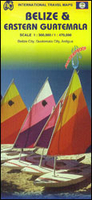
Belize & Eastern Guatemala ITMB
Waterproof and tear-resistant, double-sided map from ITMB presenting on one side Belize at 1:300, 000 accompanied by a street plan of Belize City and on the reverse the eastern part of Guatemala at 1:470, 000 with street plans of Guatemala City and Antigua Guatemala and an enlargement showing in greater detail the environs of the capital.Coverage of Guatemala extends in the northern part of the map to Sayaxché, but in the south further west, beyond Guatemala City to Chimaltenango and Escuintla. Both countries are presented with altitude colouring to indicate their topography, plus graphics for swamps. National parks and other protected areas, including Belize’s marine parks, are prominently highlighted. Road network indicates unpaved roads and includes selected country tracks.
Driving distances are shown on main routes and locations of petrol stations are marked in both countries. Railway lines are included and local airports are marked. Symbols highlight various place of interest, including both cultural and natural UNESCO World Heritage sites, beaches, diving and snorkelling sites, etc. Latitude and longitude lines are drawn at 15’ intervals in Belize and 30’ in Guatemala. Each country has a separate index.Street plans of the two capitals highlight selected accommodation, important buildings and various tourist facilities.
Driving distances are shown on main routes and locations of petrol stations are marked in both countries. Railway lines are included and local airports are marked. Symbols highlight various place of interest, including both cultural and natural UNESCO World Heritage sites, beaches, diving and snorkelling sites, etc. Latitude and longitude lines are drawn at 15’ intervals in Belize and 30’ in Guatemala. Each country has a separate index.Street plans of the two capitals highlight selected accommodation, important buildings and various tourist facilities.

Product Description
Reviews/Comments
Add New
Vouchers
No voucher codes found.
Do you know a voucher code for this product or supplier? Add it to Insights for others to use.
Do you know a voucher code for this product or supplier? Add it to Insights for others to use.
 Denmark