More From Contributor
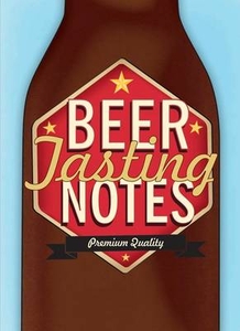
£2.99
Beer – Branscombe – Seaton area of southern Devon on a very detailed, GPS compatible hiking, cycling & horse riding map from Croydecycle at 1:12, 500, printed on light, waterproof & tear-resistant synthetic paper. The map is part of publishers’ series covering the western coast of Somerset, both coastlines of Devon, & the adjoining areas of Dorset. Each handy size, 50 x 35cm, map is double-sided to cover a wider area. Topography is indicated by contours at 10m intervals with graphics and/or colouring for different type of terrain (s&, shingle, mud, high or low cliffs, etc) & vegetation (woodlands, gorse, scrub, etc). An overprint highlights footpaths, permissive paths & small permissive paths, Bridleways, cycle tracks & country roads which are byways for all traffic. On other roads markings indicate routes which are part of the National Cycle Network. Symbols show locations of campsites & caravan sites, riding stables, pubs/cafes/restaurants, shops & other local facilities, etc. For GPS users each map has in the margins National Grid coordinates. Most 1:12, 500 maps include enlargements of main town (s), an inset providing geological information, & details of transport options. To see other titles in this series, including cycle maps, please click on the series link. The 1:12, 500 maps are numbered on our website westwards along the Somerset & north Devon coast, & then eastwards along the southern coast of Devon & into Dorset. ...
Archived Product
£16.99
Beer & Food is the definitive book about matching great food with the world`s tastiest beers. Whether you have cooked dinner & don`t know what beer to choose, or you`ve got a pale ale & can`t decide what dish is best to serve with it, Beer & Food has all the information you could possibly need. It looks at the science of taste & how the ingredients in a brewery work with ingredients in a kitchen, examining the principles of matching beer & food, & looking at the flavours they share. Over the following pages, more than 35 beer styles are showcased, telling stories about the brews & picking perfect pairings for each, before delving into different cuisines & food types from around the world. Everything is covered, from sandwiches to curries to desserts &, of course, the best beers to enjoy with fast food. As well as the greatest pairings & suggestions of the best styles to try, there`s a recipe section with over 50 dishes which use beer as an ingredient. With over 350 beers featured in total, chosen from all over the globe, it`s the book for everyone who loves a drink & a tasty bite to eat. ...
Archived Product
£14.95
At last, a hiking guide which understands the importance of beer! Great Swiss hikes for beer lovers & hiking enthusiasts. Lasting between one & six hours, the hikes follow carefully selected trails chosen for their beauty. The end of the hike is without fail near a brewery or a bistro where hikers can quench their thirst with a local craft beer. 59 hikes = 59 beers from different local breweries! With full-colour photographs, coloured description of the beers & coloured maps of hike itineraries. ...
Archived Product
£7.99
Behind the bar at Jameel`s in Cairo hang two mugs engraved with the names of Ram & Font. During their years together in London, they drank many a pint of Bass from these mugs. But there is no Bass in Nasser`s Egypt, so Ram & Font have to make do with a heady mixture of beer, vodka & whisky. Yearning for Bass they long to be far from a revolution that neither serves the people nor allows their rich aunts to live the life of leisure they are accustomed to. Stranded between two cultures, Ram & Font must choose between dagerous political opposition & reluctant acquiescence. First published in 1964, ” Beer in the Snooker Club is a classic of the literature of emigration. ...
Archived Product
£9.99
Beer is the world`s most popular alcoholic drink
- a joygiving, convivial, nutritious & delicious gift from nature & possibly
...
Archived Product
£5.99
Do you know why Kind William IV appears more frequently on Britain`s pub signs than any other monarch, why the German beer purity laws were introduced, or how a beer can widget works? This book answers these questions & innumerable others about beer & brewing. Much more complex than wine, beer is often a better accompaniement to food, & there are more than two thous&-year history, & explains how different styles emerged through the use of different ingredients & processing methods. The story is brought up to date with an insider`s expose of the modern brewing process, & an account of which additives are employed & why. ...
Archived Product
£9.50
Topographical survey of Belgium at 1:20, 000 from Nationaal Geografisch Instituut / Institut Géographique National, the country’s national survey organization. Each 20K map covers one quarter of the corresponding 1:50, 000 map (with adjustments in the border & coastal areas). The maps provide all the information expected of topographic mapping at this scale & in addition have an unusually large amount of vegetation and/or land use information (different types of woodlands, gardens, orchards, heath, etc). The maps have a 1-km UTM grid, with margin ticks for latitude & longitude at intervals of 1`. Map legend & a glossary of terms used on the maps include English. Stanfords keeps as regular stock 20K maps for the World War I battlefields around the Ypres, Messines & Passchendaele, & for the area of the Battle of Waterloo. The 1:20, 000 survey covers the whole of Belgium & maps for other regions can be supplied as special orders. To see the list of titles in this series please click on the series link.PLEASE NOTE: the Long-Distance Footpaths Map of Belgium at 1:300, 000 which shows the division of Belgium into the 50K survey sheets can also be used to see in more detail coverage by the 20K maps. ...
Archived Product
£2.95
Beeston in 1913 in a fascinating series of reproductions of old Ordnance Survey plans in the Alan Godfrey Editions, ideal for anyone interested in the history of their neighbourhood or family. Selected towns in Great Britain & Ireland are covered by maps showing the extent of urban development in the last decades of the 19th & early 20th century. In this title: the map covers the town of Beeston, south-west of Nottingham. Features include town, St John's church, Anglo-Scotian Mills, lace factories, iron foundry, small portion of railway but not station, schools, Beeston Fields, etc. On the reverse is a selection of trade directory entries from Wright's 1902 directory. About the Alan Godfrey Editions of the 25 ...
Archived Product
£3.50
Beeston in 1913 in a fascinating series of reproductions of old Ordnance Survey plans in the Alan Godfrey Editions, ideal for anyone interested in the history of their neighbourhood or family. The map covers the town of Beeston, south-west of Nottingham. Features include town, St John`s church, Anglo-Scotian Mills, lace factories, iron foundry, small portion of railway but not station, schools, Beeston Fields, etc. On the reverse is a selection of trade directory entries from Wright`s 1902 directory. About the Alan Godfrey Editions of the 25” OS Series: Selected towns in Great Britain & Ireland are covered by maps showing the extent of urban development in the last decades of the 19th & early 20th century. The plans have been taken from the Ordnance Survey mapping & reprinted at about 15 inches to one mile (1:4, 340). On the reverse most maps have historical notes & many also include extracts from contemporary directories. Most maps cover about one mile (1.6kms) north/south, one & a half miles (2.4kms) across; adjoining sheets can be combined to provide wider coverage.FOR MORE INFORMATION & A COMPLETE LIST OF ALL AVAILABLE TITLES PLEASE CLICK ON THE SERIES LINK. ...
Archived Product
£3.50
Beeston & Beeston Hill in 1905 in a fascinating series of reproductions of old Ordnance Survey plans in the Alan Godfrey Editions, ideal for anyone interested in the history of their neighbourhood or family. The map covers the Beeston area of south Leeds. The right hand third of the map is very built up with the terraces & back-to-back houses of Beeston Hill, extending south to Cross Flatts Park. Coverage then extends west along Elland Road
- with the original football ground
- & Beeston Road, the latter leading to the village of Beeston itself. Here features include Beeston Hall, St Mary`s church, St Anthony`s Padua chapel, station (on the GNR West Yorkshire Railway), Windmill Hill, Crow Nest Farm, Beeston Near Royds, Beeston Royds Mill, Crow Nest Tannery, Manor Pit, Islington, Beggars Hill, Brick & Tile Works, Cross Flats, tramways, Holbeck Cemetery, Baron Close Brick Works, etc. On the reverse are street directory entries for Beeston Road, Cambrian Road, Malvern Road & Tempest Road. About the Alan Godfrey Editions of the 25” OS Series: Selected towns in Great Britain & Ireland are covered by maps showing the extent of urban development in the last decades of the 19th & early 20th century. The plans have been taken from the Ordnance Survey mapping & reprinted at about 15 inches to one mile (1:4, 340). On the reverse most maps have historical notes & many also include extracts from contemporary directories. Most maps cover about one mile (1.6kms) north/south, one & a half miles (2.4kms) across; adjoining sheets can be combined to provide wider coverage.FOR MORE INFORMATION & A COMPLETE LIST OF ALL AVAILABLE TITLES PLEASE CLICK ON THE SERIES LINK.

...
Archived Product

Beer Tasting Notes

Fans of craft beer will love this unique journal to record the characteristics of their favourite brews. The recent explosion of outstanding beers made by exceptionally talented brewers has been a dream come true for anyone who appreciates a well-balanced beverage. But with thousands of new beers coming out every year, it`s hard to keep track of what you`ve been drinking and what you thought about it - especially if you`ve drunk quite a few! That`s where this journal containing the following comes in: Specially designed pages to record the key characteristics of over 100 beers A section for home brewers to plan their recipes A craft-paper envelope to store the labels, bottle caps or beer mats of any particularly good ales
RIP - This product is no longer available on our network. It was last seen on 25.09.2019

This page now acts as a permanent archive for this product. Add more information using the comments box below to ensure it can still be found by future generations.

Use our search facility to see if it is available from an alternative contributor.
  • External links may include paid for promotion
  • Availability: Out Of Stock
  • Supplier: Stanfords
  • SKU: 9781908862921
Availability: In Stock
£9.99

Product Description

Fans of craft beer will love this unique journal to record the characteristics of their favourite brews. The recent explosion of outstanding beers made by exceptionally talented brewers has been a dream come true for anyone who appreciates a well-balanced beverage. But with thousands of new beers coming out every year, it`s hard to keep track of what you`ve been drinking & what you thought about it
- especially if you`ve drunk quite a few! That`s where this journal containing the following comes in: Specially designed pages to record the key characteristics of over 100 beers A section for home brewers to plan their recipes A craft-paper envelope to store the labels, bottle caps or beer mats of any particularly good ales

Reviews/Comments

Add New

Intelligent Comparison

Oooops!
We couldn't find anything!
Perhaps this product's unique.... Or perhaps we are still looking for comparisons!
Click to bump this page and we'll hurry up.

Price History

Vouchers

No voucher codes found.
Do you know a voucher code for this product or supplier? Add it to Insights for others to use.

Facebook

Jargon Buster

Paper - A thin sheet mainly used for writing. Available in a variety of colours. Made mainly from wood pulp.
bottle - A container with a narrow neck in comparison to the body. Often used for containing fluids such as wine and milk.
Key - A physical or virtual device or code used for opening something
Year - The time it takes the planet earth to orbit the sun. This takes around 365.25 days.
Love - Someone who shows deep affection for someone else.
Home - A place of permanent residence for families.
Year - 365 days (366 days in a leap year), the time taken for planet earth to make one full revolution around the sun.

Supplier Information

Stanfords
Stanfords was established in 1853 and opened their iconic Covent Garden flagship store in 1901. They have become the top retailer of maps, travel books and accessories in the UK and arguably offer the largest selection of maps and travel books worldwide. Famous names such as Captain Robert Falcon Scott, Ranulph Fiennes and Michael Palin have purchased from Stanfords. They now have a shop in Bristol and both stores together with other venues operate a calendar of events including talks, book signings and exhibitions. As a specialist map retailer, the map selection is comprehensive and includes road maps, street maps and walking maps from worldwide destinations, as well as a selection of world atlases and wall maps. Books include travel guides and travel literature. Stanfords also stock globes, from miniatures made of blue marble to magnificent floor-standing globes. The website features a selection of interesting articles on travel topics.
Page Updated: 2023-11-12 20:15:36

Community Generated Product Tags

Oh No! The productWIKI community hasn't generated any tags for this product yet!
Menu