
 United Kingdom
 France
 Germany
 Netherlands
 Sweden
 USA
USA
 Italy
Italy
 Spain
Spain
More From Contributor


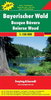
Bavarian Forest - The Danube: Regensburg - Passau - Linz
Bavarian Forest - The Danube area in a series of cycling maps of Germany at 1:150, 000 from the ADFC (Allgemeiner Deutscher Fahrrad-Club), the official German cycling federation, with extensive overprint for long-distance and local cycling routes, plus a booklet with accommodation suggestions.The maps are contoured; the interval varies according to the type of the terrain. Steep roads also indicated by gradient marking. Colouring and/or graphics show various types of landscape: woods, vineyards, etc. An overprint highlights both the national long-distance cycling routes and the shorter local cycling trails, each clearly identified by a symbol and/or an abbreviation of its name. Sections with heavy traffic and/or poor road surface are clearly marked. Symbols indicate various
facilities, such as railway stations with cycle hire, cycle repair shops, campsites, youth hostels, shelters, country restaurants/bars, sport and leisure facilities, etc. The maps have a 5-km UTM grid and each title covers an area of approx. 130 x 160km (81 x 100 miles). Map legend is in German only. The series is currently being revised - new editions are now printed on light, waterproof and tear-resistant synthetic paper and provide online links for information about accommodation, GPS waypoints, etc, previously included in the accompanying booklets. Titles still to be revised come with a booklet, as indicated in the individual descriptions.
facilities, such as railway stations with cycle hire, cycle repair shops, campsites, youth hostels, shelters, country restaurants/bars, sport and leisure facilities, etc. The maps have a 5-km UTM grid and each title covers an area of approx. 130 x 160km (81 x 100 miles). Map legend is in German only. The series is currently being revised - new editions are now printed on light, waterproof and tear-resistant synthetic paper and provide online links for information about accommodation, GPS waypoints, etc, previously included in the accompanying booklets. Titles still to be revised come with a booklet, as indicated in the individual descriptions.
Product Description
Reviews/Comments
Add New
Vouchers
No voucher codes found.
Do you know a voucher code for this product or supplier? Add it to Insights for others to use.
Do you know a voucher code for this product or supplier? Add it to Insights for others to use.
 Denmark