
 United Kingdom
 France
 Germany
 Netherlands
 Sweden
 USA
USA
 Italy
Italy
 Spain
Spain
More From Contributor


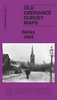
Bathgate 1896
Bathgate in 1896 in a fascinating series of reproductions of old Ordnance Survey plans in the Alan Godfrey Editions, ideal for anyone interested in the history of their neighbourhood or family. Selected towns in Great Britain and Ireland are covered by maps showing the extent of urban development in the last decades of the 19th and early 20th century.In this title: the map is double-sided. The main map covers most of the town, with coverage extending south-east to Kirkroads. Features include NBR Bathgate Section with Upper Station, Polkenmet Junction, Lower Station, mineral railway, Balbardie Collieries Mine, Bridge-end, Easton, disused colliery, Iron Foundry, West Lothian Shovel Works, Bathgate Academy, Balbardie House, etc. On the reverse is about half of the adjacent sheet
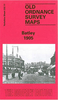
9.02 extending coverage northward to include Balbardie Mains, Glenmavis Distillery, Balbardie Pit No.1 and Ballencrieff Mains. About the Alan Godfrey Editions of the 25
9.02 extending coverage northward to include Balbardie Mains, Glenmavis Distillery, Balbardie Pit No.1 and Ballencrieff Mains. About the Alan Godfrey Editions of the 25
Product Description
Reviews/Comments
Add New
Vouchers
No voucher codes found.
Do you know a voucher code for this product or supplier? Add it to Insights for others to use.
Do you know a voucher code for this product or supplier? Add it to Insights for others to use.
 Denmark