
 United Kingdom
 France
 Germany
 Netherlands
 Sweden
 USA
USA
 Italy
Italy
 Spain
Spain
More From Contributor
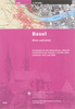


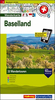


Basel Swisstopo Hiking 213T
Basel area, map No. 213T, at 1:50, 000 in a special hiking edition of the country’s topographic survey, published by Swisstopo in cooperation with the Swiss Hiking Federation. Cartography, identical to the standard version of the survey, is highly regarded for its superb use of graphic relief and hill shading to provide an almost 3-D picture of Switzerland`s mountainous terrain. Contours are at 20m intervals. An overprint highlights routes maintained by the SHF, distinguishing between hiking routes, mountain routes requiring proper footwear, and alpine routes where equipment is needed. Paths which are part of the national or regional network of long-distance hiking routes are specially marked and in the more recent editions are annotated with their official numbers. The maps show
mountain huts, refuges and in remote areas also inns, plus roads with bus service and the positions of bus stops. All the maps have a 1-km grid of the Swiss national coordinates.For a list of all the titles in this series, please click on the series link.
mountain huts, refuges and in remote areas also inns, plus roads with bus service and the positions of bus stops. All the maps have a 1-km grid of the Swiss national coordinates.For a list of all the titles in this series, please click on the series link.

Product Description
Reviews/Comments
Add New
Intelligent Comparison
Archived Product
Baden Swisstopo Hiking 215T Stanfords
£18.99
Archived Product

Bern Swisstopo Hiking 243T Stanfords
£18.99
Archived Product

Lachen Swisstopo Hiking 236T Stanfords
£18.99
Archived Product

Liestal Swisstopo Hiking 214T Stanfords
£18.99
Archived Product
Stans Swisstopo Hiking 245T Stanfords
£18.99
Archived Product
Frauenfeld Swisstopo Hiking 216T Stanfords
£18.99
Archived Product

Delémont Swisstopo Hiking 223T Stanfords
£18.99
Archived Product
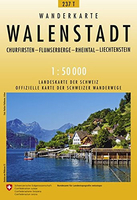
Walenstadt Swisstopo Hiking 237T Stanfords
£18.99
Vouchers
No voucher codes found.
Do you know a voucher code for this product or supplier? Add it to Insights for others to use.
Do you know a voucher code for this product or supplier? Add it to Insights for others to use.
 Denmark