
 United Kingdom
 France
 Germany
 Netherlands
 Sweden
 USA
USA
 Italy
Italy
 Spain
Spain
More From Contributor
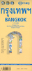


Bangkok City Map & Mini Guide
The AA City Map & Mini Guide to Bangkok is a laminated, indexed street plan of Bangkok at approximately 1:50, 000 scale. The map also includes information on top tourist attractions and sights, listings of top restaurants, tips on shopping & entertainment venues, and city transport information.Principal streets & roads are marked and named, with main roads highlighted. Parks, lakes and major public buildings are shaded, and symbols show major monuments, historical sights and temples, as well as many of the principal markets and some practical traveller information such as post offices & tourist information centres. City transport services, including the Skytrain routes & stations, railway routes & stations, parking, bus stations and ferry piers are shown.An inset gives a
diagrammatic map of the city transport network.The map covers an area of approximately 20x19km, approximately centred on Ratcha Thewi. The multi-lingual legend includes English.
diagrammatic map of the city transport network.The map covers an area of approximately 20x19km, approximately centred on Ratcha Thewi. The multi-lingual legend includes English.
Product Description
Reviews/Comments
Add New
Intelligent Comparison
Archived Product
Bangkok City Pack Guide Stanfords
£6.99
Archived Product
Bangkok City Pack Guide Stanfords
£7.99
Archived Product
Bangkok City Guide Stanfords
£13.99
Archived Product
Bangkok City Guide Stanfords
£14.99
Archived Product
Dublin City Map And Mini Guide Stanfords
£4.99
Archived Product
Bangkok MapGuide Stanfords
£5.99
Archived Product
Helsinki City Map & Guide Stanfords
£10.99
Vouchers
No voucher codes found.
Do you know a voucher code for this product or supplier? Add it to Insights for others to use.
Do you know a voucher code for this product or supplier? Add it to Insights for others to use.
 Denmark