More From Contributor

£10.00
” An utter delight”
- Jennifer Tetlow. In the Encounters in the Wild series, renowned nature writer Jim Crumley gets up close
...
Archived Product
£6.99
Badger & friends are enjoying a glorious day in the warm summer sun when they discover the stream has run dry! Badger has a plan to find water, but the journey will be long, hot & hard. Can the friends find water before it`s too late? Badger & the Great Journey is an exciting adventure about friendship, courage & water conservation. Fans of Badger & the Great Storm & Badger & the Great Rescue will love this charming sequel, featuring the bright & heart-warming illustrations of Caroline Pedler (Don`t Wake the Bear, Hare! & A Mouse So Small). ...
Archived Product
£4.99
The Sheep Foldable Shopping Bag, comes as a compact & colourful pouch in the shape of a fox & unfolds into a tote bag with delicate decorative print. Very lightweight, the little sheep can fit into any handbag & be ready to use as an alternative to a plastic bag. The Sheep Foldable Shopping Bag is ideal for when you pop out to get your lunch or a few items from the shops. ...
Archived Product
£9.99
Shortlisted for the Wainwright Prize 2014
- Britain is the home of the badger
- there are more badgers per square kilometre

...
Archived Product
£6.50
Topographic coverage of the Balearic Islands at 1:25, 000 published by the Instituto Geográfico Nacional – Centro Nacional de Información Geografica, the country’s civilian survey organization. The maps have contours at 10m intervals & colouring and/or graphics to show different types of vegetation or land use. Boundaries of national parks & other protected areas are marked. In addition to all the usual information shown on topographic mapping at this scale: detailed presentation of the road & rail networks, rural tracks & paths, etc, the maps also show campsites. The maps have a 1-km UTM grid, plus margin ticks for latitude & longitude at 1` intervals. The majority of the titles have been published since late 1990s. Map legend is in Spanish only.COVERAGE: each 25K map covers one quarter of the corresponding 1:50, 000 map, with the numbering system: I = NW quarter, II = NE quarter, III = SW quarter, & IV = SE quarter. To see other titles in this series please click on the series link. ...
Archived Product
£9.99
Map No. 239, Badlands National Park, SD, in an extensive series of GPS compatible, contoured hiking maps of USA’s national & state parks or forests & other popular recreational areas. Cartography based on the national topographic survey, with additional tourist information. The maps, with most titles now printed on light, waterproof & tear-resistant plastic paper, highlight walking trails along with campsites & other accommodation, picnic sites, areas for various recreational pursuits such as horse riding or skiing, drinking water sources, & many other facilities of interest to the outdoor enthusiast. Cartography is based on information from the USGS (United States Geological Survey
- the country’s national survey organization), revised by the National Geographic Maps in cooperation with the National Park Service, USDA Forest Service, etc. Topography is excellently presented by contours (interval varies according to scale), enhanced by relief shading & colouring/graphics for wood cover, glaciers, etc. All heights are given in feet. The maps have a UTM grid plus latitude & longitude margin ticks & GPS waypoints for selected important locations. Each map is double-sided to give either maximum coverage of the chosen area or additional enlargements of its important sections. Accompanying notes provide useful information on relevant regulations, safety precautions, contact addresses, etc.* *IMPORTANT
- PLEASE NOTE: the series is very extensive, ranging in scale from 1:400, 000 for the vast national parks of Alaska to 1:25, 000 for local map in several states. We recommend, therefore, viewing the series by state rather than the whole list.*

...
Archived Product
£11.99
A long standing feature on the traveller’s shelf, the very term ‘ Baedeker’ has been synonymous with ‘travel guide’. Baedeker divides the main section of their guides into four categories
- background, practicalities, tours & A-Z of sites. Each guide is introduced by a double spread of sightseeing highlights & special Baedeker best tips. The background section provides facts, history & cultural information on the destination, whilst summary introductions to things such as language, accommodation, transport, food & drink are found in the practicalities chapter. A selection of tours is given to take in a variety of places of interest & an approximate duration is usefully indicated for each itinerary. The major section of each book deals with a substantial & detailed A-Z of sites. The A-Z listing comes with 3-d pull outs of selected destinations & some printed building plans of historic sites & museums to help orientate the visitor. The guides have a large amount of colour illustrations, come with a free map showing key transport information & places of interest & are produced in a protective plastic jacket.
...
Archived Product
£15.99
This is the ultimate guidebook for the Victorian Tourist. Seventy two tours of Great Britain from Scilly to Shetland described in detail for visitors at the end of the nineteenth century. The latter years of the Victorian era witnessed a massive expansion in the tourist industry. The advent of railways & better roads had, at last, made travel tolerable. For previous generations serious travel had been restricted to the Grand Tour, the gentle & cultured aristocratic exploration of Europe but now, at the end of the nineteenth century, we find that the intrigue of travel has become a fascination for the new middle classes. In 1890, apart from galleries, museums, a few zoos & the occasional glimpse of a stately home there were no 'attractions', so instead the early tourist visited Britain, all of it, delving into the character of the villages, market towns, cathedral cities & a countryside that had changed little for centuries. There is advice on money, travel, hotels etc., coloured maps, street plans & fold out maps of the entire railway network. If you seek out the old in your travels, whether for real or from the comfort of your armchair, this book remains perfectly valid. ...
Archived Product
£14.99
This is what the visitor to London would have used at the close of the Victorian era. Not only are all the major sites & attractions mentioned (which are unchanged) but, most interesting to us today, there is copious advice on etiquette, security, accommodation, restaurants, pubs, travel both from overseas & within the city. It

Includes::
a fold out plan of the city & many street & site plans of buildings & museums. Compare this with a current guide to the city & see what has stayed & what has changed!

...
Archived Product
£6.95
Topographic coverage of mainland Spain at 1:50, 000 in the MTN50 (Mapa Topográfico Nacional) series from the Centro Nacional de Información Geografica, the country’s civilian survey organization. The maps have contours at 20m intervals, enhanced by relief shading, plus colouring and/or graphics to show different types of terrain, vegetation or land use. Boundaries of national parks & other protected areas are marked. In addition to all the usual information featured on topographic mapping at this scale, detailed presentation of the road & rail networks, rural tracks & paths, etc, the maps also show campsites & mountain refuges. On more recent editions some GRs, the official long-distance hiking routes, are also marked (although not as clearly as on hiking maps from other publishers). Each map covers 29.5x 18.5 km (with adjustments in the border or coastal areas). The maps have a 1-km UTM grid, plus margin ticks for latitude & longitude at 1` intervals. Map legend is in Spanish only.HOW TO CHOOSE THE RIGHT 50K MAP: all the titles in CNIG’s 200K Provincial Road Maps series at 1:200, 000 are overprinted with the grid for the 1:50, 000 maps & can be used to see the area covered by each 50K title. TO SEE THE LIST OF TITLES IN THIS SERIES PLEASE CLICK ON THE SERIES LINK.PLEASE NOTE
- MAP TITLES: the grids shown on our website serve both the civilian & the military 1:50, 000 topographic series. Although the areas covered by maps in both series are identical (apart from some border or coastal sheets), occasionally map titles differ – only one title is shown on the grid, usually the military one. In Galicia, the Basque country & in the Catalan speaking areas the tendency now is to use local place names rather than the often better known Castilian ones. Where possible, both versions are included in our titles. Map titles listed on our website are based on information received by us at the time of publication, but sometimes maps arrive showing a completely different title! As long as the map number is as ordered, the correct map has been supplied.
...
Archived Product

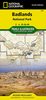
Badlands - A Tourist Trail On The Axis Of Evil SUPERCEDED

Badlands is Tony Wheeler's personal account of his experiences in some of the most repressed and dangerous regimes in the world. He selected these 'Bad Lands' based on a simple criteria - how each country treats its own citizens, if it is involved in terrorism and if it is a threat to other countries. He examines nine countries - Afghanistan, Albania, Burma, Cuba, Iran, Iraq, Libya, North Korea and Saudi Arabia - in an incisive political and social commentary that asks 'what makes a country truly evil?' 'How bad is really bad?' Badlands is a witty and personal travel account by the founder of Lonely Planet, a fascinating account of life in these closed off countries that will appeal to anyone with an interest in the state of the world today. A list of extra Badlands that didn't
quite make the list Tony Wheeler's Evil Meter[trademark] - How does a country achieve Bad Land status? What makes a country truly evil? And what country heads the list?
RIP - This product is no longer available on our network. It was last seen on 25.09.2019

This page now acts as a permanent archive for this product. Add more information using the comments box below to ensure it can still be found by future generations.

Use our search facility to see if it is available from an alternative contributor.
  • Availability: Out Of Stock
  • Supplier: Stanfords
  • SKU: 9781741791860
Availability: In Stock
£7.99

Product Description

Badlands is Tony Wheeler's personal account of his experiences in some of the most repressed & dangerous regimes in the world. He selected these ' Bad Lands' based on a simple criteria
- how each country treats its own citizens, if it is involved in terrorism & if it is a threat to other countries. He examines nine countries
- Afghanistan, Albania, Burma, Cuba, Iran, Iraq, Libya, North Korea & Saudi Arabia
- in an incisive political & social commentary that asks 'what makes a country truly evil?' ' How bad is really bad?' Badlands is a witty & personal travel account by the founder of Lonely Planet, a fascinating account of life in these closed off countries that will appeal to anyone with an interest in the state of the world today. A list of extra Badlands that didn't quite make the list Tony Wheeler's Evil Meter[trademark]
- How does a country achieve Bad Land status? What makes a country truly evil? & what country heads the list?

Reviews/Comments

Add New

Intelligent Comparison

Oooops!
We couldn't find anything!
Perhaps this product's unique.... Or perhaps we are still looking for comparisons!
Click to bump this page and we'll hurry up.

Price History

Vouchers

No voucher codes found.
Do you know a voucher code for this product or supplier? Add it to Insights for others to use.

Facebook

Jargon Buster

World - A physical grouping, commonly used to describe earth and everything associated with ti
Simple - Basic, easy no difficulty in understanding.
Personal - Something that belongs more to an individual due to it affecting them more by relating to them.

Supplier Information

Stanfords
Stanfords was established in 1853 and opened their iconic Covent Garden flagship store in 1901. They have become the top retailer of maps, travel books and accessories in the UK and arguably offer the largest selection of maps and travel books worldwide. Famous names such as Captain Robert Falcon Scott, Ranulph Fiennes and Michael Palin have purchased from Stanfords. They now have a shop in Bristol and both stores together with other venues operate a calendar of events including talks, book signings and exhibitions. As a specialist map retailer, the map selection is comprehensive and includes road maps, street maps and walking maps from worldwide destinations, as well as a selection of world atlases and wall maps. Books include travel guides and travel literature. Stanfords also stock globes, from miniatures made of blue marble to magnificent floor-standing globes. The website features a selection of interesting articles on travel topics.
Page Updated: 2023-11-12 20:15:36

Community Generated Product Tags

Oh No! The productWIKI community hasn't generated any tags for this product yet!
Menu