More From Contributor
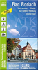
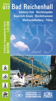
£9.50
One of the titles in a series of double-sided topographic maps with hiking routes & tourist information. Cartography is identical to the standard topographic survey of Germany, with contours at 10m intervals. Extensive overprint highlights numerous local footpaths & long-distance hiking routes, indicating waymarking. Cycling routes, mountain bike centres & trails, & cross-country ski routes are also marked. Extensive range of symbols highlight sport & leisure facilities, various types of accommodation, places of interest, tourist railways, etc. Boundaries of national parks & nature reserves are marked. The maps have a 2km UTM grid. Map legend

Includes::
English. The maps also have lists of contact details of various organizations & facilities within the region, plus brief descriptions in German only.

...
Archived Product
£16.99
Hearing a blast, journalist Anjan Sundaram headed uphill towards the sound. Grenade explosions are not entirely unusual in the city of Kigali; dissidents throw them in public areas to try & destabilise the government &, since moving to Rwanda, he had observed an increasing number of them. What was unusual about this one, however, was that when Sundaram arrived, it was as though nothing had happened. Traffic circulated as normal, there was no debris on the streets & the policeman on duty denied any event whatsoever. This was evidence of a clean-up, a cloaking of the discontent in Rwanda & a desire to silence the media in a country most of whose citizens were without internet. This was the first of many ominous events. Bad News is the extraordinary account of the battle for free speech in modern-day Rwanda. Following not only those journalists who stayed, despite fearing torture or even death from a ruthless government, but also those reporting from exile, it is the story of papers being shut down, of lies told to please foreign delegates, of the unshakeable loyalty that can be bred by terror, of history being retold, of constant surveillance, of corrupted elections & of great courage. It tells the true narrative of Rwandan society today &, in the face of powerful forces, of the fight to make explosions heard. ...
Archived Product
£9.99
Hearing a blast, journalist Anjan Sundaram headed uphill towards the sound. Grenade explosions are not entirely unusual in the city of Kigali; dissidents throw them in public areas to try & destabilise the government &, since moving to Rwanda, he had observed an increasing number of them. What was unusual about this one, however, was that when Sundaram arrived, it was as though nothing had happened. Traffic circulated as normal, there was no debris on the streets & the policeman on duty denied any event whatsoever. This was evidence of a clean-up, a cloaking of the discontent in Rwanda & a desire to silence the media in a country most of whose citizens were without internet. This was the first of many ominous events. Bad News is the extraordinary account of the battle for free speech in modern-day Rwanda. Following not only those journalists who stayed, despite fearing torture or even death from a ruthless government, but also those reporting from exile, it is the story of papers being shut down, of lies told to please foreign delegates, of the unshakeable loyalty that can be bred by terror, of history being retold, of constant surveillance, of corrupted elections & of great courage. It tells the true narrative of Rwandan society today &, in the face of powerful forces, of the fight to make explosions heard. ...
Archived Product
£8.99
Bad Reichenhall on a topographic map at 1:200, 000 from the Bundesamt für Kartographie und Geodäsie, Germany’s federal mapping agency. The map covers an area of Approx. 100 x 90km. This map is belongs to a series of 58 topographic maps from Bundesamt für Kartographie und Geodäsie, the federal cartographic agency of Germany responsible for topographic mapping at 1:200, 000 & maps at smaller scales (the more detailed topographic & leisure maps are prepared & published by the survey organizations of the individual states). Cartography is from the 200K topographic survey & the maps have very elegant, modern look whilst retaining the traditional German presentation of names of smaller towns & villages in italics. Contours are at 12, 5m intervals, enhanced by relief shading, with colouring for woodlands, moors, marches, vineyards & hop plantations. Waterways & rivers are also described in detail, with currents, waterfalls, dams, & jetties clearly marked. Road network, graded into five types, highlights in colour national & regional roads; no driving distances are marked Railway network is also shown in detail, with stations, goods only lines, etc. The maps show administrative boundaries of states & counties, & have a UTM grid plus margin ticks for latitude & longitude at 2’ intervals. Map legend is in German only. PLEASE NOTE: maps in this series provide an excellent presentation of the areas covered by them, with plenty of place names & detailed representation of the road network, & will appeal to anyone who likes quality cartography, but they are not necessarily the best option for holiday & business travel. To see other titles in this series please click on the series link. ...
Archived Product
£11.50
Bad Rodach in a series of GPS compatible recreational editions of the Bavarian topographic survey at 1:25, 000, with waymarked hiking trails & cycling routes, campsites & youth hostels, etc. Coverage

Includes::
Weitramsdorf, Meeder, Bad Colberg-Heldburg, Ummerstadt. Contours used in this map vary between 5 to 20m according to the terrain, with 20m interval predominantly used for hilly areas. Varied colouring show different types of landscape: woods, vineyards, fields etc. Maps in this series feature extensive overprint highlighting local & long-distance footpaths & cycle routes, including King Ludwig Way or different variants of the Way of St James, indicating their waymarking. Symbols highlight different types of accommodation (campsites, youth hostels, refuges, etc), sport & recreational facilities, various places of interest, etc. The maps have a 1-km UTM grid. Map legend & all the text are in German only. To see other titles in this series please click on the series link.

...
Archived Product
£9.50
One of the titles in a series of double-sided topographic maps with hiking routes & tourist information. Cartography is identical to the standard topographic survey of Germany, with contours at 10m intervals. Extensive overprint highlights numerous local footpaths & long-distance hiking routes, indicating waymarking. Cycling routes, mountain bike centres & trails, & cross-country ski routes are also marked. Extensive range of symbols highlight sport & leisure facilities, various types of accommodation, places of interest, tourist railways, etc. Boundaries of national parks & nature reserves are marked. The maps have a 2km UTM grid. Map legend

Includes::
English. The maps also have lists of contact details of various organizations & facilities within the region, plus brief descriptions in German only.

...
Archived Product
£8.99
Ben Goldacre`s wise & witty bestseller, shortlisted for the Samuel Johnson Prize, lifts the lid on quack doctors, flaky statistics, scaremongering journalists & evil pharmaceutical corporations. Since 2003 Dr Ben Goldacre has been exposing dodgy medical data in his popular Guardian column. In this eye-opening book he takes on the MMR hoax & misleading cosmetics ads, acupuncture & homeopathy, vitamins & mankind`s vexed relationship with all manner of `toxins`. Along the way, the self-confessed ` Johnny Ball cum Witchfinder General` performs a successful detox on a Barbie doll, sees his dead cat become a certified nutritionist & probes the supposed medical qualifications of ` Dr` Gillian Mc Keith. Full spleen & satire, Ben Goldacre takes us on a hilarious, invigorating & ultimately alarming journey through the bad science we are fed daily by hacks & quacks. ...
Archived Product
£9.50
Map No. 710, Bad Segeberg & Environs
- Central Holstein, in a series of hiking maps from Kompass providing extensive coverage
...
Archived Product
£12.99
Bad Tölz
- Isarwinkel area of the German Alps at 1:35, 000 from Kümmerly+ Frey in a series GPS compatible, double-sided maps
...
Archived Product

Bad Reichenhall

Bad Reichenhall in a series of GPS compatible recreational editions of the Bavarian topographic survey at 1:25, 000, with waymarked hiking trails and cycling routes, campsites and youth hostels, etc. Coverage includes Salzburg-Süd, Berchtesgaden, Bayerisch Gmain, Bischofswiesen, Marktschellenberg, Piding.Contours used in this map vary between 5 to 20m according to the terrain, with 20m interval predominantly used for hilly areas. Varied colouring show different types of landscape: woods, vineyards, fields etc. Maps in this series feature extensive overprint highlighting local and long-distance footpaths and cycle routes, including King Ludwig Way or different variants of the Way of St James, indicating their waymarking. Symbols highlight different types of accommodation
(campsites, youth hostels, refuges, etc), sport and recreational facilities, various places of interest, etc. The maps have a 1-km UTM grid. Map legend and all the text are in German only.To see other titles in this series please click on the series link.
RIP - This product is no longer available on our network. It was last seen on 25.09.2019

This page now acts as a permanent archive for this product. Add more information using the comments box below to ensure it can still be found by future generations.

Use our search facility to see if it is available from an alternative contributor.
  • Availability: Out Of Stock
  • Supplier: Stanfords
  • SKU: 9783899335187
Availability: In Stock
£11.50

Product Description

Bad Reichenhall in a series of GPS compatible recreational editions of the Bavarian topographic survey at 1:25, 000, with waymarked hiking trails & cycling routes, campsites & youth hostels, etc. Coverage

Includes::
Salzburg-Süd, Berchtesgaden, Bayerisch Gmain, Bischofswiesen, Marktschellenberg, Piding. Contours used in this map vary between 5 to 20m according to the terrain, with 20m interval predominantly used for hilly areas. Varied colouring show different types of landscape: woods, vineyards, fields etc. Maps in this series feature extensive overprint highlighting local & long-distance footpaths & cycle routes, including King Ludwig Way or different variants of the Way of St James, indicating their waymarking. Symbols highlight different types of accommodation (campsites, youth hostels, refuges, etc), sport & recreational facilities, various places of interest, etc. The maps have a 1-km UTM grid. Map legend & all the text are in German only. To see other titles in this series please click on the series link.

Reviews/Comments

Add New

Intelligent Comparison

Oooops!
We couldn't find anything!
Perhaps this product's unique.... Or perhaps we are still looking for comparisons!
Click to bump this page and we'll hurry up.

Price History

Vouchers

No voucher codes found.
Do you know a voucher code for this product or supplier? Add it to Insights for others to use.

Facebook

Jargon Buster

GPS - Global Positioning System - Global position using satellites
Hiking - An outdoor activity envolving walking in nature
King - The figure head of a monarch
Km - Kilometre. A unit of measurement equal to 1000 metres.
Accommodation - A room in which someone can live in, for example in a hotel
Feature - An attribute that makes something stand out.

Supplier Information

Stanfords
Stanfords was established in 1853 and opened their iconic Covent Garden flagship store in 1901. They have become the top retailer of maps, travel books and accessories in the UK and arguably offer the largest selection of maps and travel books worldwide. Famous names such as Captain Robert Falcon Scott, Ranulph Fiennes and Michael Palin have purchased from Stanfords. They now have a shop in Bristol and both stores together with other venues operate a calendar of events including talks, book signings and exhibitions. As a specialist map retailer, the map selection is comprehensive and includes road maps, street maps and walking maps from worldwide destinations, as well as a selection of world atlases and wall maps. Books include travel guides and travel literature. Stanfords also stock globes, from miniatures made of blue marble to magnificent floor-standing globes. The website features a selection of interesting articles on travel topics.
Page Updated: 2023-11-12 20:15:36

Community Generated Product Tags

Oh No! The productWIKI community hasn't generated any tags for this product yet!
Menu