
 United Kingdom
 France
 Germany
 Netherlands
 Sweden
 USA
USA
 Italy
Italy
 Spain
Spain
More From Contributor


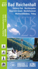

Bad Reichenhall
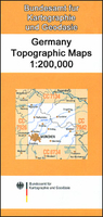
Bad Reichenhall on a topographic map at 1:200, 000 from the Bundesamt für Kartographie und Geodäsie, Germany’s federal mapping agency. The map covers an area of approximately 100 x 90km.This map is belongs to a series of 58 topographic maps from Bundesamt für Kartographie und Geodäsie, the federal cartographic agency of Germany responsible for topographic mapping at 1:200, 000 and maps at smaller scales (the more detailed topographic and leisure maps are prepared and published by the survey organizations of the individual states). Cartography is from the 200K topographic survey and the maps have very elegant, modern look whilst retaining the traditional German presentation of names of smaller towns and villages in italics. Contours are at 12, 5m intervals, enhanced by relief
shading, with colouring for woodlands, moors, marches, vineyards and hop plantations. Waterways and rivers are also described in detail, with currents, waterfalls, dams, and jetties clearly marked. Road network, graded into five types, highlights in colour national and regional roads; no driving distances are marked Railway network is also shown in detail, with stations, goods only lines, etc. The maps show administrative boundaries of states and counties, and have a UTM grid plus margin ticks for latitude and longitude at 2’ intervals. Map legend is in German only. PLEASE NOTE: maps in this series provide an excellent presentation of the areas covered by them, with plenty of place names and detailed representation of the road network, and will appeal to anyone who likes
quality cartography, but they are not necessarily the best option for holiday and business travel.To see other titles in this series please click on the series link.

Product Description
Reviews/Comments
Add New
Vouchers
No voucher codes found.
Do you know a voucher code for this product or supplier? Add it to Insights for others to use.
Do you know a voucher code for this product or supplier? Add it to Insights for others to use.
 Denmark