More From Contributor
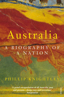
£9.50
Australia at 1:4, 000, 000 on an indexed road map with topographic & tourist information, printed on light, waterproof & tear-resistant plastic paper. The map, published by Reise Know-How as part of their highly acclaimed World Mapping Project, is double-sided to provide the best balance between a good scale & a convenient size sheet. Road network is shown on a base with light altitude colouring & contours showing the country ...
Archived Product
£7.95
Australia at 1:4, 500, 000 from Nelles Verlag, with its smaller size map offering a convenient format for use when travelling. Several insets provide street plans of city centres & enlargements of the most visited areas. The map divides the country east/west. Vivid relief shading with spot heights & names of mountain ranges, deserts, etc, presents the topography. National or state parks & other protected area are highlighted. The map presents an overview of the country ...
Archived Product
£13.59
Australia in the Countries, Regions & Cities series from Rough Guides; comprehensively detailed guidebooks specifically designed for independent travellers & serving a range of worldwide destinations. Widely recognised for their free editorial style, Rough Guide authors are allowed to express their personal opinions on a range of subjects. Although sometimes controversial, this editorial stance allows readers to experience more detailed & personal takes on each destination, a feature often more limited in other guidebooks. Cultural & historical nuances are explored in significant depth throughout the text & descriptions on the ambience of individual settings alongside personal recommendations, particularly in cities, are notably prevalent. Each Rough Guide in the Countries, Regions & Cities series has a similar layout. A ...
Archived Product
£15.19
Australia in the Countries & Regions series from Lonely Planet, market-leading comprehensive guides aimed at independent travellers & serving a large range of international destinations. Frank & informal in style, the guides explore an extensive range of sights, activities, accommodation, restaurants & nightlife & are designed for practical use while travelling on the road. Written & researched by a team of experts, each book is independent in its recommendations & suggestions, often offering individual takes on individual destinations. Widely recognised for their reliability, each Lonely Planet country & region guide has the same layout. Introductory sections profile the destination with individual chapters on particular highlights, getting started, (including when to go) itineraries, history, culture, arts, food & drink & the environment. Each guide is organised geographically by region, with individual sections detailing an extensive range of sights, places of interest, attractions, restaurants, nightlife, accommodation & any local activities. The guides have detailed explanations of historical context where relevant. There is also practical guidance on ...
Archived Product
£16.99
Australia Baedeker is divided into four main categories
- background, practicalities, tours & A-Z of sites. The guide is introduced
...
Archived Product
£18.99
Australia in the Countries, Regions & Cities series from Rough Guides; comprehensively detailed guidebooks specifically designed for independent travellers & serving a range of worldwide destinations. Widely recognised for their free editorial style, Rough Guide authors are allowed to express their personal opinions on a range of subjects. Although sometimes controversial, this editorial stance allows readers to experience more detailed & personal takes on each destination, a feature often more limited in other guidebooks. Cultural & historical nuances are explored in significant depth throughout the text & descriptions on the ambience of individual settings alongside personal recommendations, particularly in cities, are notably prevalent. Each Rough Guide in the Countries, Regions & Cities series has a similar layout. A ...
Archived Product
£5.00
Remember Australia for ever with this exquisite cut-paper guide. This beautifully illustrated three-dimensional pocket guide unfolds to a length of 1.5 metres & features the most important sites in Australia, including Sydney Opera House, Sydney Harbour Bridge, Parliament House, Melbourne Cricket Ground, Twelve Apostles, Port Arthur, Daintree Rainforest, St Peter`s Cathedral, Wave Rock, Uluru, the Ghan, Kakadu National Park & the Great Barrier Reef. Presented in a slipcase, this is the perfect gift or souvenir for anyone wishing to remember a visit to Australia. It can be sold in gift, novelty or travel sections. It is great for counter displays as it makes the perfect impulse purchase. Presented in a stylish slipcase, it makes a great alternative to a postcard. ...
Archived Product
£55.00
This landmark book charts the development of Australian art, from early Aboriginal work to that of the first colonial settlers, immigrant artists of the twentieth century & the culturally diverse inhabitants of the country today. Exploring this eclectic 300-year history, the book also celebrates key moments in the Australian canon, such as Sidney Nolans iconic paintings about the outlaw Ned Kelly, begun in the 1940s. In recent years the tenacious influence of European art on Australian practice has waned, making way for a highly original native art scene of international standing. Such contemporary artists as Tracey Moffatt, Fiona Hall & Vernon Ah Kee are also represented here. The art of this continent is indelibly linked to its epic landscape. This book focuses especially on this complex & evolving alliance, illustrating in paintings, prints, drawings, photographs & film & video stills the distinctive Australian terrain, & examining the ways in which Australian artists have sought to negotiate their identities in relation to the extremes of their l&. ...
Archived Product
£10.99
Australia at 1:2, 800, 000 on a large, double-sided road map from Hildebrand with a vivid presentation of the country’s topography, an index which

Includes::
places of interest, street plans and/or suburbs maps of main cities, a comprehensive distance table, two general maps of the whole country, plus maps of the offshore islands. The map divides the country east/west, with Alice Springs included on both sides. Bold relief shading shows the topography, with plenty of names of individual mountain ranges, deserts, etc. The map shows the boundaries of national parks & other protected areas, Aboriginal lands, plus restricted entry areas. Road network presents the main highways with their numbers & names, &

Includes::
connecting regional roads plus selected smaller local roads. Driving distances are marked on main & regional routes. Main railway lines such as The Ghan or Trans-Australian are marked, also local airports. The map indicates interesting towns, UNESCO World Heritage sites, etc. Latitude & longitude lines are drawn at 2º intervals. The index has a separate list of places of interest. Map legend

Includes::
English. Also provided are: suburb maps of Sydney, Melbourne, Brisbane, Adelaide, Perth, Darwin & Canberra, plus for Sydney & Melbourne also city centre street plans; a state map of Australia, also indicating time zones; an overview map of Australia showing principal road & rail connections; a comprehensive distance table; plus panels with maps of Australia’s offshore islands.


...
Archived Product
£6.99
Insight Guide Travel Map Australia & New Zealand: This detailed travel map is all you need to plan your route & navigate your way around Australia & New Zeal&, & also

Includes::
area highlights, top attractions, places of interest, street plans, & a fabulous free app.· Travel Map Australia & New Zealand is drawn to scale & shows the entire country, complete with a comprehensive index· Ideal for planning your route, & on-the-road-exploring ·

Includes::
free app, with top travel tips, & additional area highlights· Features detailed street plans of Sydney· Outlines Top Attractions & places of interest, including national parks, nature reserves & heritage sites· Handy distance indicators, located in the margin, give distances to the nearest townand major locations· Shows roads, rail networks & ferry routes· Pictorial symbols allow for instant, easy recognition· Detailed topography, through the use of relief shading, with mountain ranges named, & peak heights given· Legend shown in eight languages


...
Archived Product

Australia

Australia celebrated one hundred years as a nation in 2001. This book - part history, part travelogue, part memoir - tells the inspiring story of how a one-time British colony of convicts turned itself into a prosperous and confident country. Through the eyes of ordinary people, Phillip Knightley describes Australia`s journey, from federation and the trauma of the First World War, the desperate poverty of the Depression, with its attendant spectres of secret armies and near-civil war, the threat of invasion in the Second World War and the immigration that followed it, and the slow but steady decline in the relationship with Britain, the `Mother Country`, as Australia forged its own unique identity.
RIP - This product is no longer available on our network. It was last seen on 25.09.2019

This page now acts as a permanent archive for this product. Add more information using the comments box below to ensure it can still be found by future generations.

Use our search facility to see if it is available from an alternative contributor.
  • External links may include paid for promotion
  • Availability: Out Of Stock
  • Supplier: Stanfords
  • SKU: 9780099772910
Availability: In Stock
£10.99

Product Description

Australia celebrated one hundred years as a nation in 2001. This book
- part history, part travelogue, part memoir
- tells the inspiring story of how a one-time British colony of convicts turned itself into a prosperous & confident country. Through the eyes of ordinary people, Phillip Knightley describes Australia`s journey, from federation & the trauma of the First World War, the desperate poverty of the Depression, with its attendant spectres of secret armies & near-civil war, the threat of invasion in the Second World War & the immigration that followed it, & the slow but steady decline in the relationship with Britain, the ` Mother Country`, as Australia forged its own unique identity.

Reviews/Comments

Add New

Intelligent Comparison

Oooops!
We couldn't find anything!
Perhaps this product's unique.... Or perhaps we are still looking for comparisons!
Click to bump this page and we'll hurry up.

Price History

Vouchers

No voucher codes found.
Do you know a voucher code for this product or supplier? Add it to Insights for others to use.

Facebook

Jargon Buster

History - Anything that happens in the past. An acedemic subject.
World - A physical grouping, commonly used to describe earth and everything associated with ti

Supplier Information

Stanfords
Stanfords was established in 1853 and opened their iconic Covent Garden flagship store in 1901. They have become the top retailer of maps, travel books and accessories in the UK and arguably offer the largest selection of maps and travel books worldwide. Famous names such as Captain Robert Falcon Scott, Ranulph Fiennes and Michael Palin have purchased from Stanfords. They now have a shop in Bristol and both stores together with other venues operate a calendar of events including talks, book signings and exhibitions. As a specialist map retailer, the map selection is comprehensive and includes road maps, street maps and walking maps from worldwide destinations, as well as a selection of world atlases and wall maps. Books include travel guides and travel literature. Stanfords also stock globes, from miniatures made of blue marble to magnificent floor-standing globes. The website features a selection of interesting articles on travel topics.
Page Updated: 2023-11-12 20:15:36

Community Generated Product Tags

Oh No! The productWIKI community hasn't generated any tags for this product yet!
Menu