More From Contributor
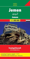
£8.99
Map No. 305, Yellowstone SE: Yellowstone Lake in Wyoming, at 1:63.360 in an extensive series of GPS compatible, contoured hiking maps of USA’s national & state parks or forests & other popular recreational areas. Cartography based on the national topographic survey, with additional tourist information. The maps, with most titles now printed on light, waterproof & tear-resistant plastic paper, highlight walking trails along with campsites & other accommodation, picnic sites, areas for various recreational pursuits such as horse riding or skiing, drinking water sources, & many other facilities of interest to the outdoor enthusiast. Cartography is based on information from the USGS (United States Geological Survey
- the country’s national survey organization), revised by the National Geographic Maps in cooperation with the National Park Service, USDA Forest Service, etc. Topography is excellently presented by contours (interval varies according to scale), enhanced by relief shading & colouring/graphics for wood cover, glaciers, etc. All heights are given in feet. The maps have a UTM grid plus latitude & longitude margin ticks & GPS waypoints for selected important locations. Each map is double-sided to give either maximum coverage of the chosen area or additional enlargements of its important sections. Accompanying notes provide useful information on relevant regulations, safety precautions, contact addresses, etc.* *IMPORTANT
- PLEASE NOTE: the series is very extensive, ranging in scale from 1:400, 000 for the vast national parks of Alaska to 1:25, 000 for local map in several states. We recommend, therefore, viewing the series by state rather than the whole list.*

...
Archived Product
£12.99
Outdoor recreation map, topographic shaded relief. The only locally-made Yellowstone trail map. Covers the entire park, with detailed maps for the Mammoth Hot Springs, Tower / Roosevelt, Canyon, & Old Faithful areas. It

Includes::
descriptions for ten day hikes, written by a former Yellowstone Ranger. It also

Includes::
descriptions for four mountain bike rides on dirt roads within the park. Printed on waterproof plastic paper.


...
Archived Product
£9.99
Map No. 201, Yellowstone National Park, WY/MT, in an extensive series of GPS compatible, contoured hiking maps of USA’s national & state parks or forests & other popular recreational areas. Cartography based on the national topographic survey, with additional tourist information. The maps, with most titles now printed on light, waterproof & tear-resistant plastic paper, highlight walking trails along with campsites & other accommodation, picnic sites, areas for various recreational pursuits such as horse riding or skiing, drinking water sources, & many other facilities of interest to the outdoor enthusiast. Cartography is based on information from the USGS (United States Geological Survey
- the country’s national survey organization), revised by the National Geographic Maps in cooperation with the National Park Service, USDA Forest Service, etc. Topography is excellently presented by contours (interval varies according to scale), enhanced by relief shading & colouring/graphics for wood cover, glaciers, etc. All heights are given in feet. The maps have a UTM grid plus latitude & longitude margin ticks & GPS waypoints for selected important locations. Each map is double-sided to give either maximum coverage of the chosen area or additional enlargements of its important sections. Accompanying notes provide useful information on relevant regulations, safety precautions, contact addresses, etc.* *IMPORTANT
- PLEASE NOTE: the series is very extensive, ranging in scale from 1:400, 000 for the vast national parks of Alaska to 1:25, 000 for local map in several states. We recommend, therefore, viewing the series by state rather than the whole list.*

...
Archived Product
£12.99
Outdoor recreation map, topographic shaded relief. the only locally made Yellowstone map.

Includes::
park

...
Archived Product
£12.99
Outdoor recreation map with topographic shaded relief. Covers Old Faithful Village, West Thumb, Grant Village, Bridge Bay, Lake Village, Fishing Bridge, West Yellowstone, Flagg Ranch. The only locally-made Yellowstone map.

Includes::
descriptions for 15 of Yellowstone`s best day hikes with hike descriptions written by Keri Thorpe, former Yellowstone National Park ranger. Also

Includes::
park regulation information. Features detailed maps for Mammoth, Tower/ Roosevelt, Canyon, & Old Faithful villages


...
Archived Product
£9.99
Yemen, including the Gulf of Aden, at 1:1, 250, 000 on an excellent & informative map from Gizi Maps, with a street plan of central Sana’a & enlargements of the environs of the capital & Aden, plus the Aden Peninsula. The map has the publisher’s characteristic bold altitude colouring & plenty of names of various mountain chains, peaks, deserts, etc. Graphics indicate swamps, salt flats, wadis, deserts, lava flows, water wells, oasis, etc, to provide a vivid picture of the country’s topography. Names of the larger towns, provinces & many geographical features are given in both Latin & Arabic alphabets; all other place names are shown only transliterated. Coverage extends southward to the northern coastline of the Horn of Africa, including the whole of Djibouti & most of Eritrea. Within the Gulf of Aden the Internationally Recommended Transit Corridor (IRTC) is marked, as well as other ferry & shipping routes including those leading to the Socotra Archipelago & in the southern part of the Red Sea. The map shows the country’s road network, including desert tracks, indicating distances on main routes & locations of border crossings to Oman & Saudi Arabia. Local airports are marked, as well as internal administrative boundaries with names of the provinces, plus oil or gas wells. Symbols highlight various places of tourist interest. The map has latitude & longitude lines at intervals of 1°. The index is next to the map. Map legend

Includes::
English. Also provided are a street plan of central Sana’a, plus enlargements of the environs of the capital, the environs of Aden (Adan) area including Little Aden, & the Aden Peninsula itself. All are annotated with various facilities & places of interest. Please note: this title is also available as a wall map.

...
Archived Product
£13.50
Yemen
- Gulf of Aden Wall Map at 1:1, 250, 000 from Gizi Maps, size 125 x 89cm (49” x 35” approx), with excellent presentation
...
Archived Product
£10.99
Our ideas of the Arabian Peninusula have been hijacked: by images of the desert, by oil, by the Gulf War. But there is another Arabia. For the Classical geographers Yemen was a fabulous land where flying serpents guarded sacred incense groves. Medieval Arab visitors told of disappearing islands & menstruating mountains. Vita Sackville-West found Aden `precisely the most repulsive corner of the world`. Arguably the most fascinating but least known country in the Arab world, Yemen has a way of attracting comment that ranges from the superficial to the wildly fictitious. In Yemen: Travels in Dictionary L&, Tim Mackintosh-Smith writes with an intimacy & depth of knowledge gained through over twenty years among the Yemenis. He is a travelling companion of the best sort
- erudite, witty & eccentric. Crossing mountain, desert, ocean & three millennia of history, he portrays hyrax hunters & dhow skippers, a noseless regicide, & a sword-wielding tyrant with a passion for Heinz Russian salad. Yet even the ordinary Yemenis are extraordinary: their family tree goes back to Noah & is rooted in a land which, in the words of a contemporary poet, has become the dictionary of its people. Every page of this book is dashed
- like the land it describes
- with the marvellous.


...
Archived Product
£10.99
Yemen at 1:1, 000, 000 from Freytag & Berndt with a separate booklet attached to the map cover also providing plans showing main streets & districts of Sana’a & Aden. All place names are given in Latin alphabet only. Topography is shown by relief shading, but disappointingly very little topographic information is included when compared with alternative coverage. The map shows the country’s road network, including selected desert tracks, with distances shown on main routes. Locations of border crossing are marked. Also shown are internal administrative boundaries with names of the provinces. The map has latitude & longitude lines at 1° intervals. Multilingual map legend

Includes::
English. The index is in a separate booklet attached to the map cover &

Includes::
plans of central Sana’a & Aden, naming main streets, districts & various places of interest.


...
Archived Product
£10.50
Indexed, waterproof & tear-resistant road map of Yemen with topographic & tourist information, published by Reise Know-How as part of their highly acclaimed World Mapping Project. The map is double-sided to present the area at best possible scale on a convenient size sheet. The island of Socotra is shown as an inset. Topography is shown by altitude colouring with contours, spot heights, mountain passes, & names of hill & mountain ranges. Desert areas, seasonal rivers & lakes, water holes, hot springs, palm groves & coral reefs are also marked. Internal administrative boundaries are shown with names of the provinces. All place names are shown transliterated, with alternative names provided for many locations. Road network

Includes::
unsurfaced roads & tracks, indicating locations of border crossings to Saudi Arabia & Oman. Local airfields are also marked. A range of symbols highlights various places of interest, including archaeological remains, selected hotels, beaches, etc. The map also indicates locations of oil wells. The map has a latitude & longitude grid at intervals of 1° & an index of place names. Map legend

Includes::
English.


...
Archived Product

Yemen

An attractive road map of the country with altitude colouring to show the relief. The cartography also shows physiography eg. dunes & lava, and hydrographic details eg. marshes and intermittent rivers.Intermediate road distances are indicated on main roads, and some unsurfaced roads and tracks are included.Symbols show the presence of many further features eg. airports, airfields, ports, hospitals, border crossings, antiquities, oases and beaches.Latitude an longitude lines are at 1
RIP - This product is no longer available on our network. It was last seen on 25.09.2019

This page now acts as a permanent archive for this product. Add more information using the comments box below to ensure it can still be found by future generations.

Use our search facility to see if it is available from an alternative contributor.
  • External links may include paid for promotion
  • Availability: Out Of Stock
  • Supplier: Stanfords
  • SKU: 9781553414629
Availability: In Stock
£9.95

Product Description

An attractive road map of the country with altitude colouring to show the relief. The cartography also shows physiography eg. dunes & lava, & hydrographic details eg. marshes & intermittent rivers. Intermediate road distances are indicated on main roads, & some unsurfaced roads & tracks are included. Symbols show the presence of many further features eg. airports, airfields, ports, hospitals, border crossings, antiquities, oases & beaches. Latitude an longitude lines are at 1

Reviews/Comments

Add New

Price History

Vouchers

No voucher codes found.
Do you know a voucher code for this product or supplier? Add it to Insights for others to use.

Facebook

Jargon Buster

Road - a manmade lane or a path that is used to speed up travel.
Altitude - Something that can be quite high in relation to sea or ground level.

Supplier Information

Stanfords
Stanfords was established in 1853 and opened their iconic Covent Garden flagship store in 1901. They have become the top retailer of maps, travel books and accessories in the UK and arguably offer the largest selection of maps and travel books worldwide. Famous names such as Captain Robert Falcon Scott, Ranulph Fiennes and Michael Palin have purchased from Stanfords. They now have a shop in Bristol and both stores together with other venues operate a calendar of events including talks, book signings and exhibitions. As a specialist map retailer, the map selection is comprehensive and includes road maps, street maps and walking maps from worldwide destinations, as well as a selection of world atlases and wall maps. Books include travel guides and travel literature. Stanfords also stock globes, from miniatures made of blue marble to magnificent floor-standing globes. The website features a selection of interesting articles on travel topics.
Page Updated: 2023-11-12 20:15:36

Community Generated Product Tags

Oh No! The productWIKI community hasn't generated any tags for this product yet!
Menu