
 United Kingdom
 France
 Germany
 Netherlands
 Sweden
 USA
USA
 Italy
Italy
 Spain
Spain
More From Contributor


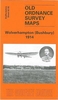
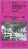
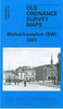
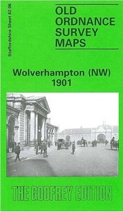
Wolverhampton North West 1901
Wolverhampton North West in 1901 in a fascinating series of reproductions of old Ordnance Survey plans in the Alan Godfrey Editions, ideal for anyone interested in the history of their neighbourhood or family. The map covers the north-western part of Wolverhampton, including part of the town centre and the Park Dale, Whitmore Reans and Newbridge areas. Coverage stretches from Stafford Street westward to Newbridge Crescent, and from Compton Road northward to Gorsebrook Road. Features include Market Hall, Market Place, St Peter`s Collegiate church, Town Hall, Drill Hall, Molineux Grounds, brewery, Christ Church, short stretches of GWR and LNWR railways, Stafford Road Works, Dunstall Hill, Morley House, West Park, Park Brewery, Whitmore Hall, grammar school, Chapel Ash
Farm, tramway, Newbridge House, Municipal Baths, Catholic Apostolic church, St Mary`s church, etc. On the reverse is a selection of trade directory entries. About the Alan Godfrey Editions of the 25” OS Series:Selected towns in Great Britain and Ireland are covered by maps showing the extent of urban development in the last decades of the 19th and early 20th century. The plans have been taken from the Ordnance Survey mapping and reprinted at about 15 inches to one mile (1:4, 340). On the reverse most maps have historical notes and many also include extracts from contemporary directories. Most maps cover about one mile (1.6kms) north/south, one and a half miles (2.4kms) across; adjoining sheets can be combined to provide wider coverage.FOR MORE INFORMATION AND A COMPLETE LIST OF
ALL AVAILABLE TITLES PLEASE CLICK ON THE SERIES LINK.

Product Description
Reviews/Comments
Add New
Intelligent Comparison
Archived Product

Wolverhampton South West 1901 Stanfords
£3.50
Archived Product

Wolverhampton South East 1901 Stanfords
£3.50
Archived Product

Wolverhampton North East And Heath Town 1901 Stanfords
£3.50
Archived Product

Walsall North West 1901 Stanfords
£3.50
Archived Product
Wigan North West 1907 Stanfords
£2.95
Archived Product

Northampton North 1899 Stanfords
£3.50
Vouchers
No voucher codes found.
Do you know a voucher code for this product or supplier? Add it to Insights for others to use.
Do you know a voucher code for this product or supplier? Add it to Insights for others to use.
 Denmark