
 United Kingdom
 France
 Germany
 Netherlands
 Sweden
 USA
USA
 Italy
Italy
 Spain
Spain
More From Contributor
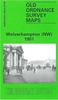

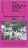
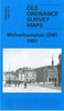


Wolverton And New Bradwell 1880
Wolverton and New Bradwell in 1880 in a fascinating series of reproductions of old Ordnance Survey plans in the Alan Godfrey Editions, ideal for anyone interested in the history of their neighbourhood or family. Selected towns in Great Britain and Ireland are covered by maps showing the extent of urban development in the last decades of the 19th and early 20th century.In this title: the map covers an area that is now at the northern end of Milton Keynes. The main map covers the centre of the new railway town of Wolverton that had sprung up around the original station on the LNWR main line, including carriage shed and part of the carriage works. St George the Martyr's church is in the middle of the development. The map also covers New Bradwill with St James's church and station (on the
Newport Pagnell branch). Other features are the Grand Junction Canal, Blue Bridge, Stonebridgehouse Farm, Corner Pin. By way of contrast, on the reverse is more than half of the 1938 survey of this areas showing how the communities had developed. Striking here is the far more extensive railway layout, with the main line (now LMSR) diverted round to the east, with a new Wolverton station. About the Alan Godfrey Editions of the 25
Newport Pagnell branch). Other features are the Grand Junction Canal, Blue Bridge, Stonebridgehouse Farm, Corner Pin. By way of contrast, on the reverse is more than half of the 1938 survey of this areas showing how the communities had developed. Striking here is the far more extensive railway layout, with the main line (now LMSR) diverted round to the east, with a new Wolverton station. About the Alan Godfrey Editions of the 25
Product Description
Reviews/Comments
Add New
Vouchers
No voucher codes found.
Do you know a voucher code for this product or supplier? Add it to Insights for others to use.
Do you know a voucher code for this product or supplier? Add it to Insights for others to use.
 Denmark