More From Contributor

£180.00
A Map Of Wiltshire, engraved From An Actual Survey.. ., an original antique map by J. Harrison, published in London, 1791. A copperplate engraving, coloured. Map size 32.5 x 46 cm with a mount size of 48.5 x 61.5 cm. An uncommon & detailed map of Wiltshire that appeared in Harrison's atlas, Maps Of The English Counties. The atlas was published in just two editions
- of 1791 & 1792. Many of the maps from the atlas have earlier dates in their imprints reflecting the date of the completion of the draught & engraving by Haywood (sometimes Heywood) & Sudlow. Although lacking decorative embellishments, these attractive & interesting maps reflect the transition from the elaborate works of the mid-eighteenth century to the more function-focused works of the next. Antique maps from various original publishers are presented on the Stanford
...
Archived Product
£80.00
Wiltshire, an original antique map by G. Cole / J. Roper published in London, 1810-1843. Copperplate, coloured. Map size 17 x 23 cm, overall mounted size 32.5 x 38.5 cm. This detailed map of Wiltshire is from Dugdale's England & Wales Delineated. The map was drawn by G. Cole & engraved by John Roper for publication first in The Beauties Of England & Wales, issued in parts, from c.1804. Such was the success of the publication that the maps were re-used in other publications, as here. The maps show accurate geographical detail, including the turnpike, mail coach & principal roads, sites of Roman & other historical remains, as well as the seats of the nobility & the gentry, & market towns with their distances from London. The maps also show the division of the counties into hundreds or wapontakes. They are representative of the functional nineteenth-century approach to cartography, yet are not unattractive. Antique maps from various original publishers are presented on the Stanford ...
Archived Product
£7.95
The 20 circular routes have been carefully designed with maximum off-lead time & minimum exposure to roads. Each walk has information on the distance & terrain, livestock likely to be encountered, number & type of stiles en route & in an emergency, the nearest veterinary surgery. The walks include Barbury Castle, Ogbourne St George, Savernake Forest, Stourhead, Tollard Royal & ancient Avebury where the Ridgeway footpath begins. ...
Archived Product
£12.99
This fully updated Philip`s street atlas of Wiltshire & Swindon gives comprehensive & detailed coverage of the area in a convenient spiral-bound format. The route planner shows all the A & B roads, & can be used when driving to get close to the destination before turning to the relevant large-scale street map. The street maps show every named road, street & lane very clearly, with major roads picked out in colour. The maps are at a scale of 3.5 inches to 1 mile, with less populated areas at 1.75 inches to 1 mile. Town maps of Andover & Frome are also included. Other information on the maps

Includes::
postcode boundaries, car parks, railway & bus stations, post offices, schools, colleges, hospitals, police & fire stations, places of worship, leisure centres, footpaths & bridleways, camping & caravan sites, golf courses, & many other places of interest. The comprehensive index lists street names & postcodes, plus schools, hospitals, railway stations, shopping centres & other such features picked out in red, with other places of interest shown in blue. Philip`s Street Atlas Wiltshire & Swindon is suitable for both business & leisure use.

...
Archived Product
£8.50
Ian White's mountain biking guide to Wiltshire has 25 circular routes along some of the most ancient tracks in Britain with sketch maps & details of the nearest railway stations. The guide also

Includes::
five ' Megaride' combinations; for these, Ian has linked together pairs of routes to create rides of between 45-75km. Why not challenge yourself on on of these epics, or create your own from a combination of the other 20 routes? The guide is a pleasure to read & use, either on the trail or off.

...
Archived Product
£9.99
Wiltshire in the AA 50 Walks series; comprising an extensive range of walking guides helping you to explore the best walking routes in Great Britain. Each guide covers a total of 50 walks, many of which are circular, between 2-10 miles & also that are suitable for a range of different walking standards. Every walk in the guides has an information box showing clear details of distance, minimum time, level of difficulty, any ascents, the nature of the terrain & landscape, suggested Ordnance Survey map, grid references for starting & finishing points, dog friendliness, parking & any public toilets en route. There are also suggestions of what to look out for & recommended places to eat & drink. Detailed walk descriptions are accompanied by clear mapping of the route ahead, in addition to colour photographs illustrating the highlights of selected routes. ...
Archived Product
£11.99
Walking is one of Britain`s favourite leisure activities, & this guide features a variety of mapped walks to suit all abilities. The book features all of the practical detail you need, accompanied by fascinating background reading on the history & wildlife of Wiltshire, & cear mapping for ease of use. Every route has been colour coded according to difficulty. All walks are annotated with local points of interest & places to stop for refreshments. Every walk is given a summary of distance, time, gradient, level of difficulty, type of surface & access, landscape, dog friendliness, parking & public toilets. ...
Archived Product
£6.99
Wiltshire
- from Salisbury to the Kennet in the Short Walks guide series, produced in association with Ordnance Survey & published
...
Archived Product
£3.50
Wimbledon in 1894 in a fascinating series of reproductions of old Ordnance Survey plans in the Alan Godfrey Editions, ideal for anyone interested in the history of their neighbourhood or family. The map covers the central & northern part of Wimbledon, stretching from Park Side eastward to the railway, & from the station northward to Wimbledon Park station. Features include Wimbledon Hill Road & Wimbledon Hill, northern part of Wimbledon station, Wimbledon Park station, Wimbledon Park House, St Mark`s church, St Mary`s church, Wimbledon House, eastern fringe of Wimbledon Common, Cannizaro House, etc. On the reverse is a selection of street directory entries, including Alexandra Road, Church Road, High Street, Hill Road & Wimbledon Hill. About the Alan Godfrey Editions of the 25” OS Series: Selected towns in Great Britain & Ireland are covered by maps showing the extent of urban development in the last decades of the 19th & early 20th century. The plans have been taken from the Ordnance Survey mapping & reprinted at about 15 inches to one mile (1:4, 340). On the reverse most maps have historical notes & many also include extracts from contemporary directories. Most maps cover about one mile (1.6kms) north/south, one & a half miles (2.4kms) across; adjoining sheets can be combined to provide wider coverage.FOR MORE INFORMATION & A COMPLETE LIST OF ALL AVAILABLE TITLES PLEASE CLICK ON THE SERIES LINK. ...
Archived Product
£30.00
From a sophisticated & decorative collection by We Love Cushions, designed to bring life & style to any room setting, a lovely cushion which would appeal to anyone who likes watching or playing mixed doubles, or has ever helped collecting & passing the balls. The image was taken from a London Transport’s pre-war poster advertising the Wimbledon championship tournament. The cover, printed using archival inks to get the brightest finish possible, with a super soft cotton linen mix, & comes complete with the cushion pad washable at 30º. To see other cushion designs in this series please lick on the series link. ...
Archived Product

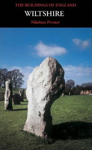
Wiltshire Pevsner Architectual Guide

Wiltshire Pevsner Architectural Guide, in a series of publications begun with the express aim of providing up-to-date guides to the most significant buildings in every part of the country, suitable for both general reader and specialist. Each volume provides an introductory overview of the architecture of the area, followed by a descriptive gazetteer arranged alphabetically by place. Whilst cathedrals and their furnishings, great country houses and their parks form the grand set pieces, the books demonstrate the enjoyable diversity of architecture in the British Isles in accounts of rural churches and farmsteads, Victorian public buildings and industrial monuments. A continuing programme of publication keeps the series up-to-date with new information on older buildings and recent
architecture while maintaining the tradition of Pevsner`s own succinct accounts. Each book has over 100 photographs, mostly specially commissioned, numerous maps and plans, a glossary and indexes.
RIP - This product is no longer available on our network. It was last seen on 25.09.2019

This page now acts as a permanent archive for this product. Add more information using the comments box below to ensure it can still be found by future generations.

Use our search facility to see if it is available from an alternative contributor.
  • Availability: Out Of Stock
  • Supplier: Stanfords
  • SKU: 9780300096590
Availability: In Stock
£25.00

Product Description

Wiltshire Pevsner Architectural Guide, in a series of publications begun with the express aim of providing up-to-date guides to the most significant buildings in every part of the country, suitable for both general reader & specialist. Each volume provides an introductory overview of the architecture of the area, followed by a descriptive gazetteer arranged alphabetically by place. Whilst cathedrals & their furnishings, great country houses & their parks form the grand set pieces, the books demonstrate the enjoyable diversity of architecture in the British Isles in accounts of rural churches & farmsteads, Victorian public buildings & industrial monuments. A continuing programme of publication keeps the series up-to-date with new information on older buildings & recent architecture while maintaining the tradition of Pevsner`s own succinct accounts. Each book has over 100 photographs, mostly specially commissioned, numerous maps & plans, a glossary & indexes.

Reviews/Comments

Add New

Price History

Vouchers

No voucher codes found.
Do you know a voucher code for this product or supplier? Add it to Insights for others to use.

Facebook

Jargon Buster

Date - A day on a calendar
Date - A social activity whith a current or potential partner
Set - a group of items usually related to one another. Some objects cannot function without the complete set of items.

Supplier Information

Stanfords
Stanfords was established in 1853 and opened their iconic Covent Garden flagship store in 1901. They have become the top retailer of maps, travel books and accessories in the UK and arguably offer the largest selection of maps and travel books worldwide. Famous names such as Captain Robert Falcon Scott, Ranulph Fiennes and Michael Palin have purchased from Stanfords. They now have a shop in Bristol and both stores together with other venues operate a calendar of events including talks, book signings and exhibitions. As a specialist map retailer, the map selection is comprehensive and includes road maps, street maps and walking maps from worldwide destinations, as well as a selection of world atlases and wall maps. Books include travel guides and travel literature. Stanfords also stock globes, from miniatures made of blue marble to magnificent floor-standing globes. The website features a selection of interesting articles on travel topics.
Page Updated: 2023-11-12 20:15:36

Community Generated Product Tags

Oh No! The productWIKI community hasn't generated any tags for this product yet!
Menu