More From Contributor

£3.50
Weston-super-Mare & Highbridge in 1897 in a series of reproductions of Ordnance Survey’s famous ” Inch to the Mile” maps published in the Alan Godfrey Editions to provide a historical record of England & Wales in the second half of 19th & early 20th century. In this title coverage extends from Weston-super-Mare southward to Highbridge & Kilton. Coverage

Includes::
Berrow, Bleadon, Brent Knoll, Burnham, East Brent, Huntspill, Hutton, Kilve, Locking, Lympsham, Steep Holme, Stert Flats, Stockland Bristol, & Uphill. On the reverse is a map of the village of Huntspill. About the Alan Godfrey Editions of the OS Inch to the Mile Maps: the maps provide an invaluable overview of a wider area, typically 18 x 12 miles (29 x 19 kms approx.), & offer historical mapping for small towns & villages not covered by the more detailed series for which the Godfrey Editions are better known. On the reverse all the maps have historical notes & most titles also include a more detailed, large scale map of a small town or a village in the area. To see other titles in this series please click on the series link.

...
Archived Product
£6.99
Map No. 182, Weston-super-Mare, in the Ordnance Survey Landranger series at 1:50, 000, including Bridgewater, Nailsea, Street, Wells, Gladstonbury, Highbridge, Burnham-on-Sea, Yatton, Backwell, Claveham, Dundry, Chew Magna, Congresbury, Blagdon, Banwell, Bleadon, Brean, Berrow, East Brent, Axbridge, Winscombe, Cheddar, Chewton Mendip, Westbury-sub-Mendip, Wedmore, Wookey, Coxley, Pilton, Meare, Catcott, Westhay, Woolavington, Childon Polden, Westonzoyl&, Othery, North Petherton, Enmore, Cannington Stogursey, High Ham, Dundon, Keinton Mandeville & Baltonsborough, with the Mendip Hills, Polden Hills, Cheddar Reservoir, Blagdon Lake, Chew Valley Lake, & Bristol Channel with the islands of Flat Holm & Steep Holm. Edition C4; Publication date February 2014 About Ordnance Survey ...
Archived Product
£9.09
Map No. 182, Weston-super-Mare, in the waterproof & tear-resistant OS Active version of the Ordnance Survey Landranger series at 1:50, 000, including Bridgewater, Nailsea, Street, Wells, Gladstonbury, Highbridge, Burnham-on-Sea, Yatton, Backwell, Claveham, Dundry, Chew Magna, Congresbury, Blagdon, Banwell, Bleadon, Brean, Berrow, East Brent, Axbridge, Winscombe, Cheddar, Chewton Mendip, Westbury-sub-Mendip, Wedmore, Wookey, Coxley, Pilton, Meare, Catcott, Westhay, Woolavington, Childon Polden, Westonzoyl&, Othery, North Petherton, Enmore, Cannington Stogursey, High Ham, Dundon, Keinton Mandeville & Baltonsborough, with the Mendip Hills, Polden Hills, Cheddar Reservoir, Blagdon Lake, Chew Valley Lake, & Bristol Channel with the islands of Flat Holm & Steep Holm. Edition C3; Publication date April 2012 About Ordnance Survey ...
Archived Product
£12.99
Map No. 182, Weston-super-Mare, in the waterproof & tear-resistant OS Active version of the Ordnance Survey Landranger series at 1:50, 000, including Bridgewater, Nailsea, Street, Wells, Gladstonbury, Highbridge, Burnham-on-Sea, Yatton, Backwell, Claveham, Dundry, Chew Magna, Congresbury, Blagdon, Banwell, Bleadon, Brean, Berrow, East Brent, Axbridge, Winscombe, Cheddar, Chewton Mendip, Westbury-sub-Mendip, Wedmore, Wookey, Coxley, Pilton, Meare, Catcott, Westhay, Woolavington, Childon Polden, Westonzoyl&, Othery, North Petherton, Enmore, Cannington Stogursey, High Ham, Dundon, Keinton Mandeville & Baltonsborough, with the Mendip Hills, Polden Hills, Cheddar Reservoir, Blagdon Lake, Chew Valley Lake, & Bristol Channel with the islands of Flat Holm & Steep Holm. Edition C4; Publication date February 2014 About Ordnance Survey ...
Archived Product
£4.50
Weston-Super-Mare Street Atlas at 1:15, 840 / 4 to a mile in an indexed, glove box size paperback format, with national grid referencing. Street atlas covers Weston-Super-Mare, Burnham-on-Sea, Clevedon, Axbridge, Banwell, Cheddar, Congresbury, Highbridge, Nailsea, Winscombe & Yatton. Motorways, A roads, B roads, dual carriageways, one way streets, pedestrianized/restricted access roads & car parks are shown. The run of street numbers on A & B roads is indicated & the locations of fixed speed cameras with mph limits are provided. Tracks & footpaths are mapped, as are selected cycleways, railways, stations, level crossings & rail bridges. Colour coding distinguishes land use, e.g. shopping centre, educational establishment or industrial building. Post offices, churches, tourist information centres & emergency services are located, as are public toilets with & without disabled access. Post town & postcode boundaries are demarcated & the atlas is indexed by street name & places of particular interest. Current edition of this atlas
- 2009
...
Archived Product
£14.99
Weston-super-Mare
- Bridgwater
- Wells area, including the Mendip & Polden Hills, on a waterproof & tear-resistant OS Active

...
Archived Product
£8.99
Weston-super-Mare
- Bridgwater
- Wells area, including the Mendip & Polden Hills, on a paper version of map No. 182 from the

...
Archived Product
£4.95
Weston-super-Mare, Burnham-on-Sea & Clevedon Street Atlas from the Geographers` A-Z Map Company in a paperback format slightly smaller than A5. Map scale is 1:15, 840 (4” to a mile). Coverage

Includes::
Axbridge, Banwell, Cheddar, Congresbury, Highbridge, Nailsea, Winscombe & Yatton. Current edition of this title was published in 2015. To see other titles in this series of A-Z street atlases of towns & cities please click on the series link. A-Z also publish a series of County Street Atlases
- for a list of titles in that series please search for SI00000917.A-Z street atlases present motorways plus A & B roads highlighted by colouring & shown with route numbers. One way or restricted access streets & car parks are marked, as are in more recently published titles locations of speed cameras. Also shown are selected cycleway routes. Where appropriate, A & B roads are annotated with selected house numbers for easier identification of addresses. Railway lines are shown with stations & level crossings. Colouring indicates different types of buildings: educational, hospitals & healthcare, industrial, leisure & recreational, shopping centres & markets, public buildings, & places of interest. Symbols mark locations of facilities usually indicated on street mapping: post offices, emergency services, public toilets, etc. Also marked are postcode & local authority boundaries. Each page has the lines & coordinates of the British National Grid. The indexes list streets, places & areas, hospitals, industrial estates, blocks of flats on housing estates, railway stations, & selected places o interest; the latter are printed in contrasting colouring to make them easier to find.


...
Archived Product
£8.99
Get back to nature with this easy to use guide to Britain`s greenery. From the experts at Westonbirt Arboretum in the depths of the Cotswolds, with one of the most beautiful gardens in the world, comes this beautiful pocket guide covering 100 popular wild plants & flowers. Categorised by type of plant, the simple layout ensures that this text is easy to use `on the go`. Meadow Saffron, Sweet Woodruff & Solomon`s Seal are just a few examples of the vibrant entries
- each accompanied by two beautiful images & a short description. Illustrated with enchanting colour artwork, depicting each plant & their individual bloom or sprig, this covetable book will educate & entertain with text by two leading experts from the Arboretum & the Forestry Commission.
...
Archived Product
£8.99
WITH AN INTRODUCTION BY LYNNE TRUSS ` Stella Gibbons is the Jane Austen of the twentieth century` The Times Set in wartime London, Westwood tells the story of Margaret Steggles, a plain bookish girl whose mother has told her that she is not the type that attracts men. Her schoolfriend Hilda has a sunny temperament & keeps her service boys `ever so cheery`. When Margaret finds a ration book on Hampstead Heath the pompous writer Gerard Challis enters both their lives. Margaret slavishly adores Challis & his artistic circle; Challis idolises Hilda for her hair & her eyes & Hilda finds Gerard`s romantic overtures a bit of a bind. This is a delightfully comic & wistful tale of love & longing. ...
Archived Product

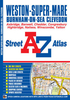
Weston-super-Mare WATERPROOF

Map No. 182, Weston-super-Mare, in a waterproof and tear-resistant version of the Ordnance Survey Landranger series at 1:50, 000, including Bridgewater, Nailsea, Street, Wells, Gladstonbury, Highbridge, Burnham-on-Sea, Yatton, Backwell, Claveham, Dundry, Chew Magna, Congresbury, Blagdon, Banwell, Bleadon, Brean, Berrow, East Brent, Axbridge, Winscombe, Cheddar, Chewton Mendip, Westbury-sub-Mendip, Wedmore, Wookey, Coxley, Pilton, Meare, Catcott, Westhay, Woolavington, Childon Polden, Westonzoyland, Othery, North Petherton, Enmore, Cannington Stogursey, High Ham, Dundon, Keinton Mandeville and Baltonsborough, with the Mendip Hills, Polden Hills, Cheddar Reservoir, Blagdon Lake, Chew Valley Lake, and Bristol Channel with the islands of Flat
Holm and Steep Holm. Edition C2; Revised for selected changes 2004; Copyright date 2005 This title is also available on our website in a paper version.Maps in this series are only published folded. Stanfords can also print flat versions of Ordnance Survey maps through the OS Select system, centring the map on a location of your choice and with a picture provided by you on the cover. For more information please click on the link at the bottom of this description.About Ordnance Survey
RIP - This product is no longer available on our network. It was last seen on 25.09.2019

This page now acts as a permanent archive for this product. Add more information using the comments box below to ensure it can still be found by future generations.

Use our search facility to see if it is available from an alternative contributor.
  • External links may include paid for promotion
  • Availability: Out Of Stock
  • Supplier: Stanfords
  • SKU: 9780755824625
Availability: In Stock
£10.39

Product Description

Map No. 182, Weston-super-Mare, in a waterproof & tear-resistant version of the Ordnance Survey Landranger series at 1:50, 000, including Bridgewater, Nailsea, Street, Wells, Gladstonbury, Highbridge, Burnham-on-Sea, Yatton, Backwell, Claveham, Dundry, Chew Magna, Congresbury, Blagdon, Banwell, Bleadon, Brean, Berrow, East Brent, Axbridge, Winscombe, Cheddar, Chewton Mendip, Westbury-sub-Mendip, Wedmore, Wookey, Coxley, Pilton, Meare, Catcott, Westhay, Woolavington, Childon Polden, Westonzoyl&, Othery, North Petherton, Enmore, Cannington Stogursey, High Ham, Dundon, Keinton Mandeville & Baltonsborough, with the Mendip Hills, Polden Hills, Cheddar Reservoir, Blagdon Lake, Chew Valley Lake, & Bristol Channel with the islands of Flat Holm & Steep Holm. Edition C2; Revised for selected changes 2004; Copyright date 2005 This title is also available on our website in a paper version. Maps in this series are only published folded. Stanfords can also print flat versions of Ordnance Survey maps through the OS Select system, centring the map on a location of your choice & with a picture provided by you on the cover. For more information please click on the link at the bottom of this description. About Ordnance Survey

Reviews/Comments

Add New

Price History

Vouchers

No voucher codes found.
Do you know a voucher code for this product or supplier? Add it to Insights for others to use.

Facebook

Jargon Buster

Paper - A thin sheet mainly used for writing. Available in a variety of colours. Made mainly from wood pulp.
Date - A day on a calendar
Date - A social activity whith a current or potential partner
Waterproof - Resistant to water, usualy specified by depth in metres
Resistant - Something that can repel against something.
Print - A mechanical process of putting text onto paper. It can also relate to a pattern on an item.

Supplier Information

Stanfords
Stanfords was established in 1853 and opened their iconic Covent Garden flagship store in 1901. They have become the top retailer of maps, travel books and accessories in the UK and arguably offer the largest selection of maps and travel books worldwide. Famous names such as Captain Robert Falcon Scott, Ranulph Fiennes and Michael Palin have purchased from Stanfords. They now have a shop in Bristol and both stores together with other venues operate a calendar of events including talks, book signings and exhibitions. As a specialist map retailer, the map selection is comprehensive and includes road maps, street maps and walking maps from worldwide destinations, as well as a selection of world atlases and wall maps. Books include travel guides and travel literature. Stanfords also stock globes, from miniatures made of blue marble to magnificent floor-standing globes. The website features a selection of interesting articles on travel topics.
Page Updated: 2023-11-12 20:15:36

Community Generated Product Tags

Oh No! The productWIKI community hasn't generated any tags for this product yet!
Menu