
 United Kingdom
 France
 Germany
 Netherlands
 Sweden
 USA
USA
 Italy
Italy
 Spain
Spain
More From Contributor


Weston-super-Mare 1901
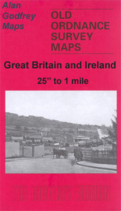
Weston-super-Mare in 1901 in a fascinating series of reproductions of old Ordnance Survey plans in the Alan Godfrey Editions, ideal for anyone interested in the history of their neighbourhood or family. Much of the town centre is included, with coverage stretching from the Town Hall westward to Marine Parade, and northward to Anchor Head and Worlebury Camp. Features include Knightstone, Grove Park, Grand Atlantic Hotel, High Street, St John`s church, Glentworth Bay, Royal Hotel, tramways, Shrubbery Walks, Atlantic Road. On the reverse is a list of private residents from a directory, entries A to H. The map links up with Sheet 9.16 for Weston East.About the Alan Godfrey Editions of the 25” OS SeriesSelected towns in Great Britain and Ireland are covered by maps showing the
extent of urban development in the last decades of the 19th and early 20th century. The plans have been taken from the Ordnance Survey mapping and reprinted at about 15 inches to one mile (1:4, 340). On the reverse most maps have historical notes and many also include extracts from contemporary directories. Most maps cover about one mile (1.6kms) north/south, one and a half miles (2.4kms) across; adjoining sheets can be combined to provide wider coverage.FOR MORE INFORMATION AND A COMPLETE LIST OF ALL AVAILABLE TITLES PLEASE CLICK ON THE SERIES LINK.
extent of urban development in the last decades of the 19th and early 20th century. The plans have been taken from the Ordnance Survey mapping and reprinted at about 15 inches to one mile (1:4, 340). On the reverse most maps have historical notes and many also include extracts from contemporary directories. Most maps cover about one mile (1.6kms) north/south, one and a half miles (2.4kms) across; adjoining sheets can be combined to provide wider coverage.FOR MORE INFORMATION AND A COMPLETE LIST OF ALL AVAILABLE TITLES PLEASE CLICK ON THE SERIES LINK.

Product Description
Reviews/Comments
Add New
Intelligent Comparison
Archived Product
Weston-super-Mare Stanfords
£5.59
Archived Product

Weston-super-Mare 1809-1833 Stanfords
£9.99
Archived Product

Weston-super-Mare 1919-1922 Stanfords
£9.99
Archived Product
Weston-super-Mare 1899-1900 Stanfords
£9.99
Archived Product
Weston-super-Mare WATERPROOF Stanfords
£10.39
Vouchers
No voucher codes found.
Do you know a voucher code for this product or supplier? Add it to Insights for others to use.
Do you know a voucher code for this product or supplier? Add it to Insights for others to use.
 Denmark