More From Contributor
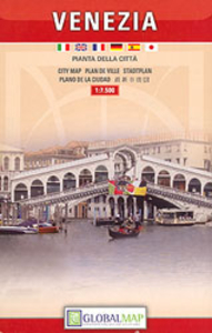
£15.99
This is the world's bestselling guide to this adventurer's paradise. It
Includes:: new Outdoors chapter; expanded activities
...
Archived Product
£7.95
Venezuela with Guyana, Suriname & the French Guiana at 1:2, 500, 000 from Nelles Verlag, with a smaller size sheet offering a convenient format for use when travelling. Included are street plans & an enlargement of Isla de Margarita. The map is double-sided, showing all but the very southernmost tip of Venezuela on one size, with the other three countries on the reverse. Large overlap means that the Gran Sabana with the Canaima National Park is included on both sides. Vivid relief shading, numerous spot heights & names of mountain ranges, plus graphics for marshlands present the topography. National parks & other protected area are marked. Road network distinguishes between highways in good & poor condition &

Includes::
partially paved roads & cart tracks, with distances shown on main routes. Railway lines & local airports are included, & the map also shows internal administrative boundaries with names of the provinces. Numerous places of interest are prominently marked. Latitude & longitude margin ticks are at 2° intervals. The map has no index of localities. Map legend

Includes::
English. Street plans highlighting main places of interest cover central areas of Caracas, Maracaibo, Paramaribo & Cayenne. An enlargement at 1:400, 000 shows Isla de Margarita in greater detail.


...
Archived Product
£14.95
Map No. K-27D in the TPC series: military topographic survey mapping covering the world's land masses & significant islands at 1:500, 000. The maps are useful as general topographical coverage where nothing else is available, although they are designed primarily as flying charts for military aircraft. TPC stands for Tactical Pilotage Chart. Relief is portrayed by a combination of contours (basic interval 500ft, intermediate contours shown where appropriate), elevation tinting & relief shading, plus spot heights. Towns, villages, major roads, railways & airports are shown but please note that many of the smaller settlements are not named & the road information is not necessarily up to date, as compilation & revision dates vary. Some air navigation information also appears on the map, such as radio beacons & restricted flying zones. Each TPC chart has both UTM & latitude/longitude grids overprinted on it, with additional margin ticks. IMPORTANT
- PLEASE NOTE: The series is gradually being withdrawn from sale to the general public & some sheets may no longer be available when ordered by us. Due to the nature of the map projection assembling these sheets to make a larger map is not recommended. in addition, colours used for relief are not constant throughout the series. In some areas of central Africa & South America the maps have blank spaces, reflecting localized deficiencies or inconsistencies in the survey data.
...
Archived Product
£9.99
The Romans left a long-lasting legacy & their influence can still be seen all around us
- from our calendar & coins, to our language
...
Archived Product
£8.50
The National Geographic map of Venice at 1:6, 500 is a durable waterproof city map & transport guide designed for tourism. Clear & easy-to-read street mapping has main attractions highlighted & 3D illustrations of top sights. Hotels, churches, theatres & information points are among the tourist features marked on the map. One-way streets & pedestrian areas are indicated. The map covers from the mouth of the Grand Canal & Saint Lucia station in the east to Sant' Elena in the west, & from Cannaregio in the north to Guidecca in the south. An inset map shows Murano, & another inset on the reverse shows the Lido strip at 1:13, 000. The reverse of the map features background information, top sights & activities, basic essential tourist info & city transport network details, including a detailed map of Vaporetto routes. There is also a small map of Marco Polo Airport showing terminals & transport connections. The map is indexed for streets, points of interest & hotels, &

Includes::
regional & national overview maps. This map is printed on a surprisingly strong rip-proof, waterproof paper.

...
Archived Product
£7.95
Venice on a light, waterproof & tear-resistant, detailed street plan from Touring Club Italiano, the best choice for any visitor who wants to escape beyond the main tourist areas for long walks across the city which invariably require constant reference to a good map. Elegant cartography & subtle colouring make this plan particularly easy to read. The main plan covers the whole of Venice, including Giudecca, San Giorgio Maggiore, San Michele cemetery & the car parking facilities on Tronchetto. All the famous monuments & public buildings are clearly marked. Vaporetto lines are shown with numbers & stops. Separate plans at a slightly less detailed scale of 1:10, 000 show most of the Lido, Murano & Burano with Torcello. An inset at 1:100, 000 covers the entire lagoon & the road network on the mainland around Mestre & the Marco Polo airport. On the reverse, the index

Includes::
streets on the islands of the lagoon & has lists of useful contact numbers, including radio taxis, etc. Map legend & index notes include English.

...
Archived Product
£3.99
Venice on a large map from Insight Guides combining a street plan at 1:6, 000 covering most of the city, a map of Venice with the nearby islands of the Lagoon, & a road map of the mainland extending north to the Dolomites & south to Ferrara. The map is arranged in four panels showing: Venice at 1:12, 500 including the city ...
Archived Product
£4.99
Venice at 1:7, 500 on a laminated, waterproof & tear-resistant street plan from the AA with on the reverse a mini guide to the city highlighting its top 25 sights, recommendations for eating out, shopping & entertainment, plus general tourist information. The map covers most of the city apart from its southernmost tip & the southern part of Giudecca. Recommended sights are highlighted & other places of interest are prominently marked. Insets show Mutano & Burano. Street index is next to the plan. Vaporetto lines & stops are not marked on the plans but are shown on a separate inset. On the reverse are publishers ...
Archived Product
£6.50
Venice street plan from Litografia Artistica Cartografica in their Global Map imprint, offering a more handy size alternative to their coverage of the whole city, but still including Murano, Burano & central Lido. The main plan covers Venice from the road access to the maritime port & the car parking facilities on Tronchetto to Isola S. Pietro & the Biennale grounds, plus Giudecca & S. Gorgio Maggiore. 92 monuments including historic buildings & churches, cultural or educational institutions, & various municipal buildings or facilities are listed next to the plan, with the most important ones also prominently marked on it. Several famous buildings are also shown by small drawings. The plan shows the lines & stops of the vaporetto services, but without indicating line numbers. On the reverse is a street index for, plus indexed plans of Murano, Burano & the Lido. ...
Archived Product
£14.95
Venice in the Blue Guides series focuses primarily on cultural tourism for the visitor who wishes to understand more of what they might see &, as such, the title provides thorough & objective reference information covering art, history & architecture. The guide features illustrations aimed to inform rather than just decorate, such as maps, diagrams, floor plans, architectural details & photographs. Cross referenced indexing means information is accessible & layout navigable. Selective listings of restaurants & accommodation are chosen in the belief that good, practical recommendations will contribute to the enjoyment of good art & culture. ...
Archived Product

Venice

Detailed, clear street plan of Venice including the San Michele Island and the southern island of La Giudecca and combining road & tourist information.Road names, Gondolas' stops, boat terminus are marked as well as car parks at the city entrance. A series of symbols indicates monuments & places of interest, tourist information points, various religious buidings, hostels, police stations, post offices and lighthouses. Also railways, bus, car-ferry & passenger-ferry (Vaporetti) lines, numbers and stops are marked.Three insets show the Burano & Murano islands at 1:10, 000, and the long Lido di Venezia from Alberoni to San Nicolo at 1:15, 000.The plan also includes an extensive index, some general tourist listings and emergency numbers.Map legend includes English.
RIP - This product is no longer available on our network. It was last seen on 25.09.2019

This page now acts as a permanent archive for this product. Add more information using the comments box below to ensure it can still be found by future generations.

Use our search facility to see if it is available from an alternative contributor.
  • Availability: Out Of Stock
  • Supplier: Stanfords
  • SKU: 9783828305823
Availability: In Stock
£7.95

Product Description

Detailed, clear street plan of Venice including the San Michele Island & the southern island of La Giudecca & combining road & tourist information. Road names, Gondolas' stops, boat terminus are marked as well as car parks at the city entrance. A series of symbols indicates monuments & places of interest, tourist information points, various religious buidings, hostels, police stations, post offices & lighthouses. Also railways, bus, car-ferry & passenger-ferry (Vaporetti) lines, numbers & stops are marked. Three insets show the Burano & Murano islands at 1:10, 000, & the long Lido di Venezia from Alberoni to San Nicolo at 1:15, 000. The plan also

Includes::
an extensive index, some general tourist listings & emergency numbers. Map legend

Includes::
English.

Reviews/Comments

Add New

Price History

Vouchers

No voucher codes found.
Do you know a voucher code for this product or supplier? Add it to Insights for others to use.

Facebook

Jargon Buster

police - Persons empowered to reduce civil disorder and enforce the law.
Railways - A set of tracks that have been laid for the purpose of trains to travel up and down them
Car - A machine used for transport which runs on roads
Road - a manmade lane or a path that is used to speed up travel.

Supplier Information

Stanfords
Stanfords was established in 1853 and opened their iconic Covent Garden flagship store in 1901. They have become the top retailer of maps, travel books and accessories in the UK and arguably offer the largest selection of maps and travel books worldwide. Famous names such as Captain Robert Falcon Scott, Ranulph Fiennes and Michael Palin have purchased from Stanfords. They now have a shop in Bristol and both stores together with other venues operate a calendar of events including talks, book signings and exhibitions. As a specialist map retailer, the map selection is comprehensive and includes road maps, street maps and walking maps from worldwide destinations, as well as a selection of world atlases and wall maps. Books include travel guides and travel literature. Stanfords also stock globes, from miniatures made of blue marble to magnificent floor-standing globes. The website features a selection of interesting articles on travel topics.
Page Updated: 2023-11-12 20:15:36

Community Generated Product Tags

Oh No! The productWIKI community hasn't generated any tags for this product yet!
Menu