
 United Kingdom
 France
 Germany
 Netherlands
 Sweden
 USA
USA
 Italy
Italy
 Spain
Spain
More From Contributor


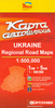

Ukraine South
Double-sided, indexed road map of Southern Ukraine at 1:750, 000 from Trivium with all names in Cyrillic alphabet only. Small villages are shown, with symbols denoting general population densities for every town, city, and village shown on the map. The major road network is displyed with carriage and unsurfaced roads, with road distances shown in kilometres. Fuel stations are marked, as are motor transport check points. Railways and airports are clearly marked; shipping routes are displayed with distances in kilometres. Topography is shown simply with spot heights. National parks and reservations are shown, with state and regional boundaries indicated. Map legend includes English. *Map text and index is in Ukrainian Cyrillic alphabet.*

Product Description
Reviews/Comments
Add New
Intelligent Comparison
Archived Product
Ukraine South Stanfords
£5.95
Archived Product
Brazil South Stanfords
£9.50
Archived Product
Brazil South Stanfords
£5.95
Archived Product
Ukraine East Stanfords
£5.95
Archived Product
Ukraine West Stanfords
£5.95
Archived Product
Ukraine West Stanfords
£6.95
Archived Product
Ukraine West Stanfords
£6.95
Archived Product
Berlin South Stanfords
£9.99
Vouchers
No voucher codes found.
Do you know a voucher code for this product or supplier? Add it to Insights for others to use.
Do you know a voucher code for this product or supplier? Add it to Insights for others to use.
 Denmark