
 United Kingdom
 France
 Germany
 Netherlands
 Sweden
 USA
USA
 Italy
Italy
 Spain
Spain
More From Contributor


Ukraine West
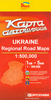
Western Ukraine at 1;500, 000 in a series of double-sided detailed maps from Kartografija in Kiev, highlighting picturesque towns and other places of interest. Road network includes local unsufaced roads and indicates locations of petrol or service stations and border crossings. Railway lines, local airports and administrative boundaries are also shown, and symbols mark places of interest, selected hotels, campsites, etc. There is no shading or contours to show the topography, but the maps do distinguish forested areas, vineyards and marches, and national parks are highlighted.All place names are in Cyrillic alphabet. Latitude and longitude lines are drawn at 20
Product Description
Reviews/Comments
Add New
Vouchers
No voucher codes found.
Do you know a voucher code for this product or supplier? Add it to Insights for others to use.
Do you know a voucher code for this product or supplier? Add it to Insights for others to use.
 Denmark