
 United Kingdom
 France
 Germany
 Netherlands
 Sweden
 USA
USA
 Italy
Italy
 Spain
Spain
More From Contributor


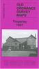


Timperley 1897
Timperley in 1897 in a fascinating series of reproductions of old Ordnance Survey plans in the Alan Godfrey Editions, ideal for anyone interested in the history of their neighbourhood or family. Selected towns in Great Britain and Ireland are covered by maps showing the extent of urban development in the last decades of the 19th and early 20th century.In this title: the map is double-sided. The main map covers the eastern part of Timperley, including Belmont House, chapel, Thorley Lane area; coverage extends east to Baguley House, Baguley station, Roundthorn Farm, Peartree Farm. On the reverse is half of adjacent sheet 18.04, extending coverage eastward to include Baguley Hall, Blackcarr Wood. About the Alan Godfrey Editions of the 25
Product Description
Reviews/Comments
Add New
Intelligent Comparison
Archived Product

Timperley 1897 Stanfords
£3.50
Archived Product
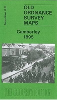
Camberley 1895 Stanfords
£3.50
Vouchers
No voucher codes found.
Do you know a voucher code for this product or supplier? Add it to Insights for others to use.
Do you know a voucher code for this product or supplier? Add it to Insights for others to use.
 Denmark