More From Contributor
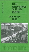
£10.99
Camargue – Les Alpilles area of western Provence in a series of GPS compatible, contoured TOP 75 maps at 1:75, 000 from the IGN, highlighting local & long-distance hiking paths, cycling routes & sites for other recreational activities. The map

Includes::
five large panels with IGN’s topographic mapping at 1:25, 000 & extensive overprint for local hiking paths & tourist facilities including campsites, covering: two areas within the Camargue – Etang de Malagroy & Etang du Fangassier, two sections of Les Alpilles around Les Baux-de-Provence & Eygalières, plus the area between Le Caillars & Aigues-Mortes. Cartography of the main map at 1:75, 000 is a direct enlargement of the mapping used in the IGN’s TOP100 series. Contours are at 40m intervals, enhanced by relief shading; additional colouring shows different types of vegetation (woods, brushwood, vineyards/orchards). Boundaries of national parks & other protected areas are marked. An overprint highlights long-distance GR hiking routes & cycling trails. Symbols
- more numerous than on the TOP100 maps
- indicate various places of interest including mountain refuges & gîtes d’etape (campsites on the enlargements), areas for other recreational pursuits such as climbing, hand gliding or water & winter sports, historic or cultural sites, etc. The map has a UTM grid & an index of communes. Map legend

Includes::
English. Coverage of the main map extends southwards from Beaucaire, Tarascon & St-Rémy-de-Provence, & west – east along the coast from Le Grau-du-Roi to Martigues & Sausset-les-Pins. Other locations include Arles, Salon-de-Provence, Maussane-les-Alpilles, Miramas, Istres, Ste-Maries-de-la-Mer, etc. To see the list of titles in this series please click on the series link.


...
Archived Product
£19.95
The Camargue, Le Crau & Les Alpilles in Provence in a series of nature guides to ecologically important regions of Europe from the Crossbill Guides Foundation, with 13 special eco-routes for exploring the area on foot, by bike or by car. The Crossbill Guides Foundation, based in the Netherlands, is a non-profit organization dedicated to increasing public involvement with nature conservation. Its aim is to produce comprehensive guides & other services for nature enthusiasts & tourist to all major European natural areas The guides are prepared in consultation with local experts. Each title, produced on high quality paper & illustrated with numerous colour photos, is divided into four sections: An extensive introduction to the area, including its climate, topography & habitat types (bogs, fens, mires, meadows, forests, etc), history & nature conservation, etc. Fauna & flora Recommended routes to explore the region on foot, by bike or by car, each accompanied by a map cross-referenced to the text plus a list of selected important species to be found along the route. Practical tourist information & observation tips, including a list of local species with names in English, Latin, German & Dutch. ...
Archived Product
£6.95
Topographic coverage of mainland Spain at 1:50, 000 in the MTN50 (Mapa Topográfico Nacional) series from the Centro Nacional de Información Geografica, the country’s civilian survey organization. The maps have contours at 20m intervals, enhanced by relief shading, plus colouring and/or graphics to show different types of terrain, vegetation or land use. Boundaries of national parks & other protected areas are marked. In addition to all the usual information featured on topographic mapping at this scale, detailed presentation of the road & rail networks, rural tracks & paths, etc, the maps also show campsites & mountain refuges. On more recent editions some GRs, the official long-distance hiking routes, are also marked (although not as clearly as on hiking maps from other publishers). Each map covers 29.5x 18.5 km (with adjustments in the border or coastal areas). The maps have a 1-km UTM grid, plus margin ticks for latitude & longitude at 1` intervals. Map legend is in Spanish only.HOW TO CHOOSE THE RIGHT 50K MAP: all the titles in CNIG’s 200K Provincial Road Maps series at 1:200, 000 are overprinted with the grid for the 1:50, 000 maps & can be used to see the area covered by each 50K title. TO SEE THE LIST OF TITLES IN THIS SERIES PLEASE CLICK ON THE SERIES LINK.PLEASE NOTE
- MAP TITLES: the grids shown on our website serve both the civilian & the military 1:50, 000 topographic series. Although the areas covered by maps in both series are identical (apart from some border or coastal sheets), occasionally map titles differ – only one title is shown on the grid, usually the military one. In Galicia, the Basque country & in the Catalan speaking areas the tendency now is to use local place names rather than the often better known Castilian ones. Where possible, both versions are included in our titles. Map titles listed on our website are based on information received by us at the time of publication, but sometimes maps arrive showing a completely different title! As long as the map number is as ordered, the correct map has been supplied.
...
Archived Product
£6.50
Topographic coverage of mainland Spain at 1:25, 000 published by the Centro Nacional de Información Geograficá, the country’s civilian survey organization. The maps have contours at 10m intervals & colouring and/or graphics to show different types of vegetation or land use. Boundaries of national parks & other protected areas are marked. In addition to all the usual information shown on topographic maps at this scale, detailed presentation of the road & rail networks, rural tracks & paths, etc, the maps also show campsites. The maps have a 1-km UTM grid, with margin ticks for latitude & longitude at 1` intervals. Map legend is in Spanish only.PLEASE NOTE: our grid for the whole of Spain is in preparation
- in the meantime, for areas other than those shown on the attached grid please use CNIG’s topographic survey at 1:50, 000 by searching for ‘SI00000832’. Each 25K map covers one quarter of the corresponding 50K map, with the numbering system: I = NW quarter, II = NE quarter, III = SW quarter & IV = SE quarter. CNIG maps in the Provincial Road Maps series at 1:200, 000 are overprinted with the grid for the 1:50, 000 survey & can be used to see the area covered by each 50K or 25K title in more detail. To see the list of titles in this series please click on the series grid
- for map numbers not yet listed on our website please contact us by email.

...
Archived Product
£14.99
Camí de Ronda Circuit, a 140kms/88 miles circular hiking trail linking Girona with the resorts of the Costa Brava on a contoured & GPS compatible map at 1:40, 000 from Editorial Alpina, plus a multilingual booklet with 12 pages in English of notes & stage-by-stage descriptions. The map has contours at 20m intervals with altitude colouring & spot heights. The course of the route is prominently highlighted, leading from Girona southwards to the Costa Brava at Sant Feliu de Guíxols, then northwards along the coast to Platja d’ Aro, Palamós, Llafranc & Fornells, before turning inland towards la Bisbal d’ Empordà & back to Girona. Also highlighted are other hiking routes, both local & the longer GR trails, & symbols show campsites & country hotels, viewpoints, beaches, & other places of interest. The map has UTM grid lines at 5km intervals. Map legend

Includes::
English. Accompanying booklet has 12 pages in English, with general notes about the area & the trail, plus brief descriptions of its eight recommended stages.PLEASE NOTE: the coastal section of this route, between San Feliu & Begur, is also available on a separate map at 1:25, 000.

...
Archived Product
£3.50
Camberwell & Stockwell in 1871 in a fascinating series of reproductions of old Ordnance Survey plans in the Alan Godfrey Editions, ideal for anyone interested in the history of their neighbourhood or family. Three versions for this area have been published, stretching from South Lambeth Road & Stockwell station eastward to Camberwell Green & from Vassall Road & Albert Square southward to Loughborough Junction. The maps therefore cover much of Stockwell, together with the western part of the vast Camberwell parish, & also included is north Brixton. Even in 1871 this area was very built up, the only undeveloped part being around Knatchbull Road where St James`s church stands in some isolation. As ever, this 1st edition is especially attractive, with many of the houses around Angel Town, North Brixton & west Camberwell being portrayed with their leafy gardens. On the reverse are directory entries for Camberwell Green, Camberwell New Rd, Stockwell Green & Cold Harbour Lane. The 1894 & 1913 maps cover the same area at a later stage. Features include Kings College Hospital, Angell Town, Ruskin Park, tramways & tramway depot, Camberwell New Road & Loughborough Junction stations, railway works at Stockwell, South Western Hospital, Myatts Fields; streets include Stockwell Road, Stockwell Park Road, Brixton Road, Wiltshire Road, Cormont Road, Flaxman Road, Camberwell New Road, Denmark Hill, etc. The maps have extracts from contemporary street directories. About the Alan Godfrey Editions of the 25” OS Series: Selected towns in Great Britain & Ireland are covered by maps showing the extent of urban development in the last decades of the 19th & early 20th century. The plans have been taken from the Ordnance Survey mapping & reprinted at about 15 inches to one mile (1:4, 340). On the reverse most maps have historical notes & many also include extracts from contemporary directories. Most maps cover about one mile (1.6kms) north/south, one & a half miles (2.4kms) across; adjoining sheets can be combined to provide wider coverage.FOR MORE INFORMATION & A COMPLETE LIST OF ALL AVAILABLE TITLES PLEASE CLICK ON THE SERIES LINK. ...
Archived Product
£3.50
Camberwell & Stockwell in 1894 in a fascinating series of reproductions of old Ordnance Survey plans in the Alan Godfrey Editions, ideal for anyone interested in the history of their neighbourhood or family. Three versions for this area have been published, stretching from South Lambeth Road & Stockwell station eastward to Camberwell Green & from Vassall Road & Albert Square southward to Loughborough Junction. The maps therefore cover much of Stockwell, together with the western part of the vast Camberwell parish, & also included is north Brixton. Even in 1871 this area was very built up, the only undeveloped part being around Knatchbull Road where St James`s church stands in some isolation. As ever, this 1st edition is especially attractive, with many of the houses around Angel Town, North Brixton & west Camberwell being portrayed with their leafy gardens. On the reverse are directory entries for Camberwell Green, Camberwell New Rd, Stockwell Green & Cold Harbour Lane. The 1894 & 1913 maps cover the same area at a later stage. Features include Kings College Hospital, Angell Town, Ruskin Park, tramways & tramway depot, Camberwell New Road & Loughborough Junction stations, railway works at Stockwell, South Western Hospital, Myatts Fields; streets include Stockwell Road, Stockwell Park Road, Brixton Road, Wiltshire Road, Cormont Road, Flaxman Road, Camberwell New Road, Denmark Hill, etc. The maps have extracts from contemporary street directories. About the Alan Godfrey Editions of the 25” OS Series: Selected towns in Great Britain & Ireland are covered by maps showing the extent of urban development in the last decades of the 19th & early 20th century. The plans have been taken from the Ordnance Survey mapping & reprinted at about 15 inches to one mile (1:4, 340). On the reverse most maps have historical notes & many also include extracts from contemporary directories. Most maps cover about one mile (1.6kms) north/south, one & a half miles (2.4kms) across; adjoining sheets can be combined to provide wider coverage.FOR MORE INFORMATION & A COMPLETE LIST OF ALL AVAILABLE TITLES PLEASE CLICK ON THE SERIES LINK. ...
Archived Product
£3.50
Camberwell & Stockwell in 1913 in a fascinating series of reproductions of old Ordnance Survey plans in the Alan Godfrey Editions, ideal for anyone interested in the history of their neighbourhood or family. Three versions for this area have been published, stretching from South Lambeth Road & Stockwell station eastward to Camberwell Green & from Vassall Road & Albert Square southward to Loughborough Junction. The maps therefore cover much of Stockwell, together with the western part of the vast Camberwell parish, & also included is north Brixton. Even in 1871 this area was very built up, the only undeveloped part being around Knatchbull Road where St James`s church stands in some isolation. As ever, this 1st edition is especially attractive, with many of the houses around Angel Town, North Brixton & west Camberwell being portrayed with their leafy gardens. On the reverse are directory entries for Camberwell Green, Camberwell New Rd, Stockwell Green & Cold Harbour Lane. The 1894 & 1913 maps cover the same area at a later stage. Features include Kings College Hospital, Angell Town, Ruskin Park, tramways & tramway depot, Camberwell New Road & Loughborough Junction stations, railway works at Stockwell, South Western Hospital, Myatts Fields; streets include Stockwell Road, Stockwell Park Road, Brixton Road, Wiltshire Road, Cormont Road, Flaxman Road, Camberwell New Road, Denmark Hill, etc. The maps have extracts from contemporary street directories. About the Alan Godfrey Editions of the 25” OS Series: Selected towns in Great Britain & Ireland are covered by maps showing the extent of urban development in the last decades of the 19th & early 20th century. The plans have been taken from the Ordnance Survey mapping & reprinted at about 15 inches to one mile (1:4, 340). On the reverse most maps have historical notes & many also include extracts from contemporary directories. Most maps cover about one mile (1.6kms) north/south, one & a half miles (2.4kms) across; adjoining sheets can be combined to provide wider coverage.FOR MORE INFORMATION & A COMPLETE LIST OF ALL AVAILABLE TITLES PLEASE CLICK ON THE SERIES LINK. ...
Archived Product
£14.99
Camberwell is an important part of the London Borough of Southwark, the city`s most historic borough. This vibrant part of South London is full of fascinating history. It was the birthplace of the poet Robert Browning & the politician Joseph Chamberlain. It was also home to authors John Ruskin & Muriel Spark. Mendolssohn was inspired to write his ` Spring Song`, originally entitled ` Camberwell Green`, while staying at Denmark Hill, where Ruskin Park is today. Author & historian Eddie Brazil grew up in Camberwell & from the early 1970s began to photograph his surroundings, knowing that developers were changing the district & that it would never be the same again. In this collection of previously unpublished images, local histories & people`s stories he illustrates the history of this South London district, providing a fascinating insight for newcomers & some valuable memories for long-time residents. ...
Archived Product
£12.99
Topographic survey of France at 1:25, 000 in IGN`s excellent TOP25 / Série Bleue series. All the maps are GPS compatible, with a 1km UTM grid plus latitude & longitude lines at 5’ intervals. Contours are at 5m intervals except for mountainous areas where the maps have contours at 10m intervals, vividly enhanced by hill shading & graphics for rocky terrain. Colouring with graphics indicates different types of vegetation or land use (deciduous or coniferous forests, moors, orchards, vineyards, etc). PLEASE NOTE: coverage of France at this scale is currently being revised – the format & the presentation of each title are indicated by the letters at the end of its Sheet Reference number (e.g. 0416ET, 3531ETR, 1923SB, etc.)MAPS WITH FULL TOURIST OVERPRINT & AN ENGLISH MAP LEGEND: all TOP25 maps & the SB editions of Série Bleue have an overprint highlighting waymarked walking trails including long-distance GR routes &, where appropriate, ski routes. Symbols indicate campsites, gîtes d’etape, refuges, equestrian centres & other recreational facilities or sites, tourist information centres, cultural heritage, etc. Towns & locations of particular interest are highlighted.- ET or OT = single-sided TOP25 map covering approx. 29x 21 km / 18x 13 miles.- ETR or OTR = waterproof & tear resistant TOP25 map covering the same area as the corresponding ET or OT number, but double-sided, printed on a smaller size sheet with a good overlap between the sides.- SB = Série Bleue map with full tourist overprint; these maps, first introduced in summer 2014, each cover approx. 29x 24km / 18x 15 miles.SÉRIE BLEUE maps with numbers ending in E (Est) or O (Ouest): most editions now indicate the GR routes, but do not show any other tourist information. Map legend is in French only. Each map covers approx. 14x 20km / 9x 12 miles. ...
Archived Product

Camberley 1895

Camberley in 1895 in a fascinating series of reproductions of old Ordnance Survey plans in the Alan Godfrey Editions, ideal for anyone interested in the history of their neighbourhood or family. The map covers the small but growing town of Camberley and extends across the Berkshire border to show part of the Royal Military College. Features include Camberley station, High Street, Osnaburgh Hill, Governor`s House, Lower Lake, American Garden, Royal Staff College, Barossa, Barossa Common, Upper Lake, Royal Military College Hospital, York House and St Michael`s church. On the reverse is a 1903 directory of Camberley.About the Alan Godfrey Editions of the 25” OS SeriesSelected towns in Great Britain and Ireland are covered by maps showing the extent of urban development in the
last decades of the 19th and early 20th century. The plans have been taken from the Ordnance Survey mapping and reprinted at about 15 inches to one mile (1:4, 340). On the reverse most maps have historical notes and many also include extracts from contemporary directories. Most maps cover about one mile (1.6kms) north/south, one and a half miles (2.4kms) across; adjoining sheets can be combined to provide wider coverage.FOR MORE INFORMATION AND A COMPLETE LIST OF ALL AVAILABLE TITLES PLEASE CLICK ON THE SERIES LINK.
RIP - This product is no longer available on our network. It was last seen on 25.09.2019

This page now acts as a permanent archive for this product. Add more information using the comments box below to ensure it can still be found by future generations.

Use our search facility to see if it is available from an alternative contributor.
  • External links may include paid for promotion
  • Availability: Out Of Stock
  • Supplier: Stanfords
  • SKU: 9781847841063
Availability: In Stock
£3.50

Product Description

Camberley in 1895 in a fascinating series of reproductions of old Ordnance Survey plans in the Alan Godfrey Editions, ideal for anyone interested in the history of their neighbourhood or family. The map covers the small but growing town of Camberley & extends across the Berkshire border to show part of the Royal Military College. Features include Camberley station, High Street, Osnaburgh Hill, Governor`s House, Lower Lake, American Garden, Royal Staff College, Barossa, Barossa Common, Upper Lake, Royal Military College Hospital, York House & St Michael`s church. On the reverse is a 1903 directory of Camberley. About the Alan Godfrey Editions of the 25” OS Series Selected towns in Great Britain & Ireland are covered by maps showing the extent of urban development in the last decades of the 19th & early 20th century. The plans have been taken from the Ordnance Survey mapping & reprinted at about 15 inches to one mile (1:4, 340). On the reverse most maps have historical notes & many also include extracts from contemporary directories. Most maps cover about one mile (1.6kms) north/south, one & a half miles (2.4kms) across; adjoining sheets can be combined to provide wider coverage.FOR MORE INFORMATION & A COMPLETE LIST OF ALL AVAILABLE TITLES PLEASE CLICK ON THE SERIES LINK.

Reviews/Comments

Add New

Price History

Vouchers

No voucher codes found.
Do you know a voucher code for this product or supplier? Add it to Insights for others to use.

Facebook

Jargon Buster

Contemporary - Modern era design
Contemporary - A design reference to indicate post war modern design
Garden - An outside area with grass and foliage
garden - A planned space used for the display, cultivation and enjoyment of plants and other forms of nature.
History - Anything that happens in the past. An acedemic subject.
Small - something that takes up less space than normal.
Contemporary - An object that is living in the same time.
Ideal - Something that satisfies a perfect criteria.
Family - A group of people that live together made up from parents and children.

Supplier Information

Stanfords
Stanfords was established in 1853 and opened their iconic Covent Garden flagship store in 1901. They have become the top retailer of maps, travel books and accessories in the UK and arguably offer the largest selection of maps and travel books worldwide. Famous names such as Captain Robert Falcon Scott, Ranulph Fiennes and Michael Palin have purchased from Stanfords. They now have a shop in Bristol and both stores together with other venues operate a calendar of events including talks, book signings and exhibitions. As a specialist map retailer, the map selection is comprehensive and includes road maps, street maps and walking maps from worldwide destinations, as well as a selection of world atlases and wall maps. Books include travel guides and travel literature. Stanfords also stock globes, from miniatures made of blue marble to magnificent floor-standing globes. The website features a selection of interesting articles on travel topics.
Page Updated: 2023-11-12 20:15:36

Community Generated Product Tags

Oh No! The productWIKI community hasn't generated any tags for this product yet!
Menu