More From Contributor

£30.00
An authoritative guide from the one of the world s leading experts: Oz Clarke Oz Clarke is widely acknowledged as one of the world s foremost wine experts & in ” Oz Clarke s World of Wine” he reveals all you need to know about his favorite wines & grapes, as well as the top vineyards, growers, & winemakers. In his trademark lively & opinionated prose, Clarke takes readers on a grand tour of the great wine regions, explaining the flavors behind different wines & how to find the wine you want. With more than 50 panoramic maps, this br&-new book illustrates & explains the vital connections between the landscape & the wine.” ...
Archived Product
£9.99
Map No. 260, Ozark National Scenic Riverwaysin Missouri, at 1:63, 360in an extensive series of GPS compatible, contoured hiking maps of USA’s national & state parks or forests & other popular recreational areas. Cartography based on the national topographic survey, with additional tourist information. The maps, with most titles now printed on light, waterproof & tear-resistant plastic paper, highlight walking trails along with campsites & other accommodation, picnic sites, areas for various recreational pursuits such as horse riding or skiing, drinking water sources, & many other facilities of interest to the outdoor enthusiast. Cartography is based on information from the USGS (United States Geological Survey
- the country’s national survey organization), revised by the National Geographic Maps in cooperation with the National Park Service, USDA Forest Service, etc. Topography is excellently presented by contours (interval varies according to scale), enhanced by relief shading & colouring/graphics for wood cover, glaciers, etc. All heights are given in feet. The maps have a UTM grid plus latitude & longitude margin ticks & GPS waypoints for selected important locations. Each map is double-sided to give either maximum coverage of the chosen area or additional enlargements of its important sections. Accompanying notes provide useful information on relevant regulations, safety precautions, contact addresses, etc.IMPORTANT
- PLEASE NOTE: the series is very extensive, ranging in scale from 1:400, 000 for the vast national parks of Alaska to 1:25, 000 for local map in several states. We recommend, therefore, viewing the series by state rather than the whole list.

...
Archived Product
£16.99
If you are from either coast, chances are you have not put Arkansas, Missouri or Oklahoma on your radar as a riding destination. Huge mistake! The Ozarks have a density of spectacular paved roads that is hard to rival anywhere. Tree-canopied twisties for miles & miles never get old. Neither do the quaint towns that offer up awesome hospitality to traveling bikers. This map shows them both. ...
Archived Product
£6.99
There are four titles in the series. In Ozzy Owl discover fascinating facts about animals; in Bobby Bear learn about the field & forest; Oscar Otter uncover secrets of the river & shore & in Billy Bunny find out about colours & counting. Read about all of the different types of creatures. Then turn to the back of the book where you`ll find lots of stickers to complete the activities on every page by filling in the animal shapes
- or you can even have fun making up your own pictures!
...
Archived Product
£8.50
O`ahu Island & Honolulu map from the Great Pacific Travel & Recreation Maps combining coverage of the island with on the reverse street plans of Honolulu, both including extensive lists of recreational facilities & places of interest. On one side is a road map of O’ahu at approx. 1:100, 000. Topography is shown by light relief shading & colouring indicates state parks & other protected areas, as well as restricted entry military zones. Road network highlights scenic routes. The map shows numerous trails & highlights various places of interest & recreational facilities, including campsites, beaches & scuba diving/snorkeling sites, surfing spots, golf courses, viewpoints, marinas, etc. The map has no geographical coordinates. The index lists communities as well as military bases plus physical features & rivers. A separate list provides details of the island’s top 25 attractions. On the reverse an enlargement presents the Honolulu area, including Pearl Harbor, in greater detail, indicating bus routes with line numbers. The city’s central districts, from downtown & Chinatown to Waikiki, are shown on a street plan also with bus routes, one way streets, numerous hotels & other important buildings, etc. Also provided is a detailed plan of the campus of University of Hawaii at Manoa, plus a large clear diagram of the bus network with a list of the lines, information on fares, etc. Both sides have a very extensive Recreational Index, with where appropriate contact details. ...
Archived Product
£9.99
Map No. 062, Ossiacher See
- Feldkirchen, with a panorama map on the reverse, in a series of hiking maps from Kompass providing
...
Archived Product
£3.50
Ovilliers (57D SE 4
- ed. 2B) in a series of British Army trench maps from the WWI, reproduced by G.H. Smith & Son at Approx.
...
Archived Product
£6.95
Topographic coverage of mainland Spain at 1:50, 000 in the MTN50 (Mapa Topográfico Nacional) series from the Centro Nacional de Información Geografica, the country’s civilian survey organization. The maps have contours at 20m intervals, enhanced by relief shading, plus colouring and/or graphics to show different types of terrain, vegetation or land use. Boundaries of national parks & other protected areas are marked. In addition to all the usual information featured on topographic mapping at this scale, detailed presentation of the road & rail networks, rural tracks & paths, etc, the maps also show campsites & mountain refuges. On more recent editions some GRs, the official long-distance hiking routes, are also marked (although not as clearly as on hiking maps from other publishers). Each map covers 29.5x 18.5 km (with adjustments in the border or coastal areas). The maps have a 1-km UTM grid, plus margin ticks for latitude & longitude at 1` intervals. Map legend is in Spanish only.HOW TO CHOOSE THE RIGHT 50K MAP: all the titles in CNIG’s 200K Provincial Road Maps series at 1:200, 000 are overprinted with the grid for the 1:50, 000 maps & can be used to see the area covered by each 50K title. TO SEE THE LIST OF TITLES IN THIS SERIES PLEASE CLICK ON THE SERIES LINK.PLEASE NOTE
- MAP TITLES: the grids shown on our website serve both the civilian & the military 1:50, 000 topographic series. Although the areas covered by maps in both series are identical (apart from some border or coastal sheets), occasionally map titles differ – only one title is shown on the grid, usually the military one. In Galicia, the Basque country & in the Catalan speaking areas the tendency now is to use local place names rather than the often better known Castilian ones. Where possible, both versions are included in our titles. Map titles listed on our website are based on information received by us at the time of publication, but sometimes maps arrive showing a completely different title! As long as the map number is as ordered, the correct map has been supplied.
...
Archived Product
£20.00
Coleridge was the first person to walk the mountains alone, & not because he had to for work, as a miner, quarryman or shepherd, but because he wanted to for pleasure & for adventure. His rapturous encounter with their natural beauty, & its literary consequences changed our view of the world. This beautifully illustrated book contains an account of his walks & explorations in the Lake District based on the jottings in his notebooks & his vast correspondence. ...
Archived Product
£20.00
After reckoning with the ends of the earth in acclaimed books such as Terra Incognita & The Magnetic North, Sara Wheeler rediscovered America thirty-five years after her first Greyhound trip across the country. She returns in turbulent midlife to trace the steps of six women who fled various sorts of trouble in nineteenth-century England & went to the United States to reinvent themselves. Her travel companions include Fanny Trollope, mother of Anthony & author of the biting Domestic Manners of the Americans; the actress Fanny Kemble, who shocked the nation with her passionate first-hand indictment of slavery; the prolifically pamphleteering economist Harriet Martineau; the homesteader Rebecca Burlend, who had never been more than twelve miles from her Yorkshire village before she sailed to the New World; the traveller Isabella Bird, whose many ailments remained in check as long as she was scaling the Rockies; & the novelist Catherine Hubback, niece of Jane Austen, who deposited her husband in a madhouse & rode the br&-new rails to San Francisco. Tough-minded outsiders, these women's truest qualities emerged in a country as incomplete & tentative as their native land was staid & settled. & they discovered second acts for themselves at a time when the world expected them to disappear politely. From the swampy heat of Georgia's Sea Islands to the icy purity of the Cascades, Sara Wheeler finds their path, & her own. ...
Archived Product

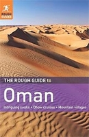
The Rough Guide To Oman

The Rough Guide to Oman is the ultimate travel guide to one of the world`s most exciting emerging tourist destinations. With clear maps and detailed coverage of all the best Oman attractions. Discover Oman`s highlights in the full colour introduction packed with stunning photography and information on everything from experiencing, an oasis of traditional culture to the frantically modernizing Gulf states. Find detailed practical advice on what to see and do in Oman, relying on up-to-date descriptions of the best hotels, bars, clubs, shops and restaurants for all budgets. The Rough Guide to Oman also includes two full-colour sections describing the country`s most notable architectural wonders, plus a detailed guide to the very best food and drink. Explore every corner of this
captivating country with easy-to-use maps to help make sure you don`t miss the unmissable.
RIP - This product is no longer available on our network. It was last seen on 25.09.2019

This page now acts as a permanent archive for this product. Add more information using the comments box below to ensure it can still be found by future generations.

Use our search facility to see if it is available from an alternative contributor.
  • Availability: Out Of Stock
  • Supplier: Stanfords
  • SKU: 9781848365988
Availability: In Stock
£15.99

Product Description

The Rough Guide to Oman is the ultimate travel guide to one of the world`s most exciting emerging tourist destinations. With clear maps & detailed coverage of all the best Oman attractions. Discover Oman`s highlights in the full colour introduction packed with stunning photography & information on everything from experiencing, an oasis of traditional culture to the frantically modernizing Gulf states. Find detailed practical advice on what to see & do in Oman, relying on up-to-date descriptions of the best hotels, bars, clubs, shops & restaurants for all budgets. The Rough Guide to Oman also

Includes::
two full-colour sections describing the country`s most notable architectural wonders, plus a detailed guide to the very best food & drink. Explore every corner of this captivating country with easy-to-use maps to help make sure you don`t miss the unmissable.

Reviews/Comments

Add New

Price History

Vouchers

No voucher codes found.
Do you know a voucher code for this product or supplier? Add it to Insights for others to use.

Facebook

Jargon Buster

Date - A day on a calendar
Date - A social activity whith a current or potential partner
World - A physical grouping, commonly used to describe earth and everything associated with ti
Colour - The categorised spectrum of light visable to humans
Traditional - Something that has become the same through a period of time and thus repeated.
Traditional - Something that has been around for a while and is repeated regularly.
Practical - Weather a task is easy to carry out and realistically succeed.

Supplier Information

Stanfords
Stanfords was established in 1853 and opened their iconic Covent Garden flagship store in 1901. They have become the top retailer of maps, travel books and accessories in the UK and arguably offer the largest selection of maps and travel books worldwide. Famous names such as Captain Robert Falcon Scott, Ranulph Fiennes and Michael Palin have purchased from Stanfords. They now have a shop in Bristol and both stores together with other venues operate a calendar of events including talks, book signings and exhibitions. As a specialist map retailer, the map selection is comprehensive and includes road maps, street maps and walking maps from worldwide destinations, as well as a selection of world atlases and wall maps. Books include travel guides and travel literature. Stanfords also stock globes, from miniatures made of blue marble to magnificent floor-standing globes. The website features a selection of interesting articles on travel topics.
Page Updated: 2023-11-12 20:15:36

Community Generated Product Tags

Oh No! The productWIKI community hasn't generated any tags for this product yet!
Menu