
 United Kingdom
 France
 Germany
 Netherlands
 Sweden
 USA
USA
 Italy
Italy
 Spain
Spain
More From Contributor


Thames Estuary
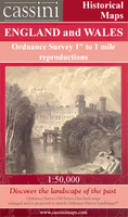
Map No. 178, Thames Estuary, in the Ordnance Survey Landranger series at 1:50, 000, including Southend-on-Sea, Billericay, Wichford, Basildon, Rayleigh, Hockley, Rochford, South Benfleet, Stanford-le-Hope, East Tilbury, Gravesend, Cliffe, Higham, Allhallows, Hoo St. Werburgh, Grain, Sheerness, Minster, Rochester, Chatham, Gillingham, Newington, Leysdown-on-Sea, Bredhurst, Sittingbourne, Teynham, Faversham, Selling, Maidstone, Offham, Ditton and Snodland, as well as the Medway Estuary, Isle of Sheppey, Canvey Island, Foulness Island and a section of the North Downs Way - E2 European long-distance path. Edition D3; Revised for selected changes 2007; Copyright date 2007 This title is also available on our website in a waterproof and tear-resistant
version.Maps in this series are only published folded. Stanfords can also print flat versions of Ordnance Survey maps through the OS Select system, centring the map on a location of your choice and with a picture provided by you on the cover. For more information please click on the link at the bottom of this description.About Ordnance Survey
version.Maps in this series are only published folded. Stanfords can also print flat versions of Ordnance Survey maps through the OS Select system, centring the map on a location of your choice and with a picture provided by you on the cover. For more information please click on the link at the bottom of this description.About Ordnance Survey
Product Description
Reviews/Comments
Add New
Intelligent Comparison
Archived Product

C1 Thames Estuary Stanfords
£19.95
Archived Product
Thames Estuary South Stanfords
£9.95
Archived Product
Thames Estuary 1805-1819 Stanfords
£7.99
Archived Product
Thames Estuary 1920-1922 Stanfords
£9.99
Archived Product
Thames Estuary 1897-1898 Stanfords
£7.99
Archived Product
Thames Estuary WATERPROOF Stanfords
£10.39
Vouchers
No voucher codes found.
Do you know a voucher code for this product or supplier? Add it to Insights for others to use.
Do you know a voucher code for this product or supplier? Add it to Insights for others to use.
 Denmark