More From Contributor

£16.99
The Thailand: Travellers' Wildlife Guide is a detailed illustrated guide to the fauna of Thail&. It also offers general information for the region such as its geography, habitats & flora, visitor information for its national parks & general advice on ecotourism. Thailand holds a special place in the minds of the world's nature-lovers as a paradise of splendid tropical forests, untrammeled ocean beaches, & spectacular underwater coral grottos. Nature travellers to Thailand want to experience these stunning habitats & catch glimpses of exotic wildlife
- gibbons & elephants, hornbills & storks, gliding lizards & cobras, brightly colored reef fishes & marine invertebrates. In this book is all the information you need to find, identify, & learn about Thailand's magnificent animal & plant life. Identifying & location information on the most frequently seen animals. Full-color illustrations of nearly 600 of Thailand's most common insects, amphibians, reptiles, birds, mammals, & coral fish. Up-to-date information on the ecology, behavior, & conservation of the animals. Information on Thailand's habitats & on the most common plants you willencounter. Brief descriptions of Thailand's most frequently visited parks & reserves. Easy-to-carry, entertainingly written, beautifully illustrated
- you will want to have this book as constant companion on your journey. Written by David L pearson & Les Beletsky About this series: Travellers' Wildlife Guides, edited by Les Beletsky, is a series of travel-wildlife books aimed at environmentally conscious travellers (ecotourists) for whom some of the best parts of any trip are glimpses of animals in natural settings. The purpose of these books is to enhance enjoyment of a trip & enrich wildlife sightings by providing identifying information on several hundred of the most frequently encountered animals of a covered country or region, along with up-to-date information on their ecology, behaviour, & conservation

...
Archived Product
£14.99
Thailand`s wealth of sun-kissed, tropical beaches & islands are one of the major reasons that this enticing country is one of the most popular destinations in the world, with visitor numbers up nearly 20 percent in 2013 alone. Whether you want to relax in a luxury resort, backpack between islands, find the best dive sites or nightlife, or immerse yourself in Thai culture, Insight Regional Guide Thailand`s Beaches & Islands will guide you to the perfect experience. Features by local writers delve into topics including local festivals, marine life, & Buddhist temple architecture, while evocative accounts of the country`s regions bring to life the buzz of Bangkok, the geographical wonders of Krabi & Ko Phi Phi, & the idyllic white sands everywhere from Phuket to Ko Lanta. Full-color photography & maps help you navigate with ease. The detailed travel tips section provides a wealth of information on how to plan your trip, plus our selection of the best hotels. Ed. 3rd, September 2014. ...
Archived Product
£14.99
The DK Eyewitness Thailand `s Beaches & Islands Travel Guide is your indispensable guide to this beautiful part of the world. The fully updated guide

Includes::
unique cutaways, floorplans & reconstructions of the must-see sites, plus street-by-street maps of all the fascinating cities & towns. The new-look guide is also packed with photographs & illustrations leading you straight to the best attractions on offer. The uniquely visual DK Eyewitness Travel guide will help you to discover everything region-by-region; from local festivals & markets to day trips around the countryside. Detailed listings will guide you to the best hotels, restaurants, bars & shops for all budgets, whilst detailed practical information will help you to get around, whether by train, bus or car. Plus, DK`s excellent insider tips & essential local information will help you explore every corner of Thailand`s Beaches & Islands effortlessly. DK Eyewitness Thailand`s Beaches & Islands Travel Guide
- showing you what others only tell you.


...
Archived Product
£16.95
First appearing in 2005 & quickly selling out, this fully revised edition of ` Thailand`s Political History` continues in the same style as the first but with its scope dramatically widened. Starting earlier than the old edition, ` Thailand`s Political History` discusses the development & evolution of the Siamese state from the early Sukhothai period through the fall of Ayutthaya to the rise of the Chakri dynasty in the late eighteenth century & its consolidation of power in the nineteenth. Moving into the twentieth century it traces the emergence of the Thai nation state, the large-scale investments in infrastructure & the commitment to economic expansion that have occurred since the 1950s onwards. A new final chapter brings the reader up-to-date & addresses Thailand`s current political situation spanning the rise & fall of Thaksin Shinawatra to the devisive & at times violent polarisation of Thai society. It traces the emergence of the red & yellow shirts, the takeover of Suvarnabhumi airport by the PAD & the occupation of the Rachaprasong intersection by the UDD & their eventual violent dispersal by the Thai military. Often at variance with dominant interpretations of nationalistic history, this absorbing account throws fresh & illumininating light on the political events in the past 700 years. ...
Archived Product
£3.50
Thame & District in 1886 in a series of reproductions of Ordnance Survey’s famous ” Inch to the Mile” maps published in the Alan Godfrey Editions to provide a historical record of England & Wales in the second half of 19th & early 20th century. The map covers the area from Cowley eastward to the west edge of Aylesbury, & from Chinnor northward to Ludgershall. Other locations on the map include: in BUCKINGAHMSHIRE Aston Sandford, Bledlow, Boarstal, Brill, Chearsley, Chilton, Cuddington, Dinton, Dorton, Haddenham, Hardwick, Horsendon, Ickford, Ilmer, Kingsey, Long Crendon, Lower Winchendon, Monks Risborough, Oakley, Princes Risborough, Saunderton, Shabbington, Stone, Towersey, Upper Winchendon, Waddesdon, Worminghall & Wotton Underwood; plus in OXFORDSHIRE Albury, Ambrosden, Beckley, Charlton on Otmoor, Cuddesdon, Elsfield, Emington, Foresthill, Garsington, Great Haseley, Great Milton, Headington, Holton, Horsepath, Merton, Noke, Oddington, Piddington, Sandford, Stanton St John, Sydenham, Tetsworth, Thame, Toot Baldon, Waterperry, Waterstock, Weston on the Green, Wheatley & Wood Eaton. About the Alan Godfrey Editions of the OS Inch to the Mile Maps: the maps provide an invaluable overview of a wider area, typically 18 x 12 miles (29 x 19 kms approx.), & offer historical mapping for small towns & villages not covered by the more detailed series for which the Godfrey Editions are better known. On the reverse all the maps have historical notes & most titles also include a more detailed, large scale map of a small town or a village in the area. To see other titles in this series please click on the series link. ...
Archived Product
£2.95
Thames Ditton in 1895 in a fascinating series of reproductions of old Ordnance Survey plans in the Alan Godfrey Editions, ideal for anyone interested in the history of their neighbourhood or family. Selected towns in Great Britain & Ireland are covered by maps showing the extent of urban development in the last decades of the 19th & early 20th century. In this title: this detailed map covers Thames Ditton, part of Long Ditton, & Weston Green. Coverage stretches from St Nicholas church to Esher station. Features include Thames Ditton village, Swan Inn, Ditton House, Boyle Farm, Giggshill, Rushett; railway with Hampton Court Junction, Esher & Thames Ditton stations; Ember or Imber Court, Weston Green, Ditton Common, Weston House etc. Extracts from a contemporary directory are included on the reverse About the Alan Godfrey Editions of the 25 ...
Archived Product
£2.95
Thames Ditton in 1895 in a fascinating series of reproductions of old Ordnance Survey plans in the Alan Godfrey Editions, ideal for anyone interested in the history of their neighbourhood or family. The map covers Thames Ditton, part of Long Ditton, & Weston Green. Coverage stretches from St Nicholas church to Esher station. Features include Thames Ditton village, Swan Inn, Ditton House, Boyle Farm, Giggshill, Rushett; railway with Hampton Court Junction, Esher & Thames Ditton stations; Ember or Imber Court, Weston Green, Ditton Common, Weston House etc. Extracts from a contemporary directory are included on the reverse About the Alan Godfrey Editions of the 25” OS Series: Selected towns in Great Britain & Ireland are covered by maps showing the extent of urban development in the last decades of the 19th & early 20th century. The plans have been taken from the Ordnance Survey mapping & reprinted at about 15 inches to one mile (1:4, 340). On the reverse most maps have historical notes & many also include extracts from contemporary directories. Most maps cover about one mile (1.6kms) north/south, one & a half miles (2.4kms) across; adjoining sheets can be combined to provide wider coverage.FOR MORE INFORMATION & A COMPLETE LIST OF ALL AVAILABLE TITLES PLEASE CLICK ON THE SERIES LINK. ...
Archived Product
£5.59
Map No. 178, Thames Estuary, in the Ordnance Survey Landranger series at 1:50, 000, including Southend-on-Sea, Billericay, Wichford, Basildon, Rayleigh, Hockley, Rochford, South Benfleet, Stanford-le-Hope, East Tilbury, Gravesend, Cliffe, Higham, Allhallows, Hoo St. Werburgh, Grain, Sheerness, Minster, Rochester, Chatham, Gillingham, Newington, Leysdown-on-Sea, Bredhurst, Sittingbourne, Teynham, Faversham, Selling, Maidstone, Offham, Ditton & Snodl&, as well as the Medway Estuary, Isle of Sheppey, Canvey Isl&, Foulness Island & a section of the North Downs Way
- E2 European long-distance path. Edition D3; Revised for selected changes 2007; Copyright date 2007 This title is also available on our website in a waterproof & tear-resistant version. Maps in this series are only published folded. Stanfords can also print flat versions of Ordnance Survey maps through the OS Select system, centring the map on a location of your choice & with a picture provided by you on the cover. For more information please click on the link at the bottom of this description. About Ordnance Survey
...
Archived Product
£7.99
Map No. 178, Thames Estuary 1805-1819, in the Cassini Historical Series of old Ordnance Survey mapping of England & Wales at 1:50, 000 in a format designed to offer a convenient comparison with the present day coverage from the OS, & most locations in three different editions. Old historical maps have been combined so that the sheet lines correspond to the current Landranger series & reproduced with the scale changed from one inch to one mile to 1:50, 000. Most locations are covered by three separate maps, showing how the area has changed over the decades, with selected major cities also presented in a fourth edition. Old Series: the first detailed survey mapping dating for most areas from the first half of the 19th century, in black & white & with relief shown by hachuring. Revised New Series from 1880s/1900s, with some colouring & a mixture of hachuring & contour lines. Popular Edition from the inter-war years, with contour lines & colouring to indicate woodlands, parks, etc. New Popular Edition from the late 1940s, reproduced in the Cassini series for the major cities. Each map

Includes::
notes on the development of Ordnance Survey & the various series produced by them. For those interested in maps & cartography in general, the Cassini series also provides a fascinating insight into how Ordnance Survey cartographic style has developed over a period of over 100 years. Coverage in this title

Includes::
present day Southend-on-Sea, Billericay, Wichford, Basildon, Rayleigh, Hockley, Rochford, South Benfleet, Stanford-le-Hope, East Tilbury, Gravesend, Cliffe, Higham, Allhallows, Hoo St. Werburgh, Grain, Sheerness, Minster, Rochester, Chatham, Gillingham, Newington, Leysdown-on-Sea, Bredhurst, Sittingbourne, Teynham, Faversham, Selling, Maidstone, Offham, Ditton & Snodl&, as well as the Medway Estuary, the Isle of Sheppey, Canvey Island & Foulness Isl&. PLEASE NOTE: Stanfords can also print on request mapping from all four series centring the map on a location of your choice. For more information please click on the link below.


...
Archived Product
£14.99
Map No. 178, Thames Estuary 1805-1922 (3-map set), in the Cassini Historical Series of old Ordnance Survey mapping of England & Wales at 1:50, 000 in a format designed to offer a convenient comparison with the present day coverage from the OS, & most locations in three different editions. Old historical maps have been combined so that the sheet lines correspond to the current Landranger series & reproduced with the scale changed from one inch to one mile to 1:50, 000. Most locations are covered by three separate maps, showing how the area has changed over the decades, with selected major cities also presented in a fourth edition. Old Series: the first detailed survey mapping dating for most areas from the first half of the 19th century, in black & white & with relief shown by hachuring. Revised New Series from 1880s/1900s, with some colouring & a mixture of hachuring & contour lines. Popular Edition from the inter-war years, with contour lines & colouring to indicate woodlands, parks, etc. New Popular Edition from the late 1940s, reproduced in the Cassini series for the major cities. Each map

Includes::
notes on the development of Ordnance Survey & the various series produced by them. For those interested in maps & cartography in general, the Cassini series also provides a fascinating insight into how Ordnance Survey cartographic style has developed over a period of over 100 years. Coverage in this title

Includes::
present day Southend-on-Sea, Billericay, Wichford, Basildon, Rayleigh, Hockley, Rochford, South Benfleet, Stanford-le-Hope, East Tilbury, Gravesend, Cliffe, Higham, Allhallows, Hoo St. Werburgh, Grain, Sheerness, Minster, Rochester, Chatham, Gillingham, Newington, Leysdown-on-Sea, Bredhurst, Sittingbourne, Teynham, Faversham, Selling, Maidstone, Offham, Ditton & Snodl&, as well as the Medway Estuary, the Isle of Sheppey, Canvey Island & Foulness Isl&. PLEASE NOTE: Stanfords can also print on request mapping from all four series centring the map on a location of your choice. For more information please click on the link below.


...
Archived Product

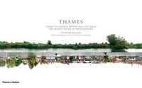
Thames - From Its Source To The Sea And Back

Here is a photographic journey along the 215 miles of the River Thames from its source in Gloucestershire to the mouth, first travelling along the north bank and then back along the south bank. The journey takes the reader through Gloucestershire, Oxfordshire, Berkshire, London and out into the Thames Estuary where the river meets the North Sea. Photographer Stephan Kaluza and his assistants made their journey partly on foot and partly by boat and took pictures of both banks every few seconds, culminating in about 30, 000 images. A selection was then digitally combined to form the long consecutive sequences of the astonishingly changing and varied river banks, whether the green fields of the Cotswolds, the university spires of Oxford, the boathouses of Henley on Thames, or the
built-up areas of London, from Battersea Power Station and the Palace of Westminster to Tower Bridge and CanaryWharf, or the industrial areas towards the mouth.
RIP - This product is no longer available on our network. It was last seen on 25.09.2019

This page now acts as a permanent archive for this product. Add more information using the comments box below to ensure it can still be found by future generations.

Use our search facility to see if it is available from an alternative contributor.
  • Availability: Out Of Stock
  • Supplier: Stanfords
  • SKU: 9780500543740
Availability: In Stock
£60.00

Product Description

Here is a photographic journey along the 215 miles of the River Thames from its source in Gloucestershire to the mouth, first travelling along the north bank & then back along the south bank. The journey takes the reader through Gloucestershire, Oxfordshire, Berkshire, London & out into the Thames Estuary where the river meets the North Sea. Photographer Stephan Kaluza & his assistants made their journey partly on foot & partly by boat & took pictures of both banks every few seconds, culminating in about 30, 000 images. A selection was then digitally combined to form the long consecutive sequences of the astonishingly changing & varied river banks, whether the green fields of the Cotswolds, the university spires of Oxford, the boathouses of Henley on Thames, or the built-up areas of London, from Battersea Power Station & the Palace of Westminster to Tower Bridge & Canary Wharf, or the industrial areas towards the mouth.

Reviews/Comments

Add New

Intelligent Comparison

Oooops!
We couldn't find anything!
Perhaps this product's unique.... Or perhaps we are still looking for comparisons!
Click to bump this page and we'll hurry up.

Price History

Vouchers

No voucher codes found.
Do you know a voucher code for this product or supplier? Add it to Insights for others to use.

Facebook

Jargon Buster

Foot - A part of the body at the bottom end of the leg
Foot - or Feet - a measurement equivilent to 30cm

Supplier Information

Stanfords
Stanfords was established in 1853 and opened their iconic Covent Garden flagship store in 1901. They have become the top retailer of maps, travel books and accessories in the UK and arguably offer the largest selection of maps and travel books worldwide. Famous names such as Captain Robert Falcon Scott, Ranulph Fiennes and Michael Palin have purchased from Stanfords. They now have a shop in Bristol and both stores together with other venues operate a calendar of events including talks, book signings and exhibitions. As a specialist map retailer, the map selection is comprehensive and includes road maps, street maps and walking maps from worldwide destinations, as well as a selection of world atlases and wall maps. Books include travel guides and travel literature. Stanfords also stock globes, from miniatures made of blue marble to magnificent floor-standing globes. The website features a selection of interesting articles on travel topics.
Page Updated: 2023-11-12 20:15:36

Community Generated Product Tags

Oh No! The productWIKI community hasn't generated any tags for this product yet!
Menu