
 United Kingdom
 France
 Germany
 Netherlands
 Sweden
 USA
USA
 Italy
Italy
 Spain
Spain
More From Contributor


Stonehaven And Banchory WATERPROOF
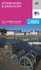
Map No. 45, Stonehaven and Banchory, in a waterproof and tear-resistant version of the Ordnance Survey Landranger series at 1:50, 000, including Bridge of Canny, Drumoak, Kirkton of Durris, Portlethen, Newtonhill, Finzean, Strachan, Rickarton, Bridge of Dye, Glenbervie, Drumlithie, Auchenblae, Catterline, Arbuthnott, Frodoum, Fettercairn, Edzell, Laurencekirk, Inverbervie, Johnshaven, St Cyrus, Marykirk, Hillside and Trinity, with Strathmore and the Hill of Trusta. Edition C; Revised 2002; Reprinted with minor change 2006; This title is also available on our website in a paper version.Maps in this series are only published folded. Stanfords can also print flat versions of Ordnance Survey maps through the OS Select system, centring the map on a location of your
choice and with a picture provided by you on the cover. For more information please click on the link at the bottom of this description.About Ordnance Survey
choice and with a picture provided by you on the cover. For more information please click on the link at the bottom of this description.About Ordnance Survey
Product Description
Reviews/Comments
Add New
Intelligent Comparison
Archived Product

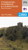
Stonehaven And Banchory Stanfords
£5.59
Archived Product
Stonehaven And Banchory Stanfords
£2.50
Archived Product
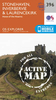
Stonehaven And Banchory OS ACTIVE Map Stanfords
£9.09
Vouchers
No voucher codes found.
Do you know a voucher code for this product or supplier? Add it to Insights for others to use.
Do you know a voucher code for this product or supplier? Add it to Insights for others to use.
 Denmark