
 United Kingdom
 France
 Germany
 Netherlands
 Sweden
 USA
USA
 Italy
Italy
 Spain
Spain
More From Contributor
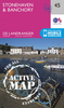
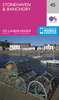


Stonehaven And Banchory OS ACTIVE Map
Map No. 45, Stonehaven and Banchory, in the waterproof and tear-resistant OS Active version of the Ordnance Survey Landranger series at 1:50, 000, including Bridge of Canny, Drumoak, Kirkton of Durris, Portlethen, Newtonhill, Finzean, Strachan, Rickarton, Bridge of Dye, Glenbervie, Drumlithie, Auchenblae, Catterline, Arbuthnott, Frodoum, Fettercairn, Edzell, Laurencekirk, Inverbervie, Johnshaven, St Cyrus, Marykirk, Hillside and Trinity, with Strathmore and the Hill of Trusta.Edition C1; Publication date April 2012About Ordnance Survey
Product Description
Reviews/Comments
Add New
Vouchers
No voucher codes found.
Do you know a voucher code for this product or supplier? Add it to Insights for others to use.
Do you know a voucher code for this product or supplier? Add it to Insights for others to use.
 Denmark