More From Contributor

£5.95
Stockholm in the Wallpaper City Guide series, published by Phaidon & encompassing a collection of pocket-size guides dedicated to the best design elements in major cities. Compiled by experts at the Wallpaper magazine, the guides are widely recognized for appealing to design-conscious travellers & are aimed at those interested in art, design & architecture. Each guide identifies the best bars, restaurants, hotels, places to shop, leisure activities & excursions with a unique emphasis on the finest examples of unusual architecture & design. Each Wallpaper City Guide has the same layout, with separate tabs allowing readers & travellers to access individual sections easily. The tabs consist of Landmarks, Hotels, 24 Hours, Urban Life, Architour, Shopping, Sports & Escapes. High quality colour photographs appear alongside brief descriptions of each hotel, bar or attraction, highlighting distinctive & unusual styles of architecture & design. Extra pages are provided at the back of each guide, allowing readers to record their own notes & sketches. ...
Archived Product
£6.95
The fast-track guide for the smart traveller A tightly edited, discreetly packaged selection of city highlights for the design-conscious visitor. Each Wallpaper* City Guide unearths the most happening restaurants & nightlife, the buzziest hotels, the most influential art galleries & enticing retail, the very best in local design, & the historical styles & contemporary architecture that define a destination. Local writers have delved deep into the urban psyche to enable you to come away from your trip, however brief, with a real flavour of the creative scene & the satisfaction you`ve seen all that you should. ...
Archived Product
£4.00
A Stockholm Interlude in a series of City Map/ Guides from Herb Lester Associates with the publishers’ recommendations of 36 places to visit, grouped into Shopping & Supplies, Eating & Drinking, & Things to See & Do. All are within the city’s central district. Maps in this series are an eclectic selection of quirky titles designed to illuminate particular aspects of a city or a district. Each title lists publishers’ recommendations, ranging from the already famous attractions to little gems known only to the well informed locals, all with brief descriptions &, where appropriate, contact details. Accompanying maps are designed to highlight the locations of the recommended places rather than to provide an accurate presentation of the street network. To see other titles in this series please click on the series link. ...
Archived Product
£12.99
Monocle reports from around the globe in print, on radio, & online. As its editors & correspondents dart from city to city, they get to know the best places to rest their heads, stretch their limbs, & kick back with a contact in a hard-to-find cocktail bar. That information is now available in The Monocle Travel Guide Series: a line-up of titles that speaks to you in an informed but informal way about everything from architecture to art, late-night bars to early-morning markets. Expect a mix of experiences dotted with some quirky surprises. These are books where grand hotels appear alongside family-owned bistros & internationally renowned galleries sit next to unassuming indie clubs that play host to top music talent. The Monocle Travel Guides mix the classic with the contemporary, go beyond the conventional, & reveal all the hidden spots that cities have to offer. ...
Archived Product
£13.99
This map of Stockholms Skargard in 1:50, 000 is part of a series of topographic maps from Norstedts Kartforlaget which


...
Archived Product
£3.50
Stockport East in 1897 in a fascinating series of reproductions of old Ordnance Survey plans in the Alan Godfrey Editions, ideal for anyone interested in the history of their neighbourhood or family. The map covers the eastern part of Stockport, eastward to the River Goyt; beyond this is a rural part of Bredbury parish around Goyt Hall. Features include Vernon Park, Stockport Little Moor, Woodbank Farm, Victoria Park, ropery, Carrington Bridge Mill, New Bridge, Lower Bredbury, Goyt Hall, Highfield, Bredbury Hall, etc. On the reverse are extracts from a directory of Stockport Borough officials. About the Alan Godfrey Editions of the 25” OS Series: Selected towns in Great Britain & Ireland are covered by maps showing the extent of urban development in the last decades of the 19th & early 20th century. The plans have been taken from the Ordnance Survey mapping & reprinted at about 15 inches to one mile (1:4, 340). On the reverse most maps have historical notes & many also include extracts from contemporary directories. Most maps cover about one mile (1.6kms) north/south, one & a half miles (2.4kms) across; adjoining sheets can be combined to provide wider coverage.FOR MORE INFORMATION & A COMPLETE LIST OF ALL AVAILABLE TITLES PLEASE CLICK ON THE SERIES LINK. ...
Archived Product
£2.95
Stockport East in 1897 in a fascinating series of reproductions of old Ordnance Survey plans in the Alan Godfrey Editions, ideal for anyone interested in the history of their neighbourhood or family. Selected towns in Great Britain & Ireland are covered by maps showing the extent of urban development in the last decades of the 19th & early 20th century. In this title: this detailed map covers the eastern part of Stockport, eastward to the River Goyt; beyond this it covers a rural part of Bredbury parish around Goyt Hall. Features include Vernon Park, Stockport Little Moor, Woodbank Farm, Victoria Park, ropery, Carrington Bridge Mill, New Bridge, Lower Bredbury, Goyt Hall, Highfield, Bredbury Hall. On the reverse are extracts from a directory re Stockport Borough officials. About the Alan Godfrey Editions of the 25 ...
Archived Product
£3.50
Stockport Heaton Norris in 1916 in a fascinating series of reproductions of old Ordnance Survey plans in the Alan Godfrey Editions, ideal for anyone interested in the history of their neighbourhood or family. Although this is a Lancashire map, it really covers the north-western area of Stockport across the River Mersey & incorporating Heaton Norris. Coverage stretches from Mauldeth Road eastward to Parsonage Street, & from Heaton Moor southward to the railway viaduct across the Mersey. Features include the LNWR railway with Heaton Norris station & junction, Cheshire Lines Railway with George`s Road Sidings, Norris Bank, Travis Brook Mill, India Mills, Hope Hill, iron foundry, Christ Church, Whitefield, Bent House Farm, tramways, Norris Bank Works, Norris Hill, Alice Briggs Home, Barnes Home Industrial School, council offices, etc. On the reverse are street directory entries for Bank Hall Road, Broomfield Road, Didsbury Road, Heaton Moor Road, Lea Road, & Thornfield Road. About the Alan Godfrey Editions of the 25” OS Series: Selected towns in Great Britain & Ireland are covered by maps showing the extent of urban development in the last decades of the 19th & early 20th century. The plans have been taken from the Ordnance Survey mapping & reprinted at about 15 inches to one mile (1:4, 340). On the reverse most maps have historical notes & many also include extracts from contemporary directories. Most maps cover about one mile (1.6kms) north/south, one & a half miles (2.4kms) across; adjoining sheets can be combined to provide wider coverage.FOR MORE INFORMATION & A COMPLETE LIST OF ALL AVAILABLE TITLES PLEASE CLICK ON THE SERIES LINK. ...
Archived Product
£2.95
Hazel Grove in 1897 in a fascinating series of reproductions of old Ordnance Survey plans in the Alan Godfrey Editions, ideal for anyone interested in the history of their neighbourhood or family. Selected towns in Great Britain & Ireland are covered by maps showing the extent of urban development in the last decades of the 19th & early 20th century. In this title: the map covers most of the village of Hazel Grove, just south of Stockport, & a linear village along the London Road, stretching from Southwood Street southward to St Thomas church. Features include Torkington House, railway with station, Torkington Lodge, Wellington Mill, Bosdenfold Cottages, Bramhall Moor, Bramhall House, Hazelgrove Mills, Steppinghill, tramway, Wood's Moor etc. On the reverse are directories of Hazel Grove & Norbury, plus a railway timetable for the Manchester-Buxton line in 1897. About the Alan Godfrey Editions of the 25 ...
Archived Product
£3.50
Hazel Grove in 1897 in a fascinating series of reproductions of old Ordnance Survey plans in the Alan Godfrey Editions, ideal for anyone interested in the history of their neighbourhood or family. The map covers most of the village of Hazel Grove, just south of Stockport, & a linear village along the London Road, stretching from Southwood Street southward to St Thomas church. Features include Torkington House, railway with station, Torkington Lodge, Wellington Mill, Bosdenfold Cottages, Bramhall Moor, Bramhall House, Hazelgrove Mills, Steppinghill, tramway, Wood`s Moor, etc. On the reverse are directories of Hazel Grove & Norbury, plus a railway timetable for the Manchester-Buxton line in 1897. * About the Alan Godfrey Editions of the 25” OS Series: Selected towns in Great Britain & Ireland are covered by maps showing the extent of urban development in the last decades of the 19th & early 20th century. The plans have been taken from the Ordnance Survey mapping & reprinted at about 15 inches to one mile (1:4, 340). On the reverse most maps have historical notes & many also include extracts from contemporary directories. Most maps cover about one mile (1.6kms) north/south, one & a half miles (2.4kms) across; adjoining sheets can be combined to provide wider coverage.FOR MORE INFORMATION & A COMPLETE LIST OF ALL AVAILABLE TITLES PLEASE CLICK ON THE SERIES LINK. ...
Archived Product

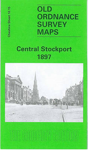
Stockport Central 1897

Central Stockport in 1897 in a fascinating series of reproductions of old Ordnance Survey plans in the Alan Godfrey Editions, ideal for anyone interested in the history of their neighbourhood or family. The map covers the central area of Stockport, extending from the River Mersey southward to Greek Street and Chatham Street, and eastward to New Zealand Road. Note that the area north of the Mersey in Lancashire, is left blank in this edition. Features include station and goods yard, tramways, hat manufactory, Middle Hillgate, Wellington Road South, Hollywood Park, Spring Mount Mill, Sovereign Iron Works, Kingston Mill, Wear Mills, St Mary`s church, New Bridge Mills, Vernon Mills, gasworks, Portwood Mills, Meadow Mill, Park Bleach Works, Millgate Bridge, River Goyt,
cattle market, etc. Also included as an inset is the built-up part of adjacent sheet 10.14 to the west showing Gorseybank Mill. On the reverse is a selection of street directory entries, including Canal Street, Chestergate, Daw Bank, Edward Street, Gorsey Brow Street, Gorsey Mount Street, Great Underbank, Higher Hillgate, Market Place, St Petersgate and Waterloo Road. About the Alan Godfrey Editions of the 25” OS Series:Selected towns in Great Britain and Ireland are covered by maps showing the extent of urban development in the last decades of the 19th and early 20th century. The plans have been taken from the Ordnance Survey mapping and reprinted at about 15 inches to one mile (1:4, 340). On the reverse most maps have historical notes and many also include extracts from
contemporary directories. Most maps cover about one mile (1.6kms) north/south, one and a half miles (2.4kms) across; adjoining sheets can be combined to provide wider coverage.FOR MORE INFORMATION AND A COMPLETE LIST OF ALL AVAILABLE TITLES PLEASE CLICK ON THE SERIES LINK.
RIP - This product is no longer available on our network. It was last seen on 25.09.2019

This page now acts as a permanent archive for this product. Add more information using the comments box below to ensure it can still be found by future generations.

Use our search facility to see if it is available from an alternative contributor.
  • External links may include paid for promotion
  • Availability: Out Of Stock
  • Supplier: Stanfords
  • SKU: 9780850548259
Availability: In Stock
£3.50

Product Description

Central Stockport in 1897 in a fascinating series of reproductions of old Ordnance Survey plans in the Alan Godfrey Editions, ideal for anyone interested in the history of their neighbourhood or family. The map covers the central area of Stockport, extending from the River Mersey southward to Greek Street & Chatham Street, & eastward to New Zealand Road. Note that the area north of the Mersey in Lancashire, is left blank in this edition. Features include station & goods yard, tramways, hat manufactory, Middle Hillgate, Wellington Road South, Hollywood Park, Spring Mount Mill, Sovereign Iron Works, Kingston Mill, Wear Mills, St Mary`s church, New Bridge Mills, Vernon Mills, gasworks, Portwood Mills, Meadow Mill, Park Bleach Works, Millgate Bridge, River Goyt, cattle market, etc. Also included as an inset is the built-up part of adjacent sheet 10.14 to the west showing Gorseybank Mill. On the reverse is a selection of street directory entries, including Canal Street, Chestergate, Daw Bank, Edward Street, Gorsey Brow Street, Gorsey Mount Street, Great Underbank, Higher Hillgate, Market Place, St Petersgate & Waterloo Road. About the Alan Godfrey Editions of the 25” OS Series: Selected towns in Great Britain & Ireland are covered by maps showing the extent of urban development in the last decades of the 19th & early 20th century. The plans have been taken from the Ordnance Survey mapping & reprinted at about 15 inches to one mile (1:4, 340). On the reverse most maps have historical notes & many also include extracts from contemporary directories. Most maps cover about one mile (1.6kms) north/south, one & a half miles (2.4kms) across; adjoining sheets can be combined to provide wider coverage.FOR MORE INFORMATION & A COMPLETE LIST OF ALL AVAILABLE TITLES PLEASE CLICK ON THE SERIES LINK.

Reviews/Comments

Add New

Price History

Vouchers

No voucher codes found.
Do you know a voucher code for this product or supplier? Add it to Insights for others to use.

Facebook

Jargon Buster

Contemporary - Modern era design
Contemporary - A design reference to indicate post war modern design
hat - A head covering worn for protection, religious reasons or as a fashion accessory.
iron - An electrical deviced used for removing creases from fabrics
iron - A chemical element (FE). The most common element on earth
History - Anything that happens in the past. An acedemic subject.
Road - a manmade lane or a path that is used to speed up travel.
Contemporary - An object that is living in the same time.
Mill - A building which can grind grain into flour.
Ideal - Something that satisfies a perfect criteria.
Family - A group of people that live together made up from parents and children.

Supplier Information

Stanfords
Stanfords was established in 1853 and opened their iconic Covent Garden flagship store in 1901. They have become the top retailer of maps, travel books and accessories in the UK and arguably offer the largest selection of maps and travel books worldwide. Famous names such as Captain Robert Falcon Scott, Ranulph Fiennes and Michael Palin have purchased from Stanfords. They now have a shop in Bristol and both stores together with other venues operate a calendar of events including talks, book signings and exhibitions. As a specialist map retailer, the map selection is comprehensive and includes road maps, street maps and walking maps from worldwide destinations, as well as a selection of world atlases and wall maps. Books include travel guides and travel literature. Stanfords also stock globes, from miniatures made of blue marble to magnificent floor-standing globes. The website features a selection of interesting articles on travel topics.
Page Updated: 2023-11-12 20:15:36

Community Generated Product Tags

Oh No! The productWIKI community hasn't generated any tags for this product yet!
Menu