
 United Kingdom
 France
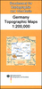
 Germany
 Netherlands
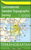
 Sweden
 USA
USA
 Italy
Italy
 Spain
Spain
More From Contributor

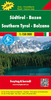
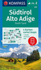


South Tyrol - Dolomites (4-map Set)
Map No. 699, South Tyrol - Dolomites (4-map set) including a panorama map, from Kompass in a series of walking maps of selected areas of Italy at 1:50, 000, with hiking routes on a topographic base, various types of accommodation, recreational facilities, places of interest, etc. Kompass are Europe
Product Description
Reviews/Comments
Add New
Intelligent Comparison
Archived Product
Central South Tyrol - Dolomites (2-map Set) Stanfords
£10.95
Archived Product

South Tyrol - Dolomites 4-Map Set Kompass 699 Stanfords
£17.99
Archived Product

South Tyrol - Dolomites Motorbike Map Set Stanfords
£19.99
Vouchers
No voucher codes found.
Do you know a voucher code for this product or supplier? Add it to Insights for others to use.
Do you know a voucher code for this product or supplier? Add it to Insights for others to use.
 Denmark