
 United Kingdom
 France
 Germany
 Netherlands
 Sweden
 USA
USA
 Italy
Italy
 Spain
Spain
More From Contributor


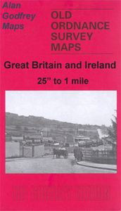
Smethwick 1901
Smethwick in 1901 in a fascinating series of reproductions of old Ordnance Survey plans in the Alan Godfrey Editions, ideal for anyone interested in the history of their neighbourhood or family. The map covers Smethwick, then a Municipal Borough, including much of Uplands, Victoria and Soho Wards. Coverage stretches from Auckland Road eastward to Vittoria Street, and from Great Arthur Street southward to Florence Road. A small portion of Birmingham is also covered. Features include Victoria Park, tramways and depot, Cape Hill Brewery, St George`s Works, Patent Screw Works, London Works, Imperial Wire Mills, Soho Foundry, Cornwall Engineering Works, Credenda Steel Tube Works, Kingston Metal Works, District Iron & Steel Works, Smethwick Iron Foundry, Holy Trinity church,
St Matthew`s church, LNWR Stour Valley line with Smethwick station, Soap Works Junction, Bridge Wharf, Birmingham Canal, Smethwick Locks, St Michael & All Angels church, etc. On the reverse are street directory entries for Bearwood Hill, Smethwick High Street, Rolfe Street, Soho Street and South Road. This title is also Warwickshire Sheet 13.03.About the Alan Godfrey Editions of the 25” OS Series:Selected towns in Great Britain and Ireland are covered by maps showing the extent of urban development in the last decades of the 19th and early 20th century. The plans have been taken from the Ordnance Survey mapping and reprinted at about 15 inches to one mile (1:4, 340). On the reverse most maps have historical notes and many also include extracts from contemporary directories.
Most maps cover about one mile (1.6kms) north/south, one and a half miles (2.4kms) across; adjoining sheets can be combined to provide wider coverage.FOR MORE INFORMATION AND A COMPLETE LIST OF ALL AVAILABLE TITLES PLEASE CLICK ON THE SERIES LINK.

Product Description
Reviews/Comments
Add New
Intelligent Comparison
Archived Product
Prestwick 1908 Stanfords
£3.50
Vouchers
No voucher codes found.
Do you know a voucher code for this product or supplier? Add it to Insights for others to use.
Do you know a voucher code for this product or supplier? Add it to Insights for others to use.
 Denmark