More From Contributor

£6.99
Saint Brieuc
- Saint Lô Michelin Centenary Map-Pack, a set of two maps showing the area at 1:200, 000: a current road map from
...
Archived Product
£10.99
A potent, powerful & timely thriller about migrants, drug lords & gang warfare set on the US/ Mexican border by PRINTZ MEDAL winning & CARNEGIE MEDAL, COSTA BOOK AWARD & GUARDIAN CHILDREN`S FICTION PRIZE shortlisted novelist, Marcus Sedgwick. Anapra is one of the poorest neighbourhoods in the Mexican city of Juarez
- twenty metres outside town lies a fence, & beyond it, America
- the dangerous goal of many a migrant. Faustino is one such trying to escape from the gang he`s been working for. He`s dipped into a pile of dollars he was supposed to be hiding & now he`s on the run. He & his friend, Arturo, have only 36 hours to replace the missing money, or they`re as good as dead. Watching over them is Saint Death. Saint Death (or Santissima Muerte)
- she of pure bone & charcoal-black eye, she of absolute loyalty & neutral morality, holy patron to rich & poor, to prostitute & narco-lord, criminal & police-chief. A folk saint, a rebel angel, a sinister guardian.


...
Archived Product
£4.99
Double-sided map with indexed street plans of Saint John & Fredericton, including Edmundston, Oromocto & Woodstock. An enlargement presents downtown Saint John in greater detail. Street plans from the Map Art / Canadian Cartographics Corporation / JDM Géo publishing group are usually produced at scales around 1:25, 000 to 1:35, 000 with smaller towns often shown at more detailed scales. All plans have street indexes. Plans of larges cities usually include an enlargement for the downtown area. Plans grouping together several smaller towns often have an overview map showing the whole of the relevant region. The plans have colouring to indicate commercial, institutional or industrial use, etc. Main traffic arteries are highlighted & one way streets are marked. A range of symbols shows, as appropriate, parking facilities, bus terminals, metro and/or railway stations, various public facilities & services, places of interest, recreational centres, etc. Map legends for cities & towns in the French speaking part of the country are sometimes in French only. To see the list of currently available Canadian street plans & pocket atlases form the Map Art / Canadian Cartographics Corporation / JDM Géo publishing group, including waterproof & tear-resistant Fast Track titles, please click on the series link. ...
Archived Product
£13.99
Saint Lucia at 1:45, 000 on an indexed map from the Caribbean-based cartographer Michal Kasprowski listing 33 diving sites, plus street plans of Castries, Soufrière, Gros Islet & Vieux Fort. Topography is shown by altitude colouring & contours at 50m intervals. Along the coast coral reefs are marked & diving sites are highlighted. Road network

Includes::
cart tracks; no driving distances are marked. Latitude & longitude lines are drawn at 1’ intervals. The index is next to the map. The map

Includes::
street plans of Castries, Soufrière, Gros Islet & Vieux Fort, an administrative map of the isl&, plus a small map of the Caribbean showing the location of St. Lucia.


...
Archived Product
£25.00
We are able to source a wide range of courtesy flags. Flags are available in many sizes & can be sewn or printed on 100% Ministry Of Defence Standard Woven & Knitted Polyester. Flags are supplied with rope & toggle. If you would like more information, have a custom size request or cannot find a desired product, please email us at maritime@stanfords.co.uk. We will be glad to help! ...
Archived Product
£10.99
Saint Malo
- Côte d` Emeraude
- Mont Saint-Michel area of northern Brittany in a series of GPS compatible, contoured TOP 75

...
Archived Product
£13.99
Saint-Martin/ Sint Maarten at 1:15, 000 on an indexed map from the Caribbean-based cartographer Michal Kasprowski highlighting beaches & water sports sites, with street plans of Marigot & Philipsburg. Main roads are highlighted & named & the map also shows names of many smaller local roads & streets in build-up areas. Also marked are cart tracks & footpaths. Symbols show beaches & water sport sites, lighthouses, harbours & marinas, etc. All information covers both the French & the Dutch side of the isl&. The map has contours at 20m intervals, with a few spot heights, plus colouring to show woodlands. Along the coast reefs & nature reserves are marked. Latitude & longitude lines are marked at 1’ intervals. Street plans at 1:5, 000 show in greater detail Marigot & Philipsburg. Map legend is in English & French. ...
Archived Product
£12.99
Meet Mazie Phillips: big-hearted & feisty, she runs The Venice, the famed movie theatre in the rundown Bowery district of New York City. She spends her days taking tickets, chatting with drunks & eccentrics, & chasing out the troublemakers. After closing up, the nights are her own, & she fills them with romance & booze aplenty
- even during Prohibition. When the Great Depression hits, & homelessness soars, Mazie opens The Venice to those in need, giving them shelter & dimes for food & booze, & earning the nickname ` Saint Mazie`. Inspired by Joseph Mitchell`s essay about Mazie in Up in the Old Hotel, acclaimed author Jami Attenberg`s novel honours an extraordinary life & heralds a completely original approach to writing historical fiction. Weaving together fictionalised diaries, writings & interviews, Attenberg has constructed an utterly convincing portrait of Mazie Philips, which is also a deeply moving portrait of New York as it passed through the First World War, Prohibition, the boom of the `20s, & then the terrible depression of the `30s.
...
Archived Product
£11.99
Meet Mazie Phillips: big-hearted & feisty, she runs The Venice, the famed movie theatre in the rundown Bowery district of New York City. She spends her days taking tickets, chatting with drunks & eccentrics, & chasing out the troublemakers. After closing up, the nights are her own, & she fills them with romance & booze aplenty
- even during Prohibition. When the Great Depression hits, & homelessness soars, Mazie opens The Venice to those in need, giving them shelter & dimes for food & booze, & earning the nickname ` Saint Mazie`. Inspired by Joseph Mitchell`s essay about Mazie in Up in the Old Hotel, acclaimed author Jami Attenberg`s novel honours an extraordinary life & heralds a completely original approach to writing historical fiction. Weaving together fictionalised diaries, writings & interviews, Attenberg has constructed an utterly convincing portrait of Mazie Philips, which is also a deeply moving portrait of New York as it passed through the First World War, Prohibition, the boom of the `20s, & then the terrible depression of the `30s.
...
Archived Product
£7.99
From the bestselling author of The Middlesteins comes comes this unique novel about a forgotten heroine of the 1930s. Meet Mazie Phillips: big-hearted & feisty, she runs The Venice, the famed movie theatre in the rundown Bowery district of New York City. She spends her days taking tickets, chatting with drunks & eccentrics, & chasing out the troublemakers. After closing up, the nights are her own, & she fills them with romance & booze aplenty-even during Prohibition. When the Great Depression hits, & homelessness soars, Mazie opens The Venice to those in need, giving them shelter & dimes for food & booze, & earning the nickname ` Saint Mazie`. Inspired by Joseph Mitchell`s essay about Mazie in Up in the Old Hotel, acclaimed author Jami Attenberg`s novel honours an extraordinary life & heralds a completely original approach to writing historical fiction. Weaving together fictionalised diaries, writings & interviews, Attenberg has constructed an utterly convincing portrait of Mazie Philips, which is also a deeply moving portrait of New York as it passed through the First World War, Prohibition, the boom of the `20s, & then the terrible depression of the `30s. ...
Archived Product

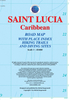
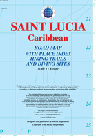
Saint Lucia Gizi Map

Lovely indexed road map of St. Lucia, with street plans of central Castries and the holiday complex at Anse Chastanet. Bright altitude colouring and vivid relief shading provide an excellent picture of the islands topography. Mangroves and coral reefs are marked. Road network includes minor local roads and tracks. The map also shows the country’s administrative divisions.Protected nature areas and animal watching locations are marked and the map highlights hotels and tourist accommodation, waymarked hiking trails, sites for scuba diving, watersports and deep see fishing, golf courses, various places of interest and natural curiosities, etc. The map has a 2’ latitude/longitude grid and is indexed.Also included are street plans of central Castries and the holiday complex at Anse
Chastenet, plus an overview map of the southern Caribbean.
RIP - This product is no longer available on our network. It was last seen on 25.09.2019

This page now acts as a permanent archive for this product. Add more information using the comments box below to ensure it can still be found by future generations.

Use our search facility to see if it is available from an alternative contributor.
  • External links may include paid for promotion
  • Availability: Out Of Stock
  • Supplier: Stanfords
  • SKU: 9789638746542
Availability: In Stock
£9.99

Product Description

Lovely indexed road map of St. Lucia, with street plans of central Castries & the holiday complex at Anse Chastanet. Bright altitude colouring & vivid relief shading provide an excellent picture of the islands topography. Mangroves & coral reefs are marked. Road network

Includes::
minor local roads & tracks. The map also shows the country’s administrative divisions. Protected nature areas & animal watching locations are marked & the map highlights hotels & tourist accommodation, waymarked hiking trails, sites for scuba diving, watersports & deep see fishing, golf courses, various places of interest & natural curiosities, etc. The map has a 2’ latitude/longitude grid & is indexed. Also included are street plans of central Castries & the holiday complex at Anse Chastenet, plus an overview map of the southern Caribbean.

Reviews/Comments

Add New

Price History

Vouchers

No voucher codes found.
Do you know a voucher code for this product or supplier? Add it to Insights for others to use.

Facebook

Jargon Buster

Hiking - An outdoor activity envolving walking in nature
Natural - not manmade
Network - A link and communication between things. Often computers or people.
Road - a manmade lane or a path that is used to speed up travel.
Caribbean - An area of islands within the Caribbean sea.
Altitude - Something that can be quite high in relation to sea or ground level.
Golf - A sport played on a large outside grass course, the aim to hit a small ball with a club into small holes.
Accommodation - A room in which someone can live in, for example in a hotel

Supplier Information

Stanfords
Stanfords was established in 1853 and opened their iconic Covent Garden flagship store in 1901. They have become the top retailer of maps, travel books and accessories in the UK and arguably offer the largest selection of maps and travel books worldwide. Famous names such as Captain Robert Falcon Scott, Ranulph Fiennes and Michael Palin have purchased from Stanfords. They now have a shop in Bristol and both stores together with other venues operate a calendar of events including talks, book signings and exhibitions. As a specialist map retailer, the map selection is comprehensive and includes road maps, street maps and walking maps from worldwide destinations, as well as a selection of world atlases and wall maps. Books include travel guides and travel literature. Stanfords also stock globes, from miniatures made of blue marble to magnificent floor-standing globes. The website features a selection of interesting articles on travel topics.
Page Updated: 2023-11-12 20:15:36

Community Generated Product Tags

Oh No! The productWIKI community hasn't generated any tags for this product yet!
Menu