
 United Kingdom
 France
 Germany
 Netherlands
 Sweden
 USA
USA
 Italy
Italy
 Spain
Spain
More From Contributor


Royton 1932
Royton in 1932 in a fascinating series of reproductions of old Ordnance Survey plans in the Alan Godfrey Editions, ideal for anyone interested in the history of their neighbourhood or family. Coverage stretches south towards Oldham and eastward towards Broadbent. Features include the town centre, with Town Hall, Market Place, Royton Hall; railway information includes the complete Royton Branch with Royton and Royton Junction stations; Mills include Delta Mill, Norman Mill, Industry Mill, Royton Ring Mill, Parkside Mill, Star Mill, Bee Mill, King Mill, Lion Mill, Belgian Mill, Turf Lane Mills, Holyrood Mill, Tay Mills, Rhos Mill, Springfield Mill and Woodstock Mill. Other features include Poor Law Institution (workhouse), Kershaw`s Cottage Hospital, gasworks, Higginshaw
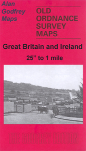
area, Heyside area, Royton Moss, Long Sight, Old Edge Lane, tramways, St Anne`s church, Dryclough House, St Mark`s church Heyside, Broadbent Moss, Higginshaw Running Ground, etc. On the reverse is a commercial directory of Royton in 1918.About the Alan Godfrey Editions of the 25” OS Series:Selected towns in Great Britain and Ireland are covered by maps showing the extent of urban development in the last decades of the 19th and early 20th century. The plans have been taken from the Ordnance Survey mapping and reprinted at about 15 inches to one mile (1:4, 340). On the reverse most maps have historical notes and many also include extracts from contemporary directories. Most maps cover about one mile (1.6kms) north/south, one and a half miles (2.4kms) across; adjoining sheets
can be combined to provide wider coverage.FOR MORE INFORMATION AND A COMPLETE LIST OF ALL AVAILABLE TITLES PLEASE CLICK ON THE SERIES LINK.

Product Description
Reviews/Comments
Add New
Intelligent Comparison
Archived Product

Royston 1904 Stanfords
£3.50
Archived Product
Moston 1933 Stanfords
£3.50
Archived Product
Syston 1902 Stanfords
£2.95
Archived Product

Syston 1902 Stanfords
£3.50
Vouchers
No voucher codes found.
Do you know a voucher code for this product or supplier? Add it to Insights for others to use.
Do you know a voucher code for this product or supplier? Add it to Insights for others to use.
 Denmark