More From Contributor
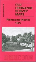
£29.99
Map No. 2830, Richards Bay, in South Africa’s official topographic survey at 1:250, 000 from the country’s national survey organization, the Chief Directorate of Surveys & Mapping. The maps have altitude colouring & contours at 50m or 100m intervals, depending on the map edition, plus spot heights. Deserts, marshes, dry pans, perennial & seasonal water features, etc, as well as protected areas are shown. The maps present the country’s road & rail networks & include the usual information expected on topographic mapping at this scale, although in more rapidly developing areas road information may not necessarily be up to date. Also indicated are magisterial district & provincial boundaries. Latitude & longitude values are shown in the margins at 5` intervals together with South African grid co-ordinates. Typically, each sheet covers an area of one degree of latitude & two degrees of longitude. The projection used is Gauss Conformal. The legend is in English & Afrikaans. ...
Archived Product
£9.99
London boroughs of Richmond & Ealing in the Cassini Past & Present map series which covers town & cities of England & Wales & offers a unique way of tracing their history & expansion by showing four different periods of their development using Ordnance Survey mapping from the mid-19th century, the late 19th century, the 1920s & the present day. Coverage

Includes::
Barnes, Battersea, Chelsea, Chiswick, Fulham, Hammersmith, Kensington, Isleworth, Paddington, Putney, Teddington, Twickenham, Wandsworth & Wimbledon. Each Past & Present map consists of four panels, all centred on a city or a town & covering exactly the same 15km x 15km area. Three of the panels reproduce Ordnance Survey’s historical editions: the Old Series, the Revised New Series & the Popular Edition, enlarged from their original inch-to-the-mile to match the 1:50, 000 scale of the present-day Landranger extract shown in the fourth panel.* Old Series: the first detailed survey mapping dating from the first half of the 19th century, in black & white & with relief shown by hachuring.* Revised New Series from 1880s/1900s, with some colouring & a mixture of hachuring & contour lines.* Popular Edition from the inter-war years, with contour lines & colouring to indicate woodlands, parks, etc. National Grid lines are shown on all four panels for easy comparison across the four time periods. Historical notes, details of the original maps used & web-links for local history societies & other sources of information are also provided. *PLEASE NOTE:** Reproductions from the Ordnance Survey’s historical series are also available as maps of a wider area, with each title corresponding in its coverage to a present day Landranger map. Please see Great Britain: Cassini Historical Reproductions of Ordnance Survey One-Inch Maps series.* Stanfords can also print on request mapping from all the series *centring the map on a location of your choice.* For more information please click on the link below.

...
Archived Product
£3.50
Richmond & St. Margaret`s in 1894 in a fascinating series of reproductions of old Ordnance Survey plans in the Alan Godfrey Editions, ideal for anyone interested in the history of their neighbourhood or family. The map covers the centre of Richmond, together with the St Margaret`s area on the west side of the Thames, & part of Twickenham including Cambridge Park & Twickenham Park. Coverage extends from London Road & Cole`s Bridge eastward to Richmond station, & from Honywood Road & Richmond Green southward to Cambridge Park. Features on the Richmond side include the riverside area, Richmond Bridge, Buccleuch House, Town Hall, most of Richmond station, George Street, Lancaster Park; features on the St Margaret’s side include Cambridge House, St Margarets House (Naval Female School), Old River Crane, Ivy Bridge. Street directories for George Street, The Green, Grosvenor Road, Hill Street, Hill Rise, King Street, Petersham Road, Vineyard are given on the reverse. About the Alan Godfrey Editions of the 25” OS Series: Selected towns in Great Britain & Ireland are covered by maps showing the extent of urban development in the last decades of the 19th & early 20th century. The plans have been taken from the Ordnance Survey mapping & reprinted at about 15 inches to one mile (1:4, 340). On the reverse most maps have historical notes & many also include extracts from contemporary directories. Most maps cover about one mile (1.6kms) north/south, one & a half miles (2.4kms) across; adjoining sheets can be combined to provide wider coverage.FOR MORE INFORMATION & A COMPLETE LIST OF ALL AVAILABLE TITLES PLEASE CLICK ON THE SERIES LINK. ...
Archived Product
£3.50
Richmond Hill & East Sheen in 1894 in a fascinating series of reproductions of old Ordnance Survey plans in the Alan Godfrey Editions, ideal for anyone interested in the history of their neighbourhood or family. The map covers the eastern part of Richmond, together with the East Sheen area of Mortlake, an area stretching from The Terrace & Friars Stile Road eastward to Sheen Lane & Sheen House, & from a short stretch of the railway southward to the Star & Garter Hotel. Features include the Wesleyan College, workhouse, cemetery, Bog Lodge, Conduit Wood, Sheen Common, Sheen Wood, Upper Richmond Road. On the reverse are street directories for Church Road, Mount Ararat Road, Queens Road, Sheen Road, Sydney Road & a few others. About the Alan Godfrey Editions of the 25” OS Series: Selected towns in Great Britain & Ireland are covered by maps showing the extent of urban development in the last decades of the 19th & early 20th century. The plans have been taken from the Ordnance Survey mapping & reprinted at about 15 inches to one mile (1:4, 340). On the reverse most maps have historical notes & many also include extracts from contemporary directories. Most maps cover about one mile (1.6kms) north/south, one & a half miles (2.4kms) across; adjoining sheets can be combined to provide wider coverage.FOR MORE INFORMATION & A COMPLETE LIST OF ALL AVAILABLE TITLES PLEASE CLICK ON THE SERIES LINK. ...
Archived Product
£9.99
David L. Robbins`s Homework, a moving account of a brief encounter between a burglar & a teacher, stands head & shoulders above the 14 other tales in Akashic`s solid noir anthology devoted to Richmond, Va. Pir Rothenberg`s The Rose Red Vial, among the better of the many recent Poe-inspired stories, features nicely nasty betrayals & counterbetrayals among those who covet Poe memorabilia on loan to the Virginia Historical Society. Set in 1807, Dean King`s concise The Fall Lines supplies an intriguing backstory to Aaron Burr`s treason trial. In Howard Owen`s The Thirteenth Floor, a well-done contemporary fair play whodunit, a political reporter reassigned to the night police beat ends up investigating a murder-by-gunshot in his own apartment building. ...
Archived Product
£25.00
Sir David Attenborough has described Richmond Park as `A very special place`
- & with good reason. This vast oasis of green, just
...
Archived Product
£9.99
Compiled to celebrate the 50th anniversairy of the Friends of Richmond Park organisation, the Guide to Richmond Park celebrates London`s largest royal park, with its famous herds of deer, anicent trees, extensive grasslands & 400 years of history. With a foreward from Sir David Attenborough & 300 colour photographs of the park, a range of writers have contributed to the volume. Individual chapters explore ecology, deer, birds, butterflies & day-flying moths, beetles & other invertebrates, bats, trees, flora, garden areas, history, buildings, the wall, gates & other structures, the management of Richmond Park, do`s & dont`s in the park, the Friends of Richmond Park overview, `true or false` & Richmond Park facts. A further section provides useful information on opening hours, information points, eating & drinking, toilet facilities, leisure facilities, education, ecology & wildlife groups, police & photographs of the park.* All profits raised from sales of this titles go to conservation projects in Richmond Park.* ...
Archived Product
£9.99
David Mc Dowall’s Walker’s Guide to Richmond Park gives the reader eleven exceptionally detailed walking routes arranged as a historical progression through the park’s varied & fascinating past. Far from merely outlining routes & providing directions, this guide constitutes one of the best-researched & richly detailed walking guides available for the park. Each walk section

Includes::
a route description & is accompanied by an explanatory text, providing an extraordinary amount of information on the park’s rich history of human activity. An introduction on the parks landscape & appendices on the park’s flora, the deer, it’s ponds & bird life are included. It also describes how the impact of present human activity & its implications for the park’s future. This wonderful guide contains many h&-drawn black & white illustrations, diagrams & maps to supplement the text.

...
Archived Product
£15.95
Originally, the area was known as Sheen; Richmond is a comparatively new name. In 1501 when Henry VII rebuilt a royal palace here, he called it Richmond Palace, after his earldom in Yorkshire. Despite the abandonment of the palace by the 18th century, the village flourished, Many of the handsome houses of that time survive, including those in Petersham & Ham. Its Quinlan Terry riverfront development continues to provoke debate. John Cloake, Richmond`s pre-eminent historian, has included many illustrations in this comprehensive account. ...
Archived Product
£3.50
Richmond South & Easby in 1927 in a fascinating series of reproductions of old Ordnance Survey plans in the Alan Godfrey Editions, ideal for anyone interested in the history of their neighbourhood or family. The map covers the southern part of Richmond, with the Town Hall, the great Castle, The Green, River Swale, Bargate, Sleegill, railway with station, Scots Dike, etc. Coverage extends south to the Westwood Picture Theatre & east to the little village of Easby with the Abbey & St Agatha`s church, Easby House, almshouses. On the reverse is a commercial directory for Richmond in 1905. About the Alan Godfrey Editions of the 25” OS Series: Selected towns in Great Britain & Ireland are covered by maps showing the extent of urban development in the last decades of the 19th & early 20th century. The plans have been taken from the Ordnance Survey mapping & reprinted at about 15 inches to one mile (1:4, 340). On the reverse most maps have historical notes & many also include extracts from contemporary directories. Most maps cover about one mile (1.6kms) north/south, one & a half miles (2.4kms) across; adjoining sheets can be combined to provide wider coverage.FOR MORE INFORMATION & A COMPLETE LIST OF ALL AVAILABLE TITLES PLEASE CLICK ON THE SERIES LINK. ...
Archived Product

Richmond North 1927

Richmond North in 1927 in a fascinating series of reproductions of old Ordnance Survey plans in the Alan Godfrey Editions, ideal for anyone interested in the history of their neighbourhood or family. The map covers the northern part of the historic Swaledale town of Richmond, with part of the Market Place including Newbiggin, The Friary, Frenchgate, Hurgill Road, Wellington Place, St Mary`s church, Gallowgate, Infantry Barracks, Queen`s Road, Anchorage Hill, St Nicholas, etc. Coverage extends eastward to High and Low Wath Cote and Scots Dike. On the reverse is half of the adjacent sheet 38.12 extending coverage west to include the Poor Law Institution, Reeth Road, Convent, Whitcliffe Paper Mills, cemetery, West Terrace, cattle market, Hurgill, High Gingerfield Lodge
and the old race course.About the Alan Godfrey Editions of the 25” OS Series:Selected towns in Great Britain and Ireland are covered by maps showing the extent of urban development in the last decades of the 19th and early 20th century. The plans have been taken from the Ordnance Survey mapping and reprinted at about 15 inches to one mile (1:4, 340). On the reverse most maps have historical notes and many also include extracts from contemporary directories. Most maps cover about one mile (1.6kms) north/south, one and a half miles (2.4kms) across; adjoining sheets can be combined to provide wider coverage.FOR MORE INFORMATION AND A COMPLETE LIST OF ALL AVAILABLE TITLES PLEASE CLICK ON THE SERIES LINK.
RIP - This product is no longer available on our network. It was last seen on 25.09.2019

This page now acts as a permanent archive for this product. Add more information using the comments box below to ensure it can still be found by future generations.

Use our search facility to see if it is available from an alternative contributor.
  • External links may include paid for promotion
  • Availability: Out Of Stock
  • Supplier: Stanfords
  • SKU: 9781841517841
Availability: In Stock
£3.50

Product Description

Richmond North in 1927 in a fascinating series of reproductions of old Ordnance Survey plans in the Alan Godfrey Editions, ideal for anyone interested in the history of their neighbourhood or family. The map covers the northern part of the historic Swaledale town of Richmond, with part of the Market Place including Newbiggin, The Friary, Frenchgate, Hurgill Road, Wellington Place, St Mary`s church, Gallowgate, Infantry Barracks, Queen`s Road, Anchorage Hill, St Nicholas, etc. Coverage extends eastward to High & Low Wath Cote & Scots Dike. On the reverse is half of the adjacent sheet 38.12 extending coverage west to include the Poor Law Institution, Reeth Road, Convent, Whitcliffe Paper Mills, cemetery, West Terrace, cattle market, Hurgill, High Gingerfield Lodge & the old race course. About the Alan Godfrey Editions of the 25” OS Series: Selected towns in Great Britain & Ireland are covered by maps showing the extent of urban development in the last decades of the 19th & early 20th century. The plans have been taken from the Ordnance Survey mapping & reprinted at about 15 inches to one mile (1:4, 340). On the reverse most maps have historical notes & many also include extracts from contemporary directories. Most maps cover about one mile (1.6kms) north/south, one & a half miles (2.4kms) across; adjoining sheets can be combined to provide wider coverage.FOR MORE INFORMATION & A COMPLETE LIST OF ALL AVAILABLE TITLES PLEASE CLICK ON THE SERIES LINK.

Reviews/Comments

Add New

Price History

Vouchers

No voucher codes found.
Do you know a voucher code for this product or supplier? Add it to Insights for others to use.

Facebook

Jargon Buster

Contemporary - Modern era design
Paper - A thin sheet mainly used for writing. Available in a variety of colours. Made mainly from wood pulp.
Contemporary - A design reference to indicate post war modern design
History - Anything that happens in the past. An acedemic subject.
Road - a manmade lane or a path that is used to speed up travel.
Contemporary - An object that is living in the same time.
Ideal - Something that satisfies a perfect criteria.
Family - A group of people that live together made up from parents and children.

Supplier Information

Stanfords
Stanfords was established in 1853 and opened their iconic Covent Garden flagship store in 1901. They have become the top retailer of maps, travel books and accessories in the UK and arguably offer the largest selection of maps and travel books worldwide. Famous names such as Captain Robert Falcon Scott, Ranulph Fiennes and Michael Palin have purchased from Stanfords. They now have a shop in Bristol and both stores together with other venues operate a calendar of events including talks, book signings and exhibitions. As a specialist map retailer, the map selection is comprehensive and includes road maps, street maps and walking maps from worldwide destinations, as well as a selection of world atlases and wall maps. Books include travel guides and travel literature. Stanfords also stock globes, from miniatures made of blue marble to magnificent floor-standing globes. The website features a selection of interesting articles on travel topics.
Page Updated: 2023-11-12 20:15:36

Community Generated Product Tags

Oh No! The productWIKI community hasn't generated any tags for this product yet!
Menu