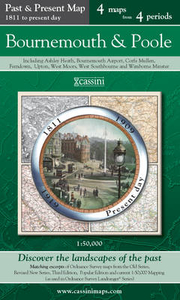
More From Contributor

£8.99
Natalie Mac Lean spent three years sipping her way through sun-drenched vineyards & cobwebbed cellars to bring us this witty, knowledgeable book about the world of wine. In the ancient vineyards of Burgundy, she uncovers the secrets of Pinot Noir, then moves on to the labyrinthine cellars of Champagne to examine the mystique of luxury bubbly. She compares notes with novelist Jay Mc Inerney at a bacchanalian dinner, goes undercover as a sommelier in a five-star restaurant, & explores the influence of powerful critics Jancis Robinson & Robert Parker. You may have a head for wine, but ” Red, White & Drunk All Over” will show you its heart. ...
Archived Product
£24.95
Following World War II, China found itself struggling with a conversion to communism that had wreaked havoc on the nation`s economy, causing a devastating famine & extreme economic depression. In 1966 China`s leader, Mao Zedong, gave his support to radicals within the communist party who envisioned a revolutionary social upheaval that would destroy all traces of the reactionary past. This was the beginning of a ten-year period of violence & chaos known as the Cultural Revolution. Many top officials lost their positions & numerous provincial governments came under the control of the radicals. The radical movement was primarily led by students who formed organizations known as ” Red Guards, ” which used violent methods to punish people they saw as ”anti-Maoists” or counter-revolutionaries. At the height of the Cultural Revolution (1966-70) China`s universities were closed & much of its populace was sent to rural ”re-education centres” where they were indoctrinated with Maoist policies. It is during this period that Li Zhensheng worked as a photojournalist for the ” Heilongjiang Daily”, shooting film both for the paper &, as we know now, for himself. While Li worked for a newspaper supporting the Maoist movement & admits he did not think Mao`s policies to be incorrect at the beginning of his tenure at the newspaper, his hiding of film was a highly subversive action. As a photographer, Li wanted to document the Cultural Revolution for himself & for others in the future. He put himself at risk by hiding film stills that the government would have destroyed, capturing events of which little or no other visual record exists. Looking at the photos in this book, one sees the difference between the photos published in the ” Daily” & those Li hid for himself, allowing for a rare understanding of how the Chinese government controlled media during the Cultural Revolution. The Heilongjiang province where Li worked was crucial because of its proximity to the then Soviet Union. Its main city, Harbin, had been occupied by the Soviets following World War II & was later set up as a communication hub between the Soviet Union & China. It was the communist centre which bred the revolutionary movement, leading to China`s unification under communist control in 1949. This Russian influence can be seen in the details of Li`s photographs, right down to the city`s typically Russian-style architecture. Many of Li`s techniques as a photographer borrow from his training as a filmmaker, including his creation of ”handheld panoramic” photos by shooting overlapping frames of large panoramas & pasting the stills together to create the illusion of one continuous shot. His inventive techniques & powerful images make Li one of the premier Chinese photographers alive today. This book, which takes its name from the literal translation of Li`s accreditation as a photographer approved by the Communist Party headquarters in Beijing, is part of the key to understanding one of the most turbulent & still notorious eras of modern history. The book

Includes::
a preface, introduction, text by the photographer, chronology, maps, & extensive photo captions for over 400 photos (almost all of which have never been seen before).

...
Archived Product
£12.99
A blue crayon mistakenly labeled as ”red” suffers an identity crisis in the new picture book by the New York Times-bestselling creator of My Heart Is Like a Zoo & It`s an Orange Aardvark! Funny, insightful, & colorful, Red: A Crayon`s Story, by Michael Hall, is about being true to your inner self & following your own path despite obstacles that may come your way. Red will appeal to fans of Lois Ehlert, Eric Carle, & The Day the Crayons Quit, & makes a great gift for readers of any age! Red has a bright red label, but he is, in fact, blue. His teacher tries to help him be red (let`s draw strawberries!), his mother tries to help him be red by sending him out on a playdate with a yellow classmate (go draw a nice orange!), & the scissors try to help him be red by snipping his label so that he has room to breathe. But Red is miserable. He just can`t be red, no matter how hard he tries! Finally, a br&-new friend offers a br&-new perspective, & Red discovers what readers have known all along. He`s blue! This funny, heartwarming, colorful picture book about finding the courage to be true to your inner self can be read on multiple levels, & it offers something for everyone! ...
Archived Product
£10.99
Wellington Redburn is a fifteen-year-old from the state of New York, with only one dream
- to run away to sea. However, when
...
Archived Product
£3.50
Redcar & Coatham in 1913 in a fascinating series of reproductions of old Ordnance Survey plans in the Alan Godfrey Editions, ideal for anyone interested in the history of their neighbourhood or family. The map is double-sided. The main map covers Redcar, stretching from Arthur Street & Henry Street eastward to the edge of town & the coast. Features include the railway with Redcar station, Redcar Pier, much of the race course, cemetery, St Peter`s church, Central Hall, High Street, Esplanade, Zetland Schools, Redcar Rocks, Newcomen Terrace, Coatham Hotel, West Dyke, Queen Street, etc. On the reverse is much of the adjacent sheet 7.02 covering Coatham; features here include Coatham Banks, Christ Church, Warrenby, Convalescent Home, Coatham Road, etc. Also included is a list of private residents from a Coatham directory 1905. About the Alan Godfrey Editions of the 25” OS Series: Selected towns in Great Britain & Ireland are covered by maps showing the extent of urban development in the last decades of the 19th & early 20th century. The plans have been taken from the Ordnance Survey mapping & reprinted at about 15 inches to one mile (1:4, 340). On the reverse most maps have historical notes & many also include extracts from contemporary directories. Most maps cover about one mile (1.6kms) north/south, one & a half miles (2.4kms) across; adjoining sheets can be combined to provide wider coverage.FOR MORE INFORMATION & A COMPLETE LIST OF ALL AVAILABLE TITLES PLEASE CLICK ON THE SERIES LINK. ...
Archived Product
£3.50
Redditch East in 1903 in a fascinating series of reproductions of old Ordnance Survey plans in the Alan Godfrey Editions, ideal for anyone interested in the history of their neighbourhood or family. The map covers the eastern part of Redditch, stretching from Evesham Street eastward to the River Arrow & the county boundary (with some fields beyond). Features include Beoley Mill, Holloway Farm, Eadie Cycle Works, Ipsley Lodge, Washford Mills, St George`s church, St Stephen`s church, British Mills, Church Green, Ipsley Street, Redditch Brickworks, Easemore Farm, etc. About the Alan Godfrey Editions of the 25” OS Series: Selected towns in Great Britain & Ireland are covered by maps showing the extent of urban development in the last decades of the 19th & early 20th century. The plans have been taken from the Ordnance Survey mapping & reprinted at about 15 inches to one mile (1:4, 340). On the reverse most maps have historical notes & many also include extracts from contemporary directories. Most maps cover about one mile (1.6kms) north/south, one & a half miles (2.4kms) across; adjoining sheets can be combined to provide wider coverage.FOR MORE INFORMATION & A COMPLETE LIST OF ALL AVAILABLE TITLES PLEASE CLICK ON THE SERIES LINK. ...
Archived Product
£2.95
Redditch West in 1903 in a fascinating series of reproductions of old Ordnance Survey plans in the Alan Godfrey Editions, ideal for anyone interested in the history of their neighbourhood or family. Selected towns in Great Britain & Ireland are covered by maps showing the extent of urban development in the last decades of the 19th & early 20th century. In this title: the map covers the western part of Redditch, stretching from Unicorn Hill westward to Foxlydiate Wood, with the Fox & Goose Inn at the western edge of the map. Features include the railway with station, Pitcher Oak Wood, Ferny Hill Brickworks, cemetery; Victoria needle works, Easemore needle works, Windsor Mills, Standard Works, Ashleigh Works, all representing the town's major needle & fishing tackle industry; iron foundry, Bates Hill, Unicorn Hotel, Bridley Moor Farm. The first half of an 1896 directory is included on the reverse. About the Alan Godfrey Editions of the 25 ...
Archived Product
£3.50
Redditch West in 1903 in a fascinating series of reproductions of old Ordnance Survey plans in the Alan Godfrey Editions, ideal for anyone interested in the history of their neighbourhood or family. The map covers the western part of Redditch, stretching from Unicorn Hill westward to Foxlydiate Wood, with the Fox & Goose Inn at the western edge. Features include the railway with station, Pitcher Oak Wood, Ferny Hill Brickworks, cemetery; Victoria needle works, Easemore needle works, Windsor Mills, Standard Works, Ashleigh Works, all representing the town`s major needle & fishing tackle industry; iron foundry, Bates Hill, Unicorn Hotel, Bridley Moor Farm, etc. The first half of an 1896 directory is included on the reverse. About the Alan Godfrey Editions of the 25” OS Series: Selected towns in Great Britain & Ireland are covered by maps showing the extent of urban development in the last decades of the 19th & early 20th century. The plans have been taken from the Ordnance Survey mapping & reprinted at about 15 inches to one mile (1:4, 340). On the reverse most maps have historical notes & many also include extracts from contemporary directories. Most maps cover about one mile (1.6kms) north/south, one & a half miles (2.4kms) across; adjoining sheets can be combined to provide wider coverage.FOR MORE INFORMATION & A COMPLETE LIST OF ALL AVAILABLE TITLES PLEASE CLICK ON THE SERIES LINK. ...
Archived Product
£4.95
Redditch, Kidderminster, Bromsgrove, Droitwich Spa & Stourport-on-Severn Street Atlas from the Geographers` A-Z Map Company in a paperback format slightly smaller than A5. Map scale is 1:15, 840 (4” to a mile). Coverage include, Alcester, Alvechurch, Bewdley, Catshill & West Hagley. Current edition of this title was published in 2015. To see other titles in this series of A-Z street atlases of towns & cities please click on the series link. A-Z also publish a series of County Street Atlases
- for a list of titles in that series please search for SI00000917.A-Z street atlases present motorways plus A & B roads highlighted by colouring & shown with route numbers. One way or restricted access streets & car parks are marked, as are in more recently published titles locations of speed cameras. Also shown are selected cycleway routes. Where appropriate, A & B roads are annotated with selected house numbers for easier identification of addresses. Railway lines are shown with stations & level crossings. Colouring indicates different types of buildings: educational, hospitals & healthcare, industrial, leisure & recreational, shopping centres & markets, public buildings, & places of interest. Symbols mark locations of facilities usually indicated on street mapping: post offices, emergency services, public toilets, etc. Also marked are postcode & local authority boundaries. Each page has the lines & coordinates of the British National Grid. The indexes list streets, places & areas, hospitals, industrial estates, blocks of flats on housing estates, railway stations, & selected places o interest; the latter are printed in contrasting colouring to make them easier to find.
...
Archived Product
£7.99
Jussi Adler-Olsen`s internationally bestselling Q series returns with Redemption, a gripping treat for all fans of the Scandinavian crime thriller. ” For those suffering withdrawals from The Killing”. (The Times). Two boys, brothers, wake tied & bound in a boathouse by the sea. Their kidnapper has gone, but soon he will return. Their bonds are inescapable. But there is a bottle & tar to seal it. Paper & a splinter for writing; blood for ink. A message begging for help... Her husband will not tell the truth: where he goes, what he does, how long he will be away. For days on end she waits & when he returns she must endure his wants, his moods, his threats. But enough is enough. She will find out the truth, no matter the cost to him
- or to herself. In Copenhagen`s cold cases division Carl Morck has received a bottle. It holds an old & decayed message, written in blood. It is a cry for help from two boys. Is it real? Who are they & why weren`t they reported missing? Can they possibly still be alive? In 2013, the makers of the Stieg Larsson movies & The Killing will bring Jussi Adler-Olsen`s Department Q novels, including Mercy, Disgrace & Redemption, to the big screen. Praise for Alder-Olsen: ” The new ”it” boy of Nordic Noir”. (The Times). ” Engrossing”. (Sunday Express). ” Adler-Olsen`s fascination with abnormal psychology once again pays off”. (Sunday Times). Jussi Adler-Olsen was born in Copenhagen & studied medicine, sociology, politics & film. He worked as a magazine editor & publisher before starting to write fiction. So far he has written three Department Q thrillers, which all hit the Danish bestseller lists on publication & stayed there ever since.
...
Archived Product

Redditch And Bromsgrove Past And Present

Redditch and Bromsgrove in the Cassini Past and Present map series which covers town and cities of England and Wales and offers a unique way of tracing their history and expansion by showing four different periods of their development using Ordnance Survey mapping from the mid-19th century, the late 19th century, the 1920s and the present day. Coverage includes Alvechurch, Barnt Green, Catshill, Hollywood, Longbridge, Mappleborough Green and Studley.Each Past and Present map consists of four panels, all centred on a city or a town and covering exactly the same 15km x 15km area. Three of the panels reproduce Ordnance Survey’s historical editions: the Old Series, the Revised New Series and the Popular Edition, enlarged from their original inch-to-the-mile to match the 1:50, 000
scale of the present-day Landranger extract shown in the fourth panel.* Old Series: the first detailed survey mapping dating from the first half of the 19th century, in black and white and with relief shown by hachuring.* Revised New Series from 1880s/1900s, with some colouring and a mixture of hachuring and contour lines.* Popular Edition from the inter-war years, with contour lines and colouring to indicate woodlands, parks, etc.National Grid lines are shown on all four panels for easy comparison across the four time periods. Historical notes, details of the original maps used and web-links for local history societies and other sources of information are also provided. *PLEASE NOTE:** Reproductions from the Ordnance Survey’s historical series are also available as maps of a wider
area, with each title corresponding in its coverage to a present day Landranger map. Please see Great Britain: Cassini Historical Reproductions of Ordnance Survey One-Inch Maps series.* Stanfords can also print on request mapping from all the series *centring the map on a location of your choice.* For more information please click on the link below.
RIP - This product is no longer available on our network. It was last seen on 25.09.2019

This page now acts as a permanent archive for this product. Add more information using the comments box below to ensure it can still be found by future generations.

Use our search facility to see if it is available from an alternative contributor.
  • Availability: Out Of Stock
  • Supplier: Stanfords
  • SKU: 9781847362667
Availability: In Stock
£9.99

Product Description

Redditch & Bromsgrove in the Cassini Past & Present map series which covers town & cities of England & Wales & offers a unique way of tracing their history & expansion by showing four different periods of their development using Ordnance Survey mapping from the mid-19th century, the late 19th century, the 1920s & the present day. Coverage

Includes::
Alvechurch, Barnt Green, Catshill, Hollywood, Longbridge, Mappleborough Green & Studley. Each Past & Present map consists of four panels, all centred on a city or a town & covering exactly the same 15km x 15km area. Three of the panels reproduce Ordnance Survey’s historical editions: the Old Series, the Revised New Series & the Popular Edition, enlarged from their original inch-to-the-mile to match the 1:50, 000 scale of the present-day Landranger extract shown in the fourth panel.* Old Series: the first detailed survey mapping dating from the first half of the 19th century, in black & white & with relief shown by hachuring.* Revised New Series from 1880s/1900s, with some colouring & a mixture of hachuring & contour lines.* Popular Edition from the inter-war years, with contour lines & colouring to indicate woodlands, parks, etc. National Grid lines are shown on all four panels for easy comparison across the four time periods. Historical notes, details of the original maps used & web-links for local history societies & other sources of information are also provided. *PLEASE NOTE:** Reproductions from the Ordnance Survey’s historical series are also available as maps of a wider area, with each title corresponding in its coverage to a present day Landranger map. Please see Great Britain: Cassini Historical Reproductions of Ordnance Survey One-Inch Maps series.* Stanfords can also print on request mapping from all the series *centring the map on a location of your choice.* For more information please click on the link below.

Reviews/Comments

Add New

Price History

Vouchers

No voucher codes found.
Do you know a voucher code for this product or supplier? Add it to Insights for others to use.

Facebook

Jargon Buster

Black - A colour which does not emit any colour of the spectrum. Black absorbs all frequencies of the spectrum.
Inch - Equivalent to approximately 2.5cm
White - A colour combining all colours
England - A country within the United Kingdom.
History - Anything that happens in the past. An acedemic subject.
Day - The time it takes a planet or other space objects to complete one rotation.
Popular - Something that is admired and liked by many people.
Print - A mechanical process of putting text onto paper. It can also relate to a pattern on an item.

Supplier Information

Stanfords
Stanfords was established in 1853 and opened their iconic Covent Garden flagship store in 1901. They have become the top retailer of maps, travel books and accessories in the UK and arguably offer the largest selection of maps and travel books worldwide. Famous names such as Captain Robert Falcon Scott, Ranulph Fiennes and Michael Palin have purchased from Stanfords. They now have a shop in Bristol and both stores together with other venues operate a calendar of events including talks, book signings and exhibitions. As a specialist map retailer, the map selection is comprehensive and includes road maps, street maps and walking maps from worldwide destinations, as well as a selection of world atlases and wall maps. Books include travel guides and travel literature. Stanfords also stock globes, from miniatures made of blue marble to magnificent floor-standing globes. The website features a selection of interesting articles on travel topics.
Page Updated: 2023-11-12 20:15:36

Community Generated Product Tags

Oh No! The productWIKI community hasn't generated any tags for this product yet!
Menu