
 United Kingdom
 France
 Germany
 Netherlands
 Sweden
 USA
USA
 Italy
Italy
 Spain
Spain
More From Contributor

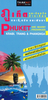
Phuket - Southern Thailand
Phuket Island at 1:110, 000 a double-sided map from Periplus, accompanied by enlargements of its main tourist areas and a plan of Phuket Town, plus maps of the surrounding region, also with additional plans and enlargements.On one side is a road map of the island itself at 1:100, 000, with enlargements showing in much greater detail four of its main tourist areas: Bang Tao and Kamala beaches, Karon and Kata Beaches, Patong beach and Chalong Bay. Also provided is a street plan of Phuket Town. The plan and all the maps are annotated with numerous hotels and other tourist facilities, as well as places of interest. Road network indicates main traffic arteries and shows small many local roads.Maps on the reverse provide a wider coverage around the Phuket Island. The immediate surrounding
part of the mainland is shown at 1:200, 000, accompanied by an enlargement of the Phi Phi Don Island plus street plans of Krabi Town and Ao Nang beach. The panhandle of Southern Thailand is presented at 1:1, 000, 000 with a separate inset showing Tarutao Islands at 1:300, 000. Like the mapping of Phuket itself, all these maps and plans are also annotated, as appropriate, with places of interest, national parks and other protected areas, accommodation, etc.None of the maps or plans are indexed. Road maps of Phuket Island, the Phuket area and Southern Thailand have latitude and longitude lines at 5
part of the mainland is shown at 1:200, 000, accompanied by an enlargement of the Phi Phi Don Island plus street plans of Krabi Town and Ao Nang beach. The panhandle of Southern Thailand is presented at 1:1, 000, 000 with a separate inset showing Tarutao Islands at 1:300, 000. Like the mapping of Phuket itself, all these maps and plans are also annotated, as appropriate, with places of interest, national parks and other protected areas, accommodation, etc.None of the maps or plans are indexed. Road maps of Phuket Island, the Phuket area and Southern Thailand have latitude and longitude lines at 5
Product Description
Reviews/Comments
Add New
Intelligent Comparison
Archived Product
Phuket & Southern Thailand Stanfords
£4.99
Archived Product

Southern Thailand Stanfords
£8.99
Archived Product
Ko Samui - Southern Thailand Stanfords
£7.99
Archived Product
Ko Samui And Southern Thailand Stanfords
£4.99
Vouchers
No voucher codes found.
Do you know a voucher code for this product or supplier? Add it to Insights for others to use.
Do you know a voucher code for this product or supplier? Add it to Insights for others to use.
 Denmark