More From Contributor

£9.99
Phugau Ghomion, sheet no. 2884-02, in the topographic survey of Nepal at 1:50, 000 published by the Nepali Government in the late 1990s & early 2000s & produced from remote sensing data by Finnish cartographers as part of that country’s international aid program. The maps cover 15’ x 15’ quadrangles.IMPORTANT – PLEASE NOTE BEFORE ORDERING: AVAILABILITY: although, theoretically at least, still in print, these maps are very difficult to get locally in Nepal and/or from various suppliers elsewhere specializing in obtaining such maps. DELIVERIES MAY TAKE SEVERAL WEEKS OR EVEN MONTHS.PROBLEMS WITH PLACE NAMES: reports from previous users indicate that transliteration of place names differs from that used widely not only on other maps & in guide books but also on the ground itself, in road signs & in the tourist & trekking industry in general. Whilst most names are similar enough to be easily recognizable, e.g. Namche Bajar for Namche Bazar or Lantan for Langtang, we have been told of confusion & difficulties arising from different spellings appearing on these maps.TREKKING ROUTES & TOURIST INFORMATION: whilst the maps show foot trails & mark locations of temples, etc, they carry no specific trekking information. Major trekking routes & places of interest are not highlighted. There is no marking for base camps & other tourist facilities. Map specifications: Contours are at 40m intervals, with graphics and/or coloring to show various features of the terrain (glaciers with moraines & crevasses, quarries, gravel or clay pits, etc.) & vegetation (forests, bush, grass, orchards & plantations, etc). Additional comments such as “open mixed forest mainly bajh & pine” annotate many area. The maps have numerous spot heights, but relatively few peaks are named. Areas outside the country’s borders are left blank. Settlements in remote areas are indicated by markings for individual buildings & the placing of names does not always make it clear which group of buildings they refer to. Road network distinguishes between major & minor foot trails. Symbols mark features such as temples, schools & hospitals, police stations, etc. Also shown are the country’s administrative divisions. The maps have a 1-km UTM grid, plus latitude & longitude lines at intervals of 5’. Map legend & all the text is in English. Coverage: the whole country is now covered, with the north at 1:50, 000, plus central & southern Nepal at 1:25, 000. The two series are complementary, do not overlap & use the same grid & numbering system (apart from the Lumbini Zone, where a different grid & numbering are used). For areas not shown on our grid & titles not listed here, please contact us by e-mail, but please do bear in mind the problems with availability & the likely very long delivery time. ...
Archived Product
£4.99
There is a top ten of places to visit, complete with useful information & a list of ten must dos for your trip. Strange but true facts & other special features supplement the quick reference travel information, all presented in a easy-to-use format. ...
Archived Product
£14.95
Phuket & Phi Phi in the Odyssey Guides series; aimed at travellers particularly interested in the culture & history of their destination; the guides focus on the atmosphere, customs, & distinctive character of a country, region or city. As the only English language publisher based in China, Odyssey Guides specialize in Asian destinations, relying on the expertise of local writers. This gives readers more of an insider ...
Archived Product
£4.99
The highly successful Globetrotter Travel Series, which

Includes::
Travel Guides, Travel Maps, Road Atlases,

...
Archived Product
£7.99
Phuket Island at 1:110, 000 a double-sided map from Periplus, accompanied by enlargements of its main tourist areas & a plan of Phuket Town, plus maps of the surrounding region, also with additional plans & enlargements. On one side is a road map of the island itself at 1:100, 000, with enlargements showing in much greater detail four of its main tourist areas: Bang Tao & Kamala beaches, Karon & Kata Beaches, Patong beach & Chalong Bay. Also provided is a street plan of Phuket Town. The plan & all the maps are annotated with numerous hotels & other tourist facilities, as well as places of interest. Road network indicates main traffic arteries & shows small many local roads. Maps on the reverse provide a wider coverage around the Phuket Isl&. The immediate surrounding part of the mainland is shown at 1:200, 000, accompanied by an enlargement of the Phi Phi Don Island plus street plans of Krabi Town & Ao Nang beach. The panhandle of Southern Thailand is presented at 1:1, 000, 000 with a separate inset showing Tarutao Islands at 1:300, 000. Like the mapping of Phuket itself, all these maps & plans are also annotated, as appropriate, with places of interest, national parks & other protected areas, accommodation, etc. None of the maps or plans are indexed. Road maps of Phuket Isl&, the Phuket area & Southern Thailand have latitude & longitude lines at 5 ...
Archived Product
£8.99
Phuket & its tourist attractions on a map from Thinknet, with a plan of Phuket Town, enlargements for the Kata
- Karon, Patong
...
Archived Product
£6.39
Phuket in the Encounter Guide Series from Lonely Planet, exploring a range of cities & regions worldwide in a handy, pocket-sized format designed to introduce visitors to the distinctive neighbourhoods of the destination. Frank & informal in style, the guides are renowned for their appeal to independent travellers & are written & researched by local authors. Each guide is organised into 5 distinct sections
- Highlights, Diary, Itineraries, Neighbourhoods & Snapshots
- recommending a series of essential encounters for visitors to the region. Each guide opens with a

...
Archived Product
£7.99
What Will Your Phuket Encounter Be...
Pinching yourself: that crimson-hued sunset & private beach setting is actually real


...
Archived Product
£7.99
DK Eyewitness Top 10 Travel Guide: Phuket will lead you straight to the very best on offer. Whether you`re looking for the things not to miss at the Top 10 sights, or want to find the best nightspots; this guide is the perfect pocket-sized companion. Rely on dozens of Top 10 lists
- from the Top 10 museums to the Top 10 events & festivals
- there`s even a list of the Top 10 things to avoid. The guide is divided by area with restaurant reviews for each, as well as recommendations for hotels, bars & places to shop. You`ll find the insider knowledge every visitor needs & explore every corner effortlessly with DK Eyewitness Top 10 Travel Guide: Phuket & its Free pull-out map. DK Eyewitness Top 10 Travel Guide: Phuket
- showing you what others only tell you.


...
Archived Product

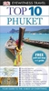
Phuket And The Andaman Coast Spotlight Guide

Moon Spotlight Phuket & the Andaman Coast is a 70-page compact guide covering this gorgeous Southeast Asian city and stunning stretch of shoreline. Author Suzanne Nam offers her seasoned advice on must-see attractions, and includes maps with sightseeing highlights so you can make the most of your time. This lightweight guide is packed with recommendations on sights, entertainment, shopping, recreation, accommodations, food, and transportation, making navigating this bustling city and lush landscape uncomplicated and enjoyable. This full-color Spotlight guidebook is excerpted from Moon Phuket & Ko Samui and includes vibrant photos and helpful maps.
RIP - This product is no longer available on our network. It was last seen on 25.09.2019

This page now acts as a permanent archive for this product. Add more information using the comments box below to ensure it can still be found by future generations.

Use our search facility to see if it is available from an alternative contributor.
  • Availability: Out Of Stock
  • Supplier: Stanfords
  • SKU: 9781612389486
Availability: In Stock
£6.99

Product Description

Moon Spotlight Phuket & the Andaman Coast is a 70-page compact guide covering this gorgeous Southeast Asian city & stunning stretch of shoreline. Author Suzanne Nam offers her seasoned advice on must-see attractions, &

Includes::
maps with sightseeing highlights so you can make the most of your time. This lightweight guide is packed with recommendations on sights, entertainment, shopping, recreation, accommodations, food, & transportation, making navigating this bustling city & lush landscape uncomplicated & enjoyable. This full-color Spotlight guidebook is excerpted from Moon Phuket & Ko Samui &

Includes::
vibrant photos & helpful maps.

Reviews/Comments

Add New

Intelligent Comparison

Oooops!
We couldn't find anything!
Perhaps this product's unique.... Or perhaps we are still looking for comparisons!
Click to bump this page and we'll hurry up.

Price History

Vouchers

No voucher codes found.
Do you know a voucher code for this product or supplier? Add it to Insights for others to use.

Facebook

Jargon Buster

compact - Carefuly designed to ensure an item has a minimal physical size
Entertainment - Something that provides amusement
Compact - something that has a lot combined within a small space.

Supplier Information

Stanfords
Stanfords was established in 1853 and opened their iconic Covent Garden flagship store in 1901. They have become the top retailer of maps, travel books and accessories in the UK and arguably offer the largest selection of maps and travel books worldwide. Famous names such as Captain Robert Falcon Scott, Ranulph Fiennes and Michael Palin have purchased from Stanfords. They now have a shop in Bristol and both stores together with other venues operate a calendar of events including talks, book signings and exhibitions. As a specialist map retailer, the map selection is comprehensive and includes road maps, street maps and walking maps from worldwide destinations, as well as a selection of world atlases and wall maps. Books include travel guides and travel literature. Stanfords also stock globes, from miniatures made of blue marble to magnificent floor-standing globes. The website features a selection of interesting articles on travel topics.
Page Updated: 2023-11-12 20:15:36

Community Generated Product Tags

Oh No! The productWIKI community hasn't generated any tags for this product yet!
Menu