
 United Kingdom
 France
 Germany
 Netherlands
 Sweden
 USA
USA
 Italy
Italy
 Spain
Spain
More From Contributor


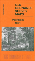
Peckham 1871
Peckham in 1871 in a fascinating series of reproductions of old Ordnance Survey plans in the Alan Godfrey Editions, ideal for anyone interested in the history of their neighbourhood or family. Three versions for this area have been published, stretching from Denmark Hill station eastward to Queen`s Road station and Asylum Road; and from Rosemary Road southward to Nunhead Green. Peckham Road and High Street runs west-east across the map with a tramway; Peckham Rye station is in the lower centre of the map. Other features include Peckham House lunatic asylum, Camberwell Workhouse, Brunswick Square, Eagle Mill, Rye Lane, St Giles Church, Brunswick Square, Camberwell Town Hall, Surrey Canal with Peckham Wharf, north end of Peckham Rye Common. The following Wards are named on the
map: Town Hall, St Giles, Lyndhurst, Goldsmith, Rye Lane, St Mary`s and Nunhead Wards (though some extend onto adjacent maps). The map is largely part of Camberwell Borough. On the reverse are street directory extracts for (1871 map) Brunswick Square, Church Street, Camberwell Grove, Grove Lane, Southampton St etc; and (1894 map) Camberwell Grove, Grove Lane, High Street, Hill Street, Rye Lane. About the Alan Godfrey Editions of the 25” OS Series:Selected towns in Great Britain and Ireland are covered by maps showing the extent of urban development in the last decades of the 19th and early 20th century. The plans have been taken from the Ordnance Survey mapping and reprinted at about 15 inches to one mile (1:4, 340). On the reverse most maps have historical notes and many
also include extracts from contemporary directories. Most maps cover about one mile (1.6kms) north/south, one and a half miles (2.4kms) across; adjoining sheets can be combined to provide wider coverage.FOR MORE INFORMATION AND A COMPLETE LIST OF ALL AVAILABLE TITLES PLEASE CLICK ON THE SERIES LINK.

Product Description
Reviews/Comments
Add New
Intelligent Comparison
Archived Product
Peckham 1871 Stanfords
£2.95
Archived Product
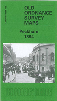
Peckham 1894 Stanfords
£3.50
Archived Product
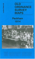
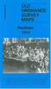
Peckham 1914 Stanfords
£3.50
Archived Product

Beckenham 1861-1871 Stanfords
£3.50
Vouchers
No voucher codes found.
Do you know a voucher code for this product or supplier? Add it to Insights for others to use.
Do you know a voucher code for this product or supplier? Add it to Insights for others to use.
 Denmark