
 United Kingdom
 France
 Germany
 Netherlands
 Sweden
 USA
USA
 Italy
Italy
 Spain
Spain
More From Contributor


Beckenham 1861-1871
Beckenham in 1861-1871 in a fascinating series of reproductions of old Ordnance Survey plans in the Alan Godfrey Editions, ideal for anyone interested in the history of their neighbourhood or family. Three versions have been published to show how this developed across the years - the maps are from different series, for Kent and for London, and so the sheetlines are somewhat different. The Kent series maps are centred on the village, and later town centre of Beckenham. The earliest map was surveyed in 1861 but was updated to 1871 to include railways. Features include Coperscope, Beckenham station (still with an overall roof), and the map stretches as far as New Beckenham Junction to the north. Westward the map extends to the boundary with Penge, eastward it reaches Foxgrove. This is
an attractive map of Beckenham as development was just beginning. The companion map showing it in 1930 provides a fascinating illustration of how the village developed into a town.Coverage of the area in 1894 is provided by the London map No. 146.About the Alan Godfrey Editions of the 25” OS Series:Selected towns in Great Britain and Ireland are covered by maps showing the extent of urban development in the last decades of the 19th and early 20th century. The plans have been taken from the Ordnance Survey mapping and reprinted at about 15 inches to one mile (1:4, 340). On the reverse most maps have historical notes and many also include extracts from contemporary directories. Most maps cover about one mile (1.6kms) north/south, one and a half miles (2.4kms) across; adjoining sheets can
be combined to provide wider coverage.FOR MORE INFORMATION AND A COMPLETE LIST OF ALL AVAILABLE TITLES PLEASE CLICK ON THE SERIES LINK.

Product Description
Reviews/Comments
Add New
Intelligent Comparison
Archived Product
Peckham 1871 Stanfords
£2.95
Archived Product
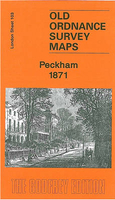
Peckham 1871 Stanfords
£3.50
Vouchers
No voucher codes found.
Do you know a voucher code for this product or supplier? Add it to Insights for others to use.
Do you know a voucher code for this product or supplier? Add it to Insights for others to use.
 Denmark