
 United Kingdom
 France
 Germany
 Netherlands
 Sweden
 USA
USA
 Italy
Italy
 Spain
Spain
More From Contributor


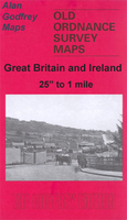
Paignton 1904
Paignton in 1904 in a fascinating series of reproductions of old Ordnance Survey plans in the Alan Godfrey Editions, ideal for anyone interested in the history of their neighbourhood or family. Selected towns in Great Britain and Ireland are covered by maps showing the extent of urban development in the last decades of the 19th and early 20th century.In this title: this detailed map covers the heart of the Torbay town of Paignton, stretching from the coast inland to St Mary's Hill and Primley Park, and from Fernham Road southward to Roundham Head. Features include railway with station, Queen's Park, Southfield area, Polsham area, part of St Michaels, The Green, St John's church, Christ Church, Paignton Harbour, Promenade Pier, Hotel Redcliffe, Esplanade Hotel, St Andrew's
church, Public Hall, town centre with individual buildings neatly shown, schools, Victoria Park, Oldenburg House, remains of Bishop's Palace, etc. On the reverse are extracts from a 1906 directory, listing Private Residents. About the Alan Godfrey Editions of the 25
church, Public Hall, town centre with individual buildings neatly shown, schools, Victoria Park, Oldenburg House, remains of Bishop's Palace, etc. On the reverse are extracts from a 1906 directory, listing Private Residents. About the Alan Godfrey Editions of the 25
Product Description
Reviews/Comments
Add New
Intelligent Comparison
Archived Product

Paignton 1904 Stanfords
£3.50
Archived Product
Patrington 1904 Stanfords
£2.95
Archived Product

Patrington 1904 Stanfords
£3.50
Archived Product

Paddington 1914 Stanfords
£3.50
Archived Product
Carrington 1904 Stanfords
£2.95
Archived Product
Carrington 1904 Stanfords
£3.50
Archived Product

Tipton 1904 Stanfords
£3.50
Archived Product

Quinton 1902 Stanfords
£3.50
Vouchers
No voucher codes found.
Do you know a voucher code for this product or supplier? Add it to Insights for others to use.
Do you know a voucher code for this product or supplier? Add it to Insights for others to use.
 Denmark