
 United Kingdom
 France
 Germany
 Netherlands
 Sweden
 USA
USA
 Italy
Italy
 Spain
Spain
More From Contributor


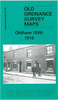

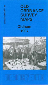
Oldham 1907
Oldham in 1907 in a fascinating series of reproductions of old Ordnance Survey plans in the Alan Godfrey Editions, ideal for anyone interested in the history of their neighbourhood or family. The map covers the heart of Oldham, with stretching from Westbourne Street eastward to Bleasby Street, and from Cromwell Street northward to Samson Street. Features include railway with Mumps station, St Mary`s church, Market Ground, Market Hall, Coldhurst Hollow, Bank Top, Cold Hurst, Sarah Moor, Oldham Edge, Moorhey, Townfield, Greenacres Moor, St James Mill, Soho Iron Works, Castle Iron Works, tramways, Hartford Old Works, Derker Old Mill, Albany Mills, Granville Mill, Greenbank Mills, Commercial Mills, tramway depot, Glodwick Road station, Hargreaves Spindle Works,
Werneth Mill, Summervale Mill, Willowbank Mill, Royal Mill, many other mills, rope works, Oldham Boiler Works, etc. On the reverse are 1918 street directory entries for High Street, Market Place, Mumps, Rock Street, Union Street and Yorkshire Street.About the Alan Godfrey Editions of the 25” OS Series:Selected towns in Great Britain and Ireland are covered by maps showing the extent of urban development in the last decades of the 19th and early 20th century. The plans have been taken from the Ordnance Survey mapping and reprinted at about 15 inches to one mile (1:4, 340). On the reverse most maps have historical notes and many also include extracts from contemporary directories. Most maps cover about one mile (1.6kms) north/south, one and a half miles (2.4kms) across;
adjoining sheets can be combined to provide wider coverage.FOR MORE INFORMATION AND A COMPLETE LIST OF ALL AVAILABLE TITLES PLEASE CLICK ON THE SERIES LINK.

Product Description
Reviews/Comments
Add New
Intelligent Comparison
Archived Product
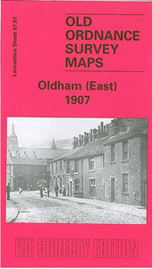
Oldham East 1907 Stanfords
£3.50
Archived Product

Oakham 1903 Stanfords
£3.50
Archived Product
Old Sarum 1900 Stanfords
£2.95
Archived Product
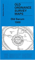
Old Sarum 1900 Stanfords
£3.50
Vouchers
No voucher codes found.
Do you know a voucher code for this product or supplier? Add it to Insights for others to use.
Do you know a voucher code for this product or supplier? Add it to Insights for others to use.
 Denmark