
 United Kingdom
 France
 Germany
 Netherlands
 Sweden
 USA
USA
 Italy
Italy
 Spain
Spain
More From Contributor


Merton 1894
Merton in 1894 in a fascinating series of reproductions of old Ordnance Survey plans in the Alan Godfrey Editions, ideal for anyone interested in the history of their neighbourhood or family. The map covers an area around the former Merton Abbey and stretches from Morden Road eastward to London Road and Tooting Junction, and from Collier`s Wood southward to Upper Mitcham. Features include Holborn Union Workhouse, Holborn Industrial Schools, both at Upper Mitcham; Merton Abbey station with a siding to Abbey Mills, Morden station (on the Croydon & Wimbledon line), Nelson`s Fields, several varnish factories by the River Wandle, High Street, Quicks Road, and the eastern fringe of South Wimbledon. Several extracts from Trim`s Directory 1909 are on the reverse.About the Alan Godfrey
Editions of the 25” OS SeriesSelected towns in Great Britain and Ireland are covered by maps showing the extent of urban development in the last decades of the 19th and early 20th century. The plans have been taken from the Ordnance Survey mapping and reprinted at about 15 inches to one mile (1:4, 340). On the reverse most maps have historical notes and many also include extracts from contemporary directories. Most maps cover about one mile (1.6kms) north/south, one and a half miles (2.4kms) across; adjoining sheets can be combined to provide wider coverage.FOR MORE INFORMATION AND A COMPLETE LIST OF ALL AVAILABLE TITLES PLEASE CLICK ON THE SERIES LINK.
Editions of the 25” OS SeriesSelected towns in Great Britain and Ireland are covered by maps showing the extent of urban development in the last decades of the 19th and early 20th century. The plans have been taken from the Ordnance Survey mapping and reprinted at about 15 inches to one mile (1:4, 340). On the reverse most maps have historical notes and many also include extracts from contemporary directories. Most maps cover about one mile (1.6kms) north/south, one and a half miles (2.4kms) across; adjoining sheets can be combined to provide wider coverage.FOR MORE INFORMATION AND A COMPLETE LIST OF ALL AVAILABLE TITLES PLEASE CLICK ON THE SERIES LINK.

Product Description
Reviews/Comments
Add New
Intelligent Comparison
Archived Product
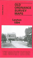
Leyton 1894 Stanfords
£3.50
Archived Product

Heston 1894 Stanfords
£3.50
Archived Product
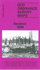
Beckton 1894 Stanfords
£3.50
Archived Product

Charlton 1894 Stanfords
£3.50
Archived Product

Harton 1895 Stanfords
£3.50
Archived Product
Leyton 1914 Stanfords
£3.50
Archived Product

Norton 1896 Stanfords
£3.50
Archived Product

Morden 1894 Stanfords
£3.50
Vouchers
No voucher codes found.
Do you know a voucher code for this product or supplier? Add it to Insights for others to use.
Do you know a voucher code for this product or supplier? Add it to Insights for others to use.
 Denmark