More From Contributor
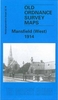
£12.99
Map No. 120, Mansfield & Worksop, in the waterproof & tear-resistant OS Active version of the Ordnance Survey Landranger series at 1:50, 000, including Alfreton, Ravenshead, Southwell, North Muskham, Cauton, Earking, Kirkby-in-Ashfield, North Wingfield, Mansfield Woodhouse, Market Warsop, New Ollerton, Tuxford, Cuckney, Shirebrook, Bolsover, Brimington, Staveley, Creswell, Elkesley, East Markham, Retford, Clayworth, Blyth, Carlton in Lindrich, Langold, Woodsetts, Dinnington, Thurcroft, Aughton, Killamarsh & Eckington, plus the Sherwood Forest. Edition D3; Publication date February 2014 About Ordnance Survey ...
Archived Product
£10.39
Map No. 120, Mansfield & Worksop, in a waterproof & tear-resistant version of the Ordnance Survey Landranger series at 1:50, 000, including Alfreton, Ravenshead, Southwell, North Muskham, Cauton, Earking, Kirkby-in-Ashfield, North Wingfield, Mansfield Woodhouse, Market Warsop, New Ollerton, Tuxford, Cuckney, Shirebrook, Bolsover, Brimington, Staveley, Creswell, Elkesley, East Markham, Retford, Clayworth, Blyth, Carlton in Lindrich, Langold, Woodsetts, Dinnington, Thurcroft, Aughton, Killamarsh & Eckington, plus the Sherwood Forest. Edition D2; Publication date: April 2010 This title is also available on our website in a paper version. Maps in this series are only published folded. Stanfords can also print flat versions of Ordnance Survey maps through the OS Select system, centring the map on a location of your choice & with a picture provided by you on the cover. For more information please click on the link at the bottom of this description. About Ordnance Survey ...
Archived Product
£2.95
Mansfield East in 1914 in a fascinating series of reproductions of old Ordnance Survey plans in the Alan Godfrey Editions, ideal for anyone interested in the history of their neighbourhood or family. Selected towns in Great Britain & Ireland are covered by maps showing the extent of urban development in the last decades of the 19th & early 20th century. In this title: the map covers the eastern part of Mansfield, stretching from West Gate & the Old Market Place eastward to the Old Race Course; & from Littleworth northward to Park Avenue. Features include Midland Railway with station, railway in course of construction, tramways, Market Place, Old Race Course, Grammar School, Town Hall, St Peter's church, schools, Rock Valley Mill, Bath Mill, Stanton Mill, The Park area, Hippodrome, Mansfield Brewery. On the reverse is an 1891 commercial directory, entries N-Z. About the Alan Godfrey Editions of the 25 ...
Archived Product
£3.50
Mansfield East in 1914 in a fascinating series of reproductions of old Ordnance Survey plans in the Alan Godfrey Editions, ideal for anyone interested in the history of their neighbourhood or family. The map covers the eastern part of Mansfield, stretching from West Gate & the Old Market Place eastward to the Old Race Course, & from Littleworth northward to Park Avenue. Features include Midland Railway with station, railway in course of construction, tramways, Market Place, Old Race Course, Grammar School, Town Hall, St Peter`s church, schools, Rock Valley Mill, Bath Mill, Stanton Mill, The Park area, Hippodrome, Mansfield Brewery, etc. On the reverse is an 1891 commercial directory, entries N to Z. About the Alan Godfrey Editions of the 25” OS Series: Selected towns in Great Britain & Ireland are covered by maps showing the extent of urban development in the last decades of the 19th & early 20th century. The plans have been taken from the Ordnance Survey mapping & reprinted at about 15 inches to one mile (1:4, 340). On the reverse most maps have historical notes & many also include extracts from contemporary directories. Most maps cover about one mile (1.6kms) north/south, one & a half miles (2.4kms) across; adjoining sheets can be combined to provide wider coverage.FOR MORE INFORMATION & A COMPLETE LIST OF ALL AVAILABLE TITLES PLEASE CLICK ON THE SERIES LINK. ...
Archived Product
£5.99
The Penguin English Library Edition of Mansfield Park by Jane Austen` We have all been more or less to blame.. . every one of us, excepting Fanny` Taken from the poverty of her parents` home in Portsmouth, Fanny Price is brought up with her rich cousins at Mansfield Park, acutely aware of her humble rank & with her cousin Edmund as her sole ally. During her uncle`s absence in Antigua, the Crawford`s arrive in the neighbourhood bringing with them the glamour of London life & a reckless taste for flirtation. Mansfield Park is considered Jane Austen`s first mature work &, with its quiet heroine & subtle examination of social position & moral integrity, one of her most profound. The Penguin English Library
- 100 editions of the best fiction in English, from the eighteenth century & the very first novels to the beginning of the First World War.
...
Archived Product
£3.50
Mansfield West in 1914 in a fascinating series of reproductions of old Ordnance Survey plans in the Alan Godfrey Editions, ideal for anyone interested in the history of their neighbourhood or family. The map covers the western part of Mansfield, stretching from West Street westward to Dalestorth Farm & Cock Lane, & from Princes Street northward to Mount Street. Features include Newtown Town area, trams & depot, Workhouse, Empire Theatre, Lawn Mills, St John`s church, schools, Westfield House, Mansfield North Junction, etc. On the reverse is an 1891 commercial directory, entries A to N. About the Alan Godfrey Editions of the 25” OS Series: Selected towns in Great Britain & Ireland are covered by maps showing the extent of urban development in the last decades of the 19th & early 20th century. The plans have been taken from the Ordnance Survey mapping & reprinted at about 15 inches to one mile (1:4, 340). On the reverse most maps have historical notes & many also include extracts from contemporary directories. Most maps cover about one mile (1.6kms) north/south, one & a half miles (2.4kms) across; adjoining sheets can be combined to provide wider coverage.FOR MORE INFORMATION & A COMPLETE LIST OF ALL AVAILABLE TITLES PLEASE CLICK ON THE SERIES LINK. ...
Archived Product
£14.99
Waterproof & tear-resistant OS Active version of map No. 120 from the Ordnance Survey’s Landranger series at 1:50, 000, with contoured & GPS compatible topographic mapping plus tourist information.MOBILE DOWNLOADS: As well as the physical edition of the map, each Landranger title now

Includes::
a code for downloading after purchase its digital version onto your smartphone or tablet for viewing on the OS smartphone app.OS LANDRANGER SERIES: to see the list of all the titles in the OS Landranger series, both paper & waterproof versions, please click on the series link. Maps in the Landranger series provide plenty of recreational & tourist information, indicating the traditional public right of way paths (except in Scotland where different laws apply), including bridleways & byways restricted or open to motorized traffic. National Trails & selected other long-distance paths are marked, as well as on-road & traffic-free cycle routes with their National/ Regional Cycle Network numbers. National Trust/ National Trust for Scotland & Forestry Commission land is clearly marked, indicating open or restricted access. A range of symbols highlights camping & caravanning sites, youth hostels, tourist information offices & visitors’ centres, parking & picnicking places, World Heritage sites, sport & recreational facilities, etc. The maps provide detailed presentation of topography with contours at 10m intervals, numerous spot heights & additional colouring and/or graphics for different types of woodlands, orchards or parkl&, rock features including scree & cliffs, water features inland & along the sea shore with marshl&, dunes, s&, mud, shingle & the high water mark. All the standard information expected of survey mapping at this scale is included: finely graded road network, railway lines with stations, cuttings, embankments, etc; individual isolated buildings; archaeological & historical sites, etc. For GPS users the British National Grid is shown at 1km intervals, with latitude & longitude given by margin ticks at 1` & cross hairs on the map at 5`. Each map covers an area of 40 x 40km, (approx. 25 x 25 miles).

...
Archived Product
£8.99
Paper version of map No. 120 from the Ordnance Survey’s Landranger series at 1:50, 000, with contoured & GPS compatible topographic mapping plus tourist information.MOBILE DOWNLOADS: As well as the physical edition of the map, each Landranger title now

Includes::
a code for downloading after purchase its digital version onto your smartphone or tablet for viewing on the OS smartphone app.OS LANDRANGER SERIES: to see the list of all the titles in the OS Landranger series, both paper & waterproof versions, please click on the series link. Maps in the Landranger series provide plenty of recreational & tourist information, indicating the traditional public right of way paths (except in Scotland where different laws apply), including bridleways & byways restricted or open to motorized traffic. National Trails & selected other long-distance paths are marked, as well as on-road & traffic-free cycle routes with their National/ Regional Cycle Network numbers. National Trust/ National Trust for Scotland & Forestry Commission land is clearly marked, indicating open or restricted access. A range of symbols highlights camping & caravanning sites, youth hostels, tourist information offices & visitors’ centres, parking & picnicking places, World Heritage sites, sport & recreational facilities, etc. The maps provide detailed presentation of topography with contours at 10m intervals, numerous spot heights & additional colouring and/or graphics for different types of woodlands, orchards or parkl&, rock features including scree & cliffs, water features inland & along the sea shore with marshl&, dunes, s&, mud, shingle & the high water mark. All the standard information expected of survey mapping at this scale is included: finely graded road network, railway lines with stations, cuttings, embankments, etc; individual isolated buildings; archaeological & historical sites, etc. For GPS users the British National Grid is shown at 1km intervals, with latitude & longitude given by margin ticks at 1` & cross hairs on the map at 5`. Each map covers an area of 40 x 40km, (approx. 25 x 25 miles).

...
Archived Product
£12.99
Topographic survey of France at 1:25, 000 in IGN`s excellent TOP25 / Série Bleue series. All the maps are GPS compatible, with a 1km UTM grid plus latitude & longitude lines at 5’ intervals. Contours are at 5m intervals except for mountainous areas where the maps have contours at 10m intervals, vividly enhanced by hill shading & graphics for rocky terrain. Colouring with graphics indicates different types of vegetation or land use (deciduous or coniferous forests, moors, orchards, vineyards, etc). PLEASE NOTE: coverage of France at this scale is currently being revised – the format & the presentation of each title are indicated by the letters at the end of its Sheet Reference number (e.g. 0416ET, 3531ETR, 1923SB, etc.)MAPS WITH FULL TOURIST OVERPRINT & AN ENGLISH MAP LEGEND: all TOP25 maps & the SB editions of Série Bleue have an overprint highlighting waymarked walking trails including long-distance GR routes &, where appropriate, ski routes. Symbols indicate campsites, gîtes d’etape, refuges, equestrian centres & other recreational facilities or sites, tourist information centres, cultural heritage, etc. Towns & locations of particular interest are highlighted.- ET or OT = single-sided TOP25 map covering approx. 29x 21 km / 18x 13 miles.- ETR or OTR = waterproof & tear resistant TOP25 map covering the same area as the corresponding ET or OT number, but double-sided, printed on a smaller size sheet with a good overlap between the sides.- SB = Série Bleue map with full tourist overprint; these maps, first introduced in summer 2014, each cover approx. 29x 24km / 18x 15 miles.SÉRIE BLEUE maps with numbers ending in E (Est) or O (Ouest): most editions now indicate the GR routes, but do not show any other tourist information. Map legend is in French only. Each map covers approx. 14x 20km / 9x 12 miles. ...
Archived Product

Mansfield West 1914

Mansfield West in 1914 in a fascinating series of reproductions of old Ordnance Survey plans in the Alan Godfrey Editions, ideal for anyone interested in the history of their neighbourhood or family. Selected towns in Great Britain and Ireland are covered by maps showing the extent of urban development in the last decades of the 19th and early 20th century.In this title: the map covers the western part of Mansfield, stretching from West Street westward to Dalestorth Farm and Cock Lane, and from Princes Street northward to Mount Street. Features include Newtown Town area, trams and depot, Workhouse, Empire Theatre, Lawn Mills, St John's church, schools, Westfield House, Mansfield North Junction, etc. On the reverse is an 1891 commercial directory, entries A-N. About the Alan
Godfrey Editions of the 25
RIP - This product is no longer available on our network. It was last seen on 25.09.2019

This page now acts as a permanent archive for this product. Add more information using the comments box below to ensure it can still be found by future generations.

Use our search facility to see if it is available from an alternative contributor.
  • External links may include paid for promotion
  • Availability: Out Of Stock
  • Supplier: Stanfords
  • SKU: 9786000007768
Availability: In Stock
£2.95

Product Description

Mansfield West in 1914 in a fascinating series of reproductions of old Ordnance Survey plans in the Alan Godfrey Editions, ideal for anyone interested in the history of their neighbourhood or family. Selected towns in Great Britain & Ireland are covered by maps showing the extent of urban development in the last decades of the 19th & early 20th century. In this title: the map covers the western part of Mansfield, stretching from West Street westward to Dalestorth Farm & Cock Lane, & from Princes Street northward to Mount Street. Features include Newtown Town area, trams & depot, Workhouse, Empire Theatre, Lawn Mills, St John's church, schools, Westfield House, Mansfield North Junction, etc. On the reverse is an 1891 commercial directory, entries A-N. About the Alan Godfrey Editions of the 25

Reviews/Comments

Add New

Price History

Vouchers

No voucher codes found.
Do you know a voucher code for this product or supplier? Add it to Insights for others to use.

Facebook

Jargon Buster

lawn - An area of aesthetic or recreational land planted with grasses.
History - Anything that happens in the past. An acedemic subject.
Junction - A point where two or more things come together, typically used to describe roads
Ideal - Something that satisfies a perfect criteria.
Family - A group of people that live together made up from parents and children.

Supplier Information

Stanfords
Stanfords was established in 1853 and opened their iconic Covent Garden flagship store in 1901. They have become the top retailer of maps, travel books and accessories in the UK and arguably offer the largest selection of maps and travel books worldwide. Famous names such as Captain Robert Falcon Scott, Ranulph Fiennes and Michael Palin have purchased from Stanfords. They now have a shop in Bristol and both stores together with other venues operate a calendar of events including talks, book signings and exhibitions. As a specialist map retailer, the map selection is comprehensive and includes road maps, street maps and walking maps from worldwide destinations, as well as a selection of world atlases and wall maps. Books include travel guides and travel literature. Stanfords also stock globes, from miniatures made of blue marble to magnificent floor-standing globes. The website features a selection of interesting articles on travel topics.
Page Updated: 2023-11-12 20:15:36

Community Generated Product Tags

Oh No! The productWIKI community hasn't generated any tags for this product yet!
Menu