
 United Kingdom
 France
 Germany
 Netherlands
 Sweden
 USA
USA
 Italy
Italy
 Spain
Spain
More From Contributor


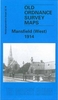
Mansfield East 1914
Mansfield East in 1914 in a fascinating series of reproductions of old Ordnance Survey plans in the Alan Godfrey Editions, ideal for anyone interested in the history of their neighbourhood or family. Selected towns in Great Britain and Ireland are covered by maps showing the extent of urban development in the last decades of the 19th and early 20th century.In this title: the map covers the eastern part of Mansfield, stretching from West Gate and the Old Market Place eastward to the Old Race Course; and from Littleworth northward to Park Avenue. Features include Midland Railway with station, railway in course of construction, tramways, Market Place, Old Race Course, Grammar School, Town Hall, St Peter's church, schools, Rock Valley Mill, Bath Mill, Stanton Mill, The Park area,
Hippodrome, Mansfield Brewery. On the reverse is an 1891 commercial directory, entries N-Z. About the Alan Godfrey Editions of the 25
Hippodrome, Mansfield Brewery. On the reverse is an 1891 commercial directory, entries N-Z. About the Alan Godfrey Editions of the 25
Product Description
Reviews/Comments
Add New
Intelligent Comparison
Archived Product

Mansfield East 1914 Stanfords
£3.50
Archived Product
Mansfield West 1914 Stanfords
£2.95
Archived Product

Mansfield West 1914 Stanfords
£3.50
Archived Product

Enfield Wash 1910 Stanfords
£3.50
Vouchers
No voucher codes found.
Do you know a voucher code for this product or supplier? Add it to Insights for others to use.
Do you know a voucher code for this product or supplier? Add it to Insights for others to use.
 Denmark